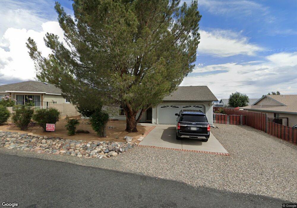
6069 N Old McDonald Dr Unit 17 Prescott Valley, AZ 86314
Estimated Value: $399,968 - $461,000
3
Beds
2
Baths
1,435
Sq Ft
$297/Sq Ft
Est. Value
About This Home
This home is located at 6069 N Old McDonald Dr Unit 17, Prescott Valley, AZ 86314 and is currently estimated at $425,492, approximately $296 per square foot. 6069 N Old McDonald Dr Unit 17 is a home located in Yavapai County with nearby schools including Coyote Springs Elementary School, Bradshaw Mountain Middle School, and Bradshaw Mountain High School.
Ownership History
Date
Name
Owned For
Owner Type
Purchase Details
Closed on
Aug 12, 2015
Sold by
Lancaster Paul and Lancaster Andrea
Bought by
The Arthurs Family 2004 Trust
Current Estimated Value
Purchase Details
Closed on
Mar 1, 2009
Sold by
Maxwell Robert D and Maxwell Deborah
Bought by
Lancaster Paul and Lancaster Andrea
Purchase Details
Closed on
Nov 16, 2005
Sold by
Kietzman Robert D and Kietzman Patricia A
Bought by
Maxwell Robert D and Maxwell Deborah
Home Financials for this Owner
Home Financials are based on the most recent Mortgage that was taken out on this home.
Original Mortgage
$203,200
Interest Rate
6.87%
Mortgage Type
New Conventional
Purchase Details
Closed on
Jul 1, 1996
Sold by
Calkins Merle and Calkins Kaye S
Bought by
Kietzman Robert D and Kietzman Patricia A
Create a Home Valuation Report for This Property
The Home Valuation Report is an in-depth analysis detailing your home's value as well as a comparison with similar homes in the area
Home Values in the Area
Average Home Value in this Area
Purchase History
| Date | Buyer | Sale Price | Title Company |
|---|---|---|---|
| The Arthurs Family 2004 Trust | $209,000 | Lawyers Title Yavapai-Coconi | |
| Lancaster Paul | $140,000 | Yavapai Title Agency Inc | |
| Maxwell Robert D | $254,000 | Chicago Title Ins Co | |
| Kietzman Robert D | $92,500 | First American Title |
Source: Public Records
Mortgage History
| Date | Status | Borrower | Loan Amount |
|---|---|---|---|
| Previous Owner | Maxwell Robert D | $203,200 |
Source: Public Records
Tax History Compared to Growth
Tax History
| Year | Tax Paid | Tax Assessment Tax Assessment Total Assessment is a certain percentage of the fair market value that is determined by local assessors to be the total taxable value of land and additions on the property. | Land | Improvement |
|---|---|---|---|---|
| 2026 | $1,619 | $31,612 | -- | -- |
| 2024 | $1,502 | $33,116 | -- | -- |
| 2023 | $1,502 | $27,313 | $0 | $0 |
| 2022 | $1,478 | $22,226 | $2,868 | $19,358 |
| 2021 | $1,517 | $20,568 | $2,883 | $17,685 |
| 2020 | $1,464 | $0 | $0 | $0 |
| 2019 | $1,445 | $0 | $0 | $0 |
| 2018 | $1,382 | $0 | $0 | $0 |
| 2017 | $1,355 | $0 | $0 | $0 |
| 2016 | $1,311 | $0 | $0 | $0 |
| 2015 | $1,097 | $0 | $0 | $0 |
| 2014 | -- | $0 | $0 | $0 |
Source: Public Records
Map
Nearby Homes
- 6001 N Tower Ln
- 6101 N Wildhorse Dr Unit 17
- 6167 N Moonlight Way
- 7174 E Thrush Ln
- 7080 E Pueblo Ave
- 7144 E Thrush Ln
- 6050 N Wildhorse Dr
- 7755 E Broken Wagon Way
- 5721 N Bronco Ln
- 7835 E Spanish Moss Ln
- 5839 N Gallery Ln Unit II
- 7868 E Spanish Moss Ln
- 7961 E Broken Wagon Way
- 5551 N Ramada Ln
- 8061 E Dust Devil Dr Unit 5681
- 8061 E Dust Devil Dr
- 6778 E Kilkenny Place Unit II
- 7024 Pronghorn
- 5491 N Ardmore Ave
- 7323 E Ryder Rd
- 6069 N Old McDonald Dr
- 6083 N Old McDonald Dr
- 6051 N Old McDonald Dr
- 6076 N Reata Dr
- 6044 N Reata Dr
- 6068 N Old McDonald Dr
- 6091 N Old McDonald Dr
- 6035 N Old McDonald Dr
- 6035 N Old McDonald Dr Unit 1
- 6050 N Old McDonald Dr
- 6084 N Old McDonald Dr
- 6090 N Reata Dr
- 6034 N Old McDonald Dr
- 6060 N Reata Dr Unit 17
- 6100 N Old McDonald Dr
- 6100 N Old McDonald Dr Unit 18
- 6101 N Old McDonald Dr
- 6017 N Old McDonald Dr
- 6017 N Old McDonald Dr Unit 17
- 6069 N Buckboard Dr