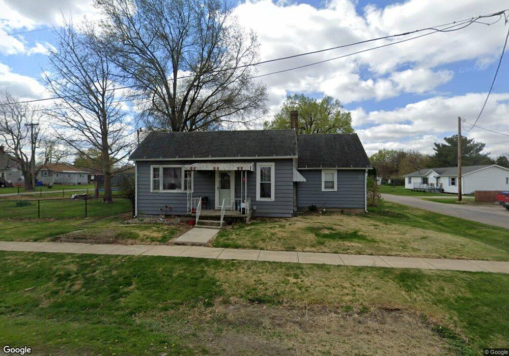
607 5th St Middletown, IL 62666
Estimated Value: $60,445 - $108,000
2
Beds
--
Bath
1,070
Sq Ft
$79/Sq Ft
Est. Value
About This Home
This home is located at 607 5th St, Middletown, IL 62666 and is currently estimated at $84,861, approximately $79 per square foot. 607 5th St is a home located in Logan County with nearby schools including New Holland-Middletown Elementary School and Lincoln Community High School.
Ownership History
Date
Name
Owned For
Owner Type
Purchase Details
Closed on
May 1, 2015
Sold by
Randle Lacie M
Bought by
Aiken Mark and Aiken Debra A
Current Estimated Value
Purchase Details
Closed on
Jun 15, 2010
Sold by
Whiteman Bernard Joseph and Whiteman Robert Vincent
Bought by
Randle Lacie M
Home Financials for this Owner
Home Financials are based on the most recent Mortgage that was taken out on this home.
Original Mortgage
$1,750
Interest Rate
4.77%
Mortgage Type
Stand Alone Second
Create a Home Valuation Report for This Property
The Home Valuation Report is an in-depth analysis detailing your home's value as well as a comparison with similar homes in the area
Home Values in the Area
Average Home Value in this Area
Purchase History
| Date | Buyer | Sale Price | Title Company |
|---|---|---|---|
| Aiken Mark | -- | -- | |
| Randle Lacie M | -- | -- |
Source: Public Records
Mortgage History
| Date | Status | Borrower | Loan Amount |
|---|---|---|---|
| Previous Owner | Randle Lacie M | $1,750 | |
| Previous Owner | Randle Lacie M | $33,998 |
Source: Public Records
Tax History Compared to Growth
Tax History
| Year | Tax Paid | Tax Assessment Tax Assessment Total Assessment is a certain percentage of the fair market value that is determined by local assessors to be the total taxable value of land and additions on the property. | Land | Improvement |
|---|---|---|---|---|
| 2024 | $1,323 | $15,930 | $2,250 | $13,680 |
| 2023 | $1,230 | $14,680 | $2,070 | $12,610 |
| 2022 | $1,175 | $13,690 | $1,930 | $11,760 |
| 2021 | $1,121 | $13,170 | $1,860 | $11,310 |
| 2020 | $1,083 | $12,970 | $1,830 | $11,140 |
| 2019 | $1,067 | $12,780 | $1,800 | $10,980 |
| 2018 | $1,081 | $12,780 | $1,800 | $10,980 |
| 2017 | $1,277 | $14,990 | $2,120 | $12,870 |
| 2016 | $1,274 | $15,010 | $2,120 | $12,890 |
| 2015 | $468 | $11,880 | $1,870 | $10,010 |
| 2014 | $468 | $11,880 | $1,870 | $10,010 |
| 2013 | $468 | $11,200 | $1,760 | $9,440 |
| 2012 | $468 | $11,160 | $1,750 | $9,410 |
Source: Public Records
Map
Nearby Homes
- 200 N Anson St
- 304 N Grove St
- 201 W Delavan St
- 400 N Logan St
- 16969 Peoria St
- 13 Chicory Dr
- 14 Chicory Dr
- 11-12 Chicory Dr
- 0 Blue Stem Dr
- 304 Kennedy Rd
- 1598 700th Ave
- 3 Governor's Dr
- 0 Prairie Pointe Dr Unit RMACA1027909
- 0 Prairie Pointe Dr Unit RMACA1028503
- 421 N Rutledge St
- 519 W Chestnut St
- 1668 825th Ave
- 521 N West Ave
- 223 Lester St
- 227 Lester St
- 202 S Grove St
- 201 S Grove St
- 106 S Grove St
- 203 S Grove St
- 107 S Grove St
- 205 S Clinton St
- 207 S Clinton St
- 105 S Grove St
- 102 S Grove St
- 209 S Clinton St
- 108 S Anson St
- 603 4th St
- 701 W 6th St
- 102 S Anson St
- 301 S Grove St
- 301 S Clinton St
- 100 S Anson St
- 303 S Clinton St
- 305 S Grove St
- 305 S Clinton St