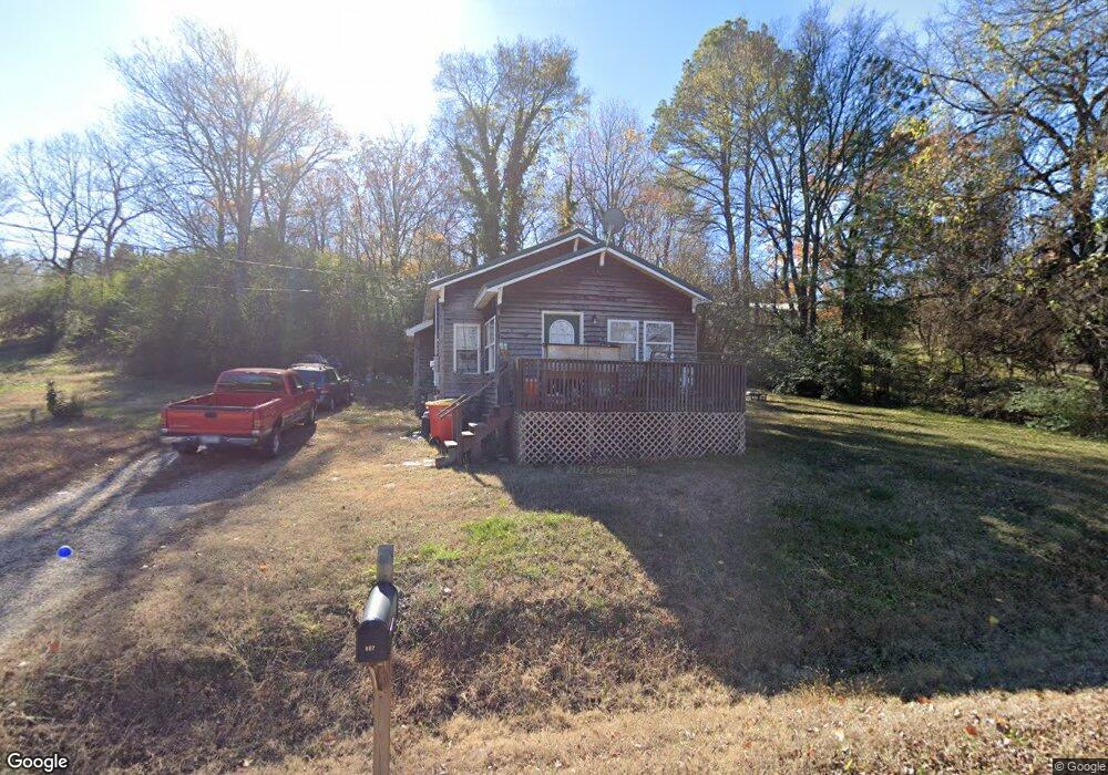
607 Bennett St Morrilton, AR 72110
Estimated Value: $86,000 - $155,000
Studio
2
Baths
1,012
Sq Ft
$110/Sq Ft
Est. Value
About This Home
This home is located at 607 Bennett St, Morrilton, AR 72110 and is currently estimated at $110,941, approximately $109 per square foot. 607 Bennett St is a home located in Conway County with nearby schools including Morrilton Primary School, Morrilton Elementary School, and Morrilton Intermediate School.
Ownership History
Date
Name
Owned For
Owner Type
Purchase Details
Closed on
Oct 19, 2022
Sold by
White Carolyn
Bought by
Zion Group Llc
Current Estimated Value
Purchase Details
Closed on
Apr 8, 2022
Sold by
Freeman and Sandra
Bought by
Zion Group Llc
Purchase Details
Closed on
Oct 20, 2004
Bought by
Geiger Stetson and Geiger Marilyn R
Purchase Details
Closed on
Jan 10, 2002
Bought by
Geiger Marilyn R and Geiger C
Purchase Details
Closed on
Nov 22, 2000
Bought by
Geiger Marilyn R
Purchase Details
Closed on
Jan 1, 1984
Bought by
Schenebeck Eugene
Create a Home Valuation Report for This Property
The Home Valuation Report is an in-depth analysis detailing your home's value as well as a comparison with similar homes in the area
Home Values in the Area
Average Home Value in this Area
Purchase History
| Date | Buyer | Sale Price | Title Company |
|---|---|---|---|
| Zion Group Llc | $22,000 | Morrilton Abstract | |
| Zion Group Llc | $2,000 | None Listed On Document | |
| Geiger Stetson | -- | -- | |
| Geiger Marilyn R | -- | -- | |
| Geiger Marilyn R | $8,000 | -- | |
| Schenebeck Eugene | -- | -- |
Source: Public Records
Mortgage History
| Date | Status | Borrower | Loan Amount |
|---|---|---|---|
| Previous Owner | Schenebeck Eugene | $37,119 |
Source: Public Records
Tax History Compared to Growth
Tax History
| Year | Tax Paid | Tax Assessment Tax Assessment Total Assessment is a certain percentage of the fair market value that is determined by local assessors to be the total taxable value of land and additions on the property. | Land | Improvement |
|---|---|---|---|---|
| 2025 | $576 | $10,650 | $1,470 | $9,180 |
| 2024 | $576 | $10,650 | $1,470 | $9,180 |
| 2023 | $546 | $10,650 | $1,470 | $9,180 |
| 2022 | $501 | $10,650 | $1,470 | $9,180 |
| 2021 | $450 | $8,320 | $1,500 | $6,820 |
| 2020 | $450 | $8,320 | $1,500 | $6,820 |
| 2019 | $450 | $8,320 | $1,500 | $6,820 |
| 2018 | $450 | $8,320 | $1,500 | $6,820 |
| 2017 | $450 | $8,320 | $1,500 | $6,820 |
| 2016 | $444 | $8,320 | $1,500 | $6,820 |
| 2015 | $412 | $8,320 | $1,500 | $6,820 |
| 2014 | $412 | $8,320 | $1,500 | $6,820 |
Source: Public Records
Map
Nearby Homes
- 315 S Cherokee St
- 304 S Ola St
- 405 W Valley St
- 202 N Griffin St
- 401 S Moose St
- 209 N Griffin St
- 805 W Elm St
- 200 N Morrill St
- Block 1 Lots 16 & 17
- Block 1 Lots 13 & 14
- TBD Burrow
- 00 Hwy 113
- 401 Lane St
- 303 S Saint Joseph St
- 306 N Bentley St
- 9 W Winthrop Rd
- 404 Maple St
- 409 N West St
- 901 & 902 S Moose St
- 402 N Morrill St