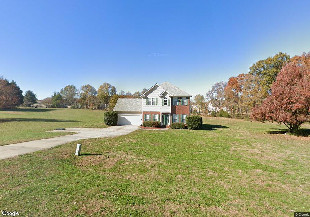
607 Butternut Ln Matthews, NC 28104
Estimated Value: $435,532 - $566,000
3
Beds
3
Baths
1,682
Sq Ft
$291/Sq Ft
Est. Value
About This Home
This home is located at 607 Butternut Ln, Matthews, NC 28104 and is currently estimated at $489,883, approximately $291 per square foot. 607 Butternut Ln is a home located in Union County with nearby schools including Stallings Elementary School, Porter Ridge Middle School, and Porter Ridge High School.
Ownership History
Date
Name
Owned For
Owner Type
Purchase Details
Closed on
Nov 13, 1998
Sold by
Love Construction Company
Bought by
Widgeon Lannie L and Widgeon Pamela M
Current Estimated Value
Home Financials for this Owner
Home Financials are based on the most recent Mortgage that was taken out on this home.
Original Mortgage
$110,000
Outstanding Balance
$23,989
Interest Rate
6.58%
Estimated Equity
$465,894
Create a Home Valuation Report for This Property
The Home Valuation Report is an in-depth analysis detailing your home's value as well as a comparison with similar homes in the area
Home Values in the Area
Average Home Value in this Area
Purchase History
| Date | Buyer | Sale Price | Title Company |
|---|---|---|---|
| Widgeon Lannie L | $141,500 | -- |
Source: Public Records
Mortgage History
| Date | Status | Borrower | Loan Amount |
|---|---|---|---|
| Open | Widgeon Lannie L | $110,000 |
Source: Public Records
Tax History Compared to Growth
Tax History
| Year | Tax Paid | Tax Assessment Tax Assessment Total Assessment is a certain percentage of the fair market value that is determined by local assessors to be the total taxable value of land and additions on the property. | Land | Improvement |
|---|---|---|---|---|
| 2024 | $2,259 | $255,600 | $62,600 | $193,000 |
| 2023 | $2,168 | $255,600 | $62,600 | $193,000 |
| 2022 | $2,147 | $255,600 | $62,600 | $193,000 |
| 2021 | $2,145 | $255,600 | $62,600 | $193,000 |
| 2020 | $1,856 | $180,920 | $45,620 | $135,300 |
| 2019 | $1,848 | $180,920 | $45,620 | $135,300 |
| 2018 | $1,848 | $180,920 | $45,620 | $135,300 |
| 2017 | $1,893 | $180,900 | $45,600 | $135,300 |
| 2016 | $1,913 | $180,920 | $45,620 | $135,300 |
| 2015 | $1,932 | $180,920 | $45,620 | $135,300 |
| 2014 | $1,404 | $198,390 | $54,400 | $143,990 |
Source: Public Records
Map
Nearby Homes
- 211 Samuel St
- 4216 Scarlet Dr
- 1201 Mountain Laurel Ct
- 1905 Yellow Daisy Dr
- 4006 Scarlet Dr Unit 29
- 4023 Lawrence Daniel Dr
- 1228 Tranquil Falls Ln
- 5401 Stevens Mill Rd
- 1847 Yellow Daisy Dr
- 5419 Stevens Mill Rd
- 6008 Grassy Knoll Cir
- 2746 Cameron Commons Way
- 14807 Middlesborough Dr
- 15108 Castlebridge Ln
- 113 Eaglecrest Dr
- 14601 Phillips Rd
- 809 Clonmel Dr
- 2100 Light Brigade Dr
- 1830 Light Brigade Dr
- 201 Limerick Dr
- 633 Butternut Ln
- 618 Butternut Ln
- 618 Butternut Ln Unit 9
- 626 Butternut Ln
- 603 Butternut Ln
- 650 Butternut Ln
- 203 Houston Blair Rd Unit Lot 47
- 207 Houston Blair Rd Unit 46
- 602 Butternut Ln
- 634 Butternut Ln
- 127 Houston Blair Rd Unit Lot 48
- 642 Butternut Ln
- 211 Houston Blair Rd Unit 45
- 601 Butternut Ln
- 600 Butternut Ln
- 0 Houston Blair Rd Unit 40
- 4855 Stevens Mill Rd
- 4849 Stevens Mill Rd
- 215 Houston Blair Rd Unit 44
- 215 Houston Blair Rd