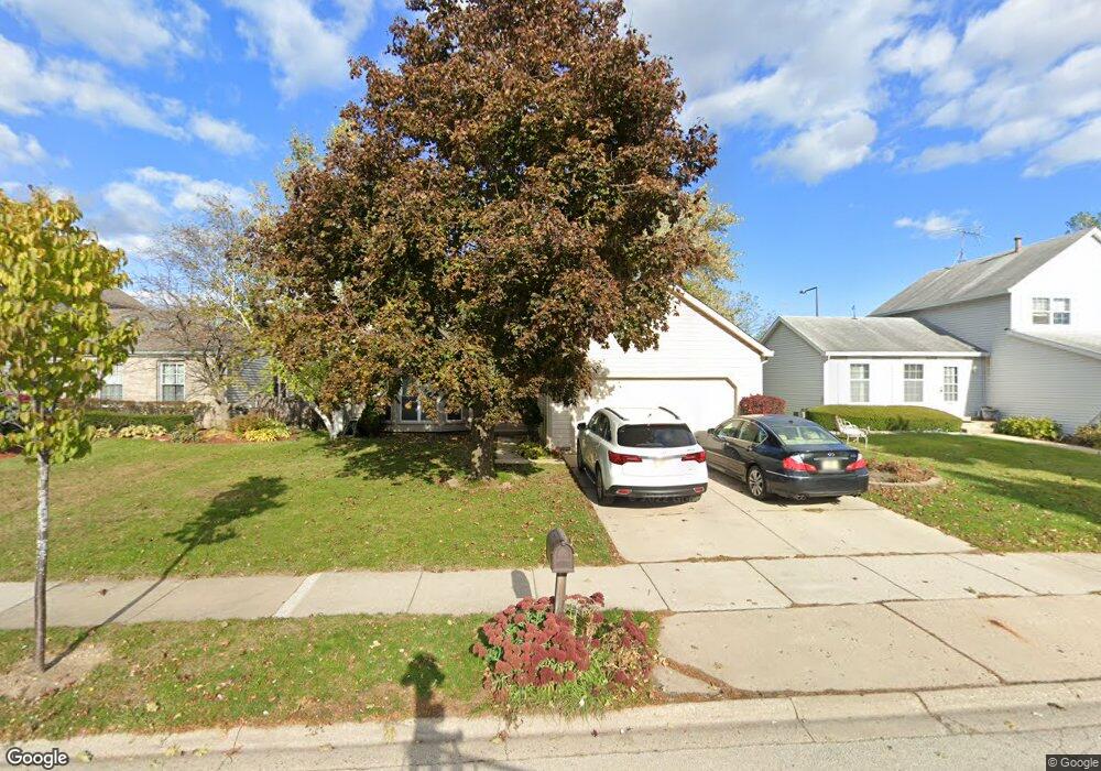
607 Harris Dr Buffalo Grove, IL 60089
Estimated Value: $510,000 - $539,000
--
Bed
3
Baths
1,944
Sq Ft
$269/Sq Ft
Est. Value
About This Home
This home is located at 607 Harris Dr, Buffalo Grove, IL 60089 and is currently estimated at $523,381, approximately $269 per square foot. 607 Harris Dr is a home located in Lake County with nearby schools including Ivy Hall Elementary School, Twin Groves Middle School, and Adlai E Stevenson High School.
Ownership History
Date
Name
Owned For
Owner Type
Purchase Details
Closed on
Mar 28, 2003
Sold by
Dionisio Emmanuel and Dionisio Rosalinda
Bought by
Ku Eun Kang and Ku Calvin
Current Estimated Value
Home Financials for this Owner
Home Financials are based on the most recent Mortgage that was taken out on this home.
Original Mortgage
$299,250
Interest Rate
5.86%
Mortgage Type
Balloon
Purchase Details
Closed on
Oct 30, 2002
Sold by
Dy Manuel D and Dy Victoria S
Bought by
Dionisio Emmanuel and Dionisio Rosalinda
Home Financials for this Owner
Home Financials are based on the most recent Mortgage that was taken out on this home.
Original Mortgage
$265,500
Interest Rate
6.38%
Create a Home Valuation Report for This Property
The Home Valuation Report is an in-depth analysis detailing your home's value as well as a comparison with similar homes in the area
Home Values in the Area
Average Home Value in this Area
Purchase History
| Date | Buyer | Sale Price | Title Company |
|---|---|---|---|
| Ku Eun Kang | $332,500 | -- | |
| Dionisio Emmanuel | $279,500 | Commonwealth Land Title Ins |
Source: Public Records
Mortgage History
| Date | Status | Borrower | Loan Amount |
|---|---|---|---|
| Closed | Ku Eun Kang | $299,250 | |
| Previous Owner | Dionisio Emmanuel | $265,500 |
Source: Public Records
Tax History Compared to Growth
Tax History
| Year | Tax Paid | Tax Assessment Tax Assessment Total Assessment is a certain percentage of the fair market value that is determined by local assessors to be the total taxable value of land and additions on the property. | Land | Improvement |
|---|---|---|---|---|
| 2024 | $13,531 | $148,273 | $28,392 | $119,881 |
| 2023 | $12,349 | $139,907 | $26,790 | $113,117 |
| 2022 | $12,349 | $124,432 | $23,827 | $100,605 |
| 2021 | $11,881 | $123,090 | $23,570 | $99,520 |
| 2020 | $11,601 | $123,510 | $23,650 | $99,860 |
| 2019 | $11,442 | $123,055 | $23,563 | $99,492 |
| 2018 | $10,208 | $113,781 | $23,289 | $90,492 |
| 2017 | $10,014 | $111,125 | $22,745 | $88,380 |
| 2016 | $9,749 | $106,411 | $21,780 | $84,631 |
| 2015 | $9,486 | $99,514 | $20,368 | $79,146 |
| 2014 | $9,107 | $94,485 | $21,875 | $72,610 |
| 2012 | $9,050 | $94,675 | $21,919 | $72,756 |
Source: Public Records
Map
Nearby Homes
- 603 Cherbourg Ct N
- 412 Chateau Dr
- 711 Woodhollow Ln
- 720 Dunhill Dr
- 938 Hidden Lake Dr
- 51 W Fabish Dr
- 871 Shady Grove Ln
- 12 Aberdeen Ct
- 1113 Lockwood Dr
- 746 Old Checker Rd Unit E5
- 931 Shady Grove Ln
- 1012 Hobson Dr
- 872 Old Checker Rd Unit E3
- 126 Woodstone Dr Unit 14
- 128 Woodstone Dr
- 1118 Larraway Dr
- 620 Cobblestone Ln
- 800 Clohesey Dr
- 455 Thorndale Dr
- 1141 Devonshire Rd