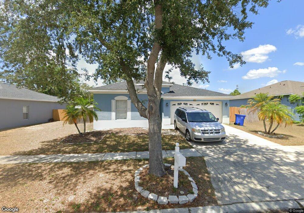
607 Maple Pointe Dr Unit B Seffner, FL 33584
Estimated Value: $391,000 - $426,000
4
Beds
2
Baths
2,425
Sq Ft
$169/Sq Ft
Est. Value
About This Home
This home is located at 607 Maple Pointe Dr Unit B, Seffner, FL 33584 and is currently estimated at $409,486, approximately $168 per square foot. 607 Maple Pointe Dr Unit B is a home located in Hillsborough County with nearby schools including Lopez Elementary School, Burnett Middle School, and Armwood High School.
Ownership History
Date
Name
Owned For
Owner Type
Purchase Details
Closed on
Feb 16, 2025
Sold by
Quinn Linda Y
Bought by
Cole Lynetra Shantel and Cole Britton Kodi
Current Estimated Value
Purchase Details
Closed on
Dec 14, 2011
Sold by
Rodriguez De Jesus Nitsa M and De Jesus David
Bought by
Quinn Linda Y
Home Financials for this Owner
Home Financials are based on the most recent Mortgage that was taken out on this home.
Original Mortgage
$82,000
Interest Rate
4.06%
Mortgage Type
New Conventional
Purchase Details
Closed on
Jan 26, 2004
Sold by
The Ryland Group Inc
Bought by
Dejesus David and Rodriguez Dejesus Nitsa M
Home Financials for this Owner
Home Financials are based on the most recent Mortgage that was taken out on this home.
Original Mortgage
$164,950
Interest Rate
5.77%
Mortgage Type
Unknown
Create a Home Valuation Report for This Property
The Home Valuation Report is an in-depth analysis detailing your home's value as well as a comparison with similar homes in the area
Home Values in the Area
Average Home Value in this Area
Purchase History
| Date | Buyer | Sale Price | Title Company |
|---|---|---|---|
| Cole Lynetra Shantel | -- | None Listed On Document | |
| Quinn Linda Y | $116,000 | Compass Land & Title Llc | |
| Dejesus David | $183,400 | Ryland Title Company |
Source: Public Records
Mortgage History
| Date | Status | Borrower | Loan Amount |
|---|---|---|---|
| Previous Owner | Quinn Linda Y | $82,000 | |
| Previous Owner | Dejesus David | $164,950 |
Source: Public Records
Tax History
| Year | Tax Paid | Tax Assessment Tax Assessment Total Assessment is a certain percentage of the fair market value that is determined by local assessors to be the total taxable value of land and additions on the property. | Land | Improvement |
|---|---|---|---|---|
| 2025 | $6,170 | $331,465 | $106,942 | $224,523 |
| 2024 | $5,708 | $330,622 | $103,378 | $227,244 |
| 2023 | $5,708 | $312,542 | $103,378 | $209,164 |
| 2022 | $5,508 | $286,452 | $89,119 | $197,333 |
| 2021 | $5,028 | $236,477 | $71,295 | $165,182 |
| 2020 | $4,603 | $213,793 | $64,166 | $149,627 |
| 2019 | $4,431 | $205,493 | $55,254 | $150,239 |
| 2018 | $4,108 | $186,499 | $0 | $0 |
| 2017 | $3,976 | $179,819 | $0 | $0 |
| 2016 | $3,746 | $160,472 | $0 | $0 |
| 2015 | $3,554 | $145,884 | $0 | $0 |
| 2014 | $3,292 | $132,622 | $0 | $0 |
| 2013 | -- | $120,565 | $0 | $0 |
Source: Public Records
Map
Nearby Homes
- 719 Vineyard Reserve Ct
- 762 Parsons Mooring Ct
- 788 Parsons Mooring Ct
- 503 de Resine Carre St Unit 503DR
- 603 U S 92
- 502 Calhoun Ave
- 131 Elina Sky Dr
- 634 Auxerre Cir Unit 634AC
- 920 Brinwood Dr
- 605 de Resine Carre St Unit 605DR
- 1214 Florablu Dr
- 106 Phillips Dr
- 109 Azul Dr
- 1241 Florablu Dr
- 801 N Kingsway Rd
- 308 Abyhara Ave Unit 308
- 106 Winston Manor Cir
- 1244 Florablu Dr
- 1246 Florablu Dr
- 821 Walnut Dr
- 605 Maple Pointe Dr
- 603 Maple Pointe Dr Unit B
- 611 Maple Pointe Dr Unit B
- 608 Maple Pointe Dr
- 606 Maple Pointe Dr
- 610 Maple Pointe Dr
- 908 Coade Stone Dr
- 604 Maple Pointe Dr
- 601 Maple Pointe Dr Unit B
- 910 Coade Stone Dr
- 613 Maple Pointe Dr Unit B
- 612 Maple Pointe Dr
- 518 Magnolia Pointe Ct
- 704 Vineyard Reserve Ct
- 614 Maple Pointe Dr
- 615 Maple Pointe Dr Unit B
- 912 Coade Stone Dr
- 516 Magnolia Pointe Ct
- 0 N Parsons Ave
Your Personal Tour Guide
Ask me questions while you tour the home.