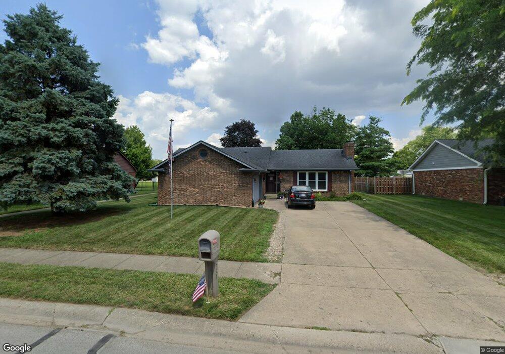
607 Oakland Way Whiteland, IN 46184
Estimated Value: $241,000 - $267,000
3
Beds
2
Baths
1,450
Sq Ft
$172/Sq Ft
Est. Value
About This Home
This home is located at 607 Oakland Way, Whiteland, IN 46184 and is currently estimated at $248,821, approximately $171 per square foot. 607 Oakland Way is a home located in Johnson County with nearby schools including Break-O-Day Elementary School, Clark-Pleasant Middle School, and Whiteland Community High School.
Ownership History
Date
Name
Owned For
Owner Type
Purchase Details
Closed on
May 19, 2025
Sold by
Mattick Stephen Douglas
Bought by
Trusted Nest Properties Llc
Current Estimated Value
Purchase Details
Closed on
Dec 14, 2012
Sold by
Mattick Properties Llc and Mattick Stephen D
Bought by
Mattick Stephen D and Mattick Gloria P
Create a Home Valuation Report for This Property
The Home Valuation Report is an in-depth analysis detailing your home's value as well as a comparison with similar homes in the area
Home Values in the Area
Average Home Value in this Area
Purchase History
| Date | Buyer | Sale Price | Title Company |
|---|---|---|---|
| Trusted Nest Properties Llc | -- | None Listed On Document | |
| Mattick Stephen D | -- | None Available |
Source: Public Records
Tax History Compared to Growth
Tax History
| Year | Tax Paid | Tax Assessment Tax Assessment Total Assessment is a certain percentage of the fair market value that is determined by local assessors to be the total taxable value of land and additions on the property. | Land | Improvement |
|---|---|---|---|---|
| 2025 | $3,438 | $186,000 | $51,000 | $135,000 |
| 2024 | $3,438 | $164,600 | $51,000 | $113,600 |
| 2023 | $3,472 | $166,400 | $51,000 | $115,400 |
| 2022 | $3,064 | $147,400 | $32,000 | $115,400 |
| 2021 | $2,848 | $136,400 | $32,000 | $104,400 |
| 2020 | $2,600 | $123,700 | $26,400 | $97,300 |
| 2019 | $2,395 | $113,900 | $26,400 | $87,500 |
| 2018 | $2,230 | $109,300 | $17,500 | $91,800 |
| 2017 | $2,170 | $107,800 | $17,500 | $90,300 |
| 2016 | $2,161 | $107,800 | $17,500 | $90,300 |
| 2014 | $1,974 | $98,800 | $17,500 | $81,300 |
| 2013 | $1,974 | $98,600 | $17,600 | $81,000 |
Source: Public Records
Map
Nearby Homes
- 733 Hanover Dr
- 652 Mooreland Dr
- 1003 Hilltop Commons Blvd
- 132 Arabian Ct
- 240 Shelton Place
- 647 Bluestem Cir
- 587 Bluestem Ln
- 0 E 700 N Unit MBR22036500
- 76 Fernleaf Dr
- 114 Tracy Ridge Blvd
- 135 Bradford Place
- Lincoln Plan at Crossroads at Southport
- Liberty Plan at Crossroads at Southport
- Rushmore Plan at Crossroads at Southport
- Jefferson Plan at Crossroads at Southport
- Washington Plan at Crossroads at Southport
- 588 Bluestem Ln
- 152 Tracy Ridge Blvd
- 131 Belaire Dr
- 34 Crestwood Dr
- 605 Oakland Way
- 609 Oakland Way
- 603 Oakland Way
- 611 Oakland Way
- 608 Oakland Way
- 606 Oakland Way
- 610 Oakland Way
- 613 Oakland Way
- 20 Rypma Row
- 604 Oakland Way
- 612 Oakland Way
- 18 Rypma Row
- 16 Rypma Row
- 614 Oakland Way
- 602 Oakland Way
- 615 Oakland Way
- 14 Rypma Row
- 29 Morningside Ct
- 605 Rypma Place
- 21 Rypma Row