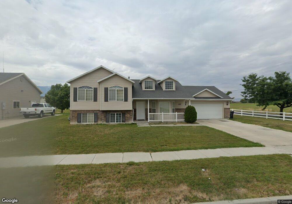
607 S 1580 W Logan, UT 84321
Woodruff NeighborhoodEstimated Value: $426,000 - $453,000
5
Beds
3
Baths
2,003
Sq Ft
$220/Sq Ft
Est. Value
About This Home
This home is located at 607 S 1580 W, Logan, UT 84321 and is currently estimated at $439,770, approximately $219 per square foot. 607 S 1580 W is a home located in Cache County with nearby schools including Woodruff School, Mount Logan Middle School, and Logan High School.
Ownership History
Date
Name
Owned For
Owner Type
Purchase Details
Closed on
Mar 16, 2023
Sold by
Landaverry Jose G
Bought by
Duran Peter Samuel and Duran Flora Aki
Current Estimated Value
Home Financials for this Owner
Home Financials are based on the most recent Mortgage that was taken out on this home.
Original Mortgage
$345,200
Outstanding Balance
$333,891
Interest Rate
6.09%
Mortgage Type
New Conventional
Estimated Equity
$105,879
Purchase Details
Closed on
Oct 16, 2020
Sold by
Landaverry Linda M
Bought by
Landaverry Jose G
Home Financials for this Owner
Home Financials are based on the most recent Mortgage that was taken out on this home.
Original Mortgage
$96,000
Interest Rate
2.8%
Mortgage Type
New Conventional
Create a Home Valuation Report for This Property
The Home Valuation Report is an in-depth analysis detailing your home's value as well as a comparison with similar homes in the area
Home Values in the Area
Average Home Value in this Area
Purchase History
| Date | Buyer | Sale Price | Title Company |
|---|---|---|---|
| Duran Peter Samuel | -- | Advanced Title | |
| Landaverry Jose G | -- | Advanced Title |
Source: Public Records
Mortgage History
| Date | Status | Borrower | Loan Amount |
|---|---|---|---|
| Open | Duran Peter Samuel | $345,200 | |
| Previous Owner | Landaverry Jose G | $96,000 |
Source: Public Records
Tax History Compared to Growth
Tax History
| Year | Tax Paid | Tax Assessment Tax Assessment Total Assessment is a certain percentage of the fair market value that is determined by local assessors to be the total taxable value of land and additions on the property. | Land | Improvement |
|---|---|---|---|---|
| 2025 | $1,758 | $227,345 | $0 | $0 |
| 2024 | $1,818 | $227,705 | $0 | $0 |
| 2023 | $1,889 | $225,505 | $0 | $0 |
| 2022 | $1,746 | $194,705 | $0 | $0 |
| 2021 | $1,695 | $292,010 | $44,000 | $248,010 |
| 2020 | $1,623 | $251,575 | $44,000 | $207,575 |
| 2019 | $1,696 | $251,575 | $44,000 | $207,575 |
| 2018 | $1,658 | $224,500 | $44,000 | $180,500 |
| 2017 | $1,431 | $102,465 | $0 | $0 |
| 2016 | $1,484 | $102,465 | $0 | $0 |
| 2015 | $1,282 | $88,460 | $0 | $0 |
| 2014 | $1,159 | $88,460 | $0 | $0 |
| 2013 | -- | $88,460 | $0 | $0 |
Source: Public Records
Map
Nearby Homes
- 539 S 1580 W Unit 121
- 679 Trail Cir
- Redwood Plan at Rivergate - Logan
- Madison Plan at Rivergate - Logan
- Sitka Plan at Sugar Creek - Logan (Townhomes)
- Hawthorne Plan at Rivergate - Logan
- Springhill Plan at Rivergate - Logan
- Auburn Plan at Rivergate - Logan
- Hilldale Plan at Rivergate - Logan
- 534 S 1580 W
- 2157 S 1580 W
- 1615 W Silver Canoe Way Unit 215
- 552 Rivergate Dr
- 1790 W 620 S
- 524 Rivergate Dr
- 1603 Silver Canoe Way
- 1506 Silver Canoe Loop
- 1506 Silver Canoe Loop Unit 102
- 763 S 1500 W
- 1585 W Silver Canoe Way
- 600 S 1580 W
- 623 S 1580 W
- 1575 Sundown Way
- 641 S 1580 W
- 1576 Sundown Way
- 695 Trail Cir
- 1559 Sundown Way
- 697 Trail Cir
- 687 Trail Cir
- 1514 Silver Canoe Loop Unit 104
- 1514 Silver Canoe Loop
- 1560 Sundown Way
- 648 S 1580 W
- 1513 Silver Canoe Loop Unit 123
- 1513 Silver Canoe Loop
- 655 S 1580 W
- 683 Trail Cir
- 1547 Sundown Way
- 1563 W 660 S
- 1548 Sundown Way