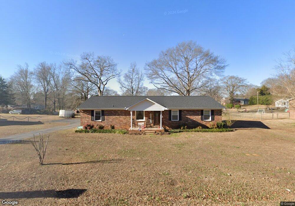
607 Wingo Rd Roebuck, SC 29376
Estimated Value: $221,000 - $263,607
3
Beds
2
Baths
1,617
Sq Ft
$150/Sq Ft
Est. Value
About This Home
This home is located at 607 Wingo Rd, Roebuck, SC 29376 and is currently estimated at $242,402, approximately $149 per square foot. 607 Wingo Rd is a home located in Spartanburg County with nearby schools including Dorman High School Freshman Campus, Dorman High School, and Eddlemon Adventist School.
Ownership History
Date
Name
Owned For
Owner Type
Purchase Details
Closed on
Aug 18, 2016
Sold by
Wilson Tami and Mcabee Jackie
Bought by
Crocker Matthew Phillip and Crocker Rhonda Billings
Current Estimated Value
Home Financials for this Owner
Home Financials are based on the most recent Mortgage that was taken out on this home.
Original Mortgage
$97,172
Outstanding Balance
$77,407
Interest Rate
3.43%
Estimated Equity
$164,995
Purchase Details
Closed on
Jul 5, 2016
Sold by
The Estate Of Debra Ann Mcabee Moore
Bought by
Mcabee Jackie
Home Financials for this Owner
Home Financials are based on the most recent Mortgage that was taken out on this home.
Original Mortgage
$97,172
Outstanding Balance
$77,407
Interest Rate
3.43%
Estimated Equity
$164,995
Purchase Details
Closed on
Jul 31, 2007
Sold by
Mcabee Helen King
Bought by
Mcabee John Chris
Create a Home Valuation Report for This Property
The Home Valuation Report is an in-depth analysis detailing your home's value as well as a comparison with similar homes in the area
Home Values in the Area
Average Home Value in this Area
Purchase History
| Date | Buyer | Sale Price | Title Company |
|---|---|---|---|
| Crocker Matthew Phillip | $94,500 | None Available | |
| Mcabee Jackie | -- | None Available | |
| Mcabee John Chris | -- | None Available |
Source: Public Records
Mortgage History
| Date | Status | Borrower | Loan Amount |
|---|---|---|---|
| Open | Crocker Matthew Phillip | $97,172 |
Source: Public Records
Tax History
| Year | Tax Paid | Tax Assessment Tax Assessment Total Assessment is a certain percentage of the fair market value that is determined by local assessors to be the total taxable value of land and additions on the property. | Land | Improvement |
|---|---|---|---|---|
| 2025 | $1,262 | $6,581 | $701 | $5,880 |
| 2024 | $1,262 | $6,581 | $701 | $5,880 |
| 2023 | $1,262 | $6,581 | $701 | $5,880 |
| 2022 | $1,135 | $5,723 | $653 | $5,070 |
| 2021 | $1,122 | $5,723 | $653 | $5,070 |
| 2020 | $1,095 | $5,723 | $653 | $5,070 |
| 2019 | $1,066 | $5,723 | $653 | $5,070 |
| 2018 | $1,070 | $5,723 | $653 | $5,070 |
| 2017 | $927 | $4,976 | $600 | $4,376 |
| 2016 | $947 | $4,976 | $600 | $4,376 |
| 2015 | $576 | $4,976 | $600 | $4,376 |
| 2014 | $556 | $4,976 | $600 | $4,376 |
Source: Public Records
Map
Nearby Homes
- 189 Birchwood Dr
- 3032 Emberly Dr
- 3040 Emberly Dr
- 3016 Emberly Dr
- 3012 Emberly Dr
- 3808 Zepelin Way
- 3045 Emberly Dr
- 3049 Emberly Dr
- 3053 Emberly Dr
- 3069 Emberly Dr
- 3073 Emberly Dr
- 3081 Emberly Dr
- 3077 Emberly Dr
- 507 Wingo Rd
- 3172 Emberly Dr
- 864 Canaan Rd
- 622 Farcroft Trail
- 3208 Emberly Dr
- 628 Farcroft Trail
- 618 Farcroft Trail
Your Personal Tour Guide
Ask me questions while you tour the home.