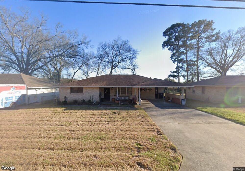
6070 Linden St Baton Rouge, LA 70805
Mid City North NeighborhoodEstimated Value: $100,000 - $188,000
3
Beds
2
Baths
1,427
Sq Ft
$89/Sq Ft
Est. Value
About This Home
This home is located at 6070 Linden St, Baton Rouge, LA 70805 and is currently estimated at $127,589, approximately $89 per square foot. 6070 Linden St is a home located in East Baton Rouge Parish with nearby schools including Brookstown Middle Magnet Academy, Capitol Middle School, and Istrouma High School.
Ownership History
Date
Name
Owned For
Owner Type
Purchase Details
Closed on
Apr 15, 2004
Sold by
Ud H
Bought by
Calrk Willard
Current Estimated Value
Home Financials for this Owner
Home Financials are based on the most recent Mortgage that was taken out on this home.
Original Mortgage
$58,000
Outstanding Balance
$27,199
Interest Rate
5.61%
Mortgage Type
New Conventional
Estimated Equity
$100,390
Purchase Details
Closed on
Dec 31, 2003
Sold by
Wells Fargo Home Mortage
Bought by
Department Of Hud
Create a Home Valuation Report for This Property
The Home Valuation Report is an in-depth analysis detailing your home's value as well as a comparison with similar homes in the area
Home Values in the Area
Average Home Value in this Area
Purchase History
| Date | Buyer | Sale Price | Title Company |
|---|---|---|---|
| Calrk Willard | $58,005 | -- | |
| Department Of Hud | $62,026 | -- |
Source: Public Records
Mortgage History
| Date | Status | Borrower | Loan Amount |
|---|---|---|---|
| Open | Calrk Willard | $58,000 |
Source: Public Records
Tax History Compared to Growth
Tax History
| Year | Tax Paid | Tax Assessment Tax Assessment Total Assessment is a certain percentage of the fair market value that is determined by local assessors to be the total taxable value of land and additions on the property. | Land | Improvement |
|---|---|---|---|---|
| 2024 | $88 | $7,336 | $437 | $6,899 |
| 2023 | $88 | $6,550 | $390 | $6,160 |
| 2022 | $782 | $6,550 | $390 | $6,160 |
| 2021 | $764 | $6,550 | $390 | $6,160 |
| 2020 | $759 | $6,550 | $390 | $6,160 |
| 2019 | $721 | $5,950 | $350 | $5,600 |
| 2018 | $712 | $5,950 | $350 | $5,600 |
| 2017 | $712 | $5,950 | $350 | $5,600 |
| 2016 | $51 | $3,990 | $350 | $3,640 |
| 2015 | $76 | $5,800 | $350 | $5,450 |
| 2014 | $76 | $5,800 | $350 | $5,450 |
| 2013 | -- | $5,800 | $350 | $5,450 |
Source: Public Records
Map
Nearby Homes
- 5949 Heidel Ave
- 6550/6534 Prescott Rd
- 4791 Prescott Rd
- TBD E Brookstown Dr
- 3905 Elm Dr
- 3076 Elgin St
- 5156 Linden St
- 4126 Prescott Ct
- 3555 Eleanor Dr
- 4778 Broadway St
- 3704 N Foster Dr
- 3162 Elm Dr
- 4887 Enterprise St
- 3575 Victoria Dr
- 5537 Frey St
- TBD Victoria Dr
- 3045 Voss Dr
- 5950 Saint Gerard Ave
- 2945 Anita Cir
- 5496 Frey St
- 6112 Linden St
- 6058 Linden St
- 6036 Linden St
- 6103 Linden St
- 6014 Linden St
- 6059 Linden St
- 6045 Linden St
- 6155 Linden St
- 6168 Linden St
- 6002 Linden St
- 6023 Linden St
- 3875 E Brookstown Dr
- 6001 Linden St
- 5990 Linden St
- 5978 Linden St
- 5999 Linden St
- 5977 Linden St
- 5956 Linden St
- 6066 Heidel Ave
- 6108 Heidel Ave