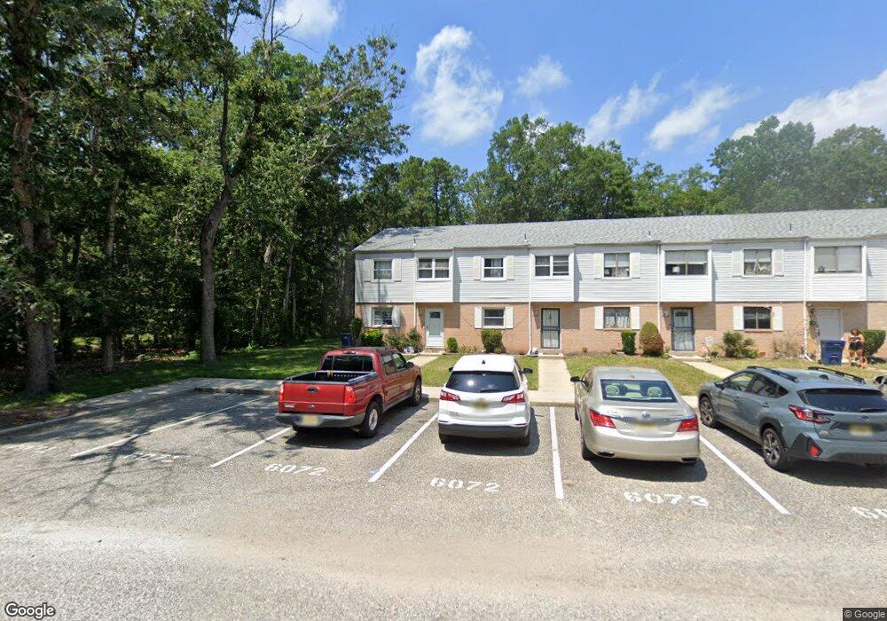
6071 Hoover Dr Unit 7A Mays Landing, NJ 08330
Estimated Value: $139,524 - $159,000
3
Beds
3
Baths
1,292
Sq Ft
$117/Sq Ft
Est. Value
About This Home
This home is located at 6071 Hoover Dr Unit 7A, Mays Landing, NJ 08330 and is currently estimated at $151,381, approximately $117 per square foot. 6071 Hoover Dr Unit 7A is a home located in Atlantic County with nearby schools including Joseph Shaner School, George L. Hess Educational Complex, and William Davies Middle School.
Ownership History
Date
Name
Owned For
Owner Type
Purchase Details
Closed on
Apr 7, 2022
Sold by
Yvette Soto
Bought by
Lopez Juan Carlos Lopez and Ochoa Larissa Andrea
Current Estimated Value
Purchase Details
Closed on
Aug 31, 2004
Sold by
Wimbish Tangela and Wimbish Michael
Bought by
Soto Yvette
Home Financials for this Owner
Home Financials are based on the most recent Mortgage that was taken out on this home.
Original Mortgage
$83,600
Interest Rate
6.01%
Mortgage Type
Purchase Money Mortgage
Purchase Details
Closed on
May 28, 1997
Sold by
Laielli Timothy C and Laielli Susan
Bought by
Curtis Tangela A
Home Financials for this Owner
Home Financials are based on the most recent Mortgage that was taken out on this home.
Original Mortgage
$55,000
Interest Rate
7.97%
Create a Home Valuation Report for This Property
The Home Valuation Report is an in-depth analysis detailing your home's value as well as a comparison with similar homes in the area
Home Values in the Area
Average Home Value in this Area
Purchase History
| Date | Buyer | Sale Price | Title Company |
|---|---|---|---|
| Lopez Juan Carlos Lopez | -- | None Listed On Document | |
| Soto Yvette | $88,000 | Surety Title Agency Of Atlan | |
| Curtis Tangela A | $56,000 | -- |
Source: Public Records
Mortgage History
| Date | Status | Borrower | Loan Amount |
|---|---|---|---|
| Previous Owner | Soto Yvette | $83,600 | |
| Previous Owner | Curtis Tangela A | $55,000 |
Source: Public Records
Tax History Compared to Growth
Tax History
| Year | Tax Paid | Tax Assessment Tax Assessment Total Assessment is a certain percentage of the fair market value that is determined by local assessors to be the total taxable value of land and additions on the property. | Land | Improvement |
|---|---|---|---|---|
| 2025 | $1,479 | $64,100 | $20,000 | $44,100 |
| 2024 | $1,479 | $43,100 | $4,500 | $38,600 |
| 2023 | $1,390 | $43,100 | $4,500 | $38,600 |
| 2022 | $1,390 | $43,100 | $4,500 | $38,600 |
| 2021 | $1,162 | $36,100 | $3,000 | $33,100 |
| 2020 | $1,162 | $36,100 | $3,000 | $33,100 |
| 2019 | $1,165 | $36,100 | $3,000 | $33,100 |
| 2018 | $1,124 | $36,100 | $3,000 | $33,100 |
| 2017 | $1,106 | $36,100 | $3,000 | $33,100 |
| 2016 | $1,215 | $40,800 | $5,000 | $35,800 |
| 2015 | $1,174 | $40,800 | $5,000 | $35,800 |
| 2014 | $1,508 | $57,400 | $5,000 | $52,400 |
Source: Public Records
Map
Nearby Homes
- 6310 Phillips Ave
- 37 Delancy Ct
- 6301 Knight Ave
- 6314 Lance Ave
- 87 Devon Rd
- 6202 Lance Ave
- 0 Harding Hwy Unit 597638
- 0 Harding Hwy Unit NJAC2019438
- 6206 Roberts Ave
- 6140 Robin Dr
- 0 Wheeling Ave Unit NJAC2018470
- 16 Holly Ct
- 24 Holly Ct
- 1 Walnut Ct
- 11 Maple Ct
- 13 Hickory Ln
- 9 Oaks Dr Unit 341
- 14 Hickory Ln
- 10 Locust Ct
- 39 Dogwood Ln Unit OAKS OF WEYMOUTH
- 6072 Hoover Dr
- 6073 Hoover Dr
- 6074 Hoover Dr Unit 7D
- 6076 Hoover Dr
- 6077 Hoover Dr
- 6108 Hoover Dr
- 6078 Hoover Dr Unit 7H
- 6107 Hoover Dr Unit 10G
- 6081 Hoover Dr Unit 8A
- 6082 Hoover Dr
- 6105 Hoover Dr Unit 10E
- 6083 Hoover Dr Unit 8C
- 6104 Hoover Dr Unit 10D
- 6084 Hoover Dr
- 6103 Hoover Dr Unit 10C
- 6085 Hoover Dr
- 6102 Hoover Dr
- 6086 Hoover Dr Unit 8F
- 6061 Hoover Dr