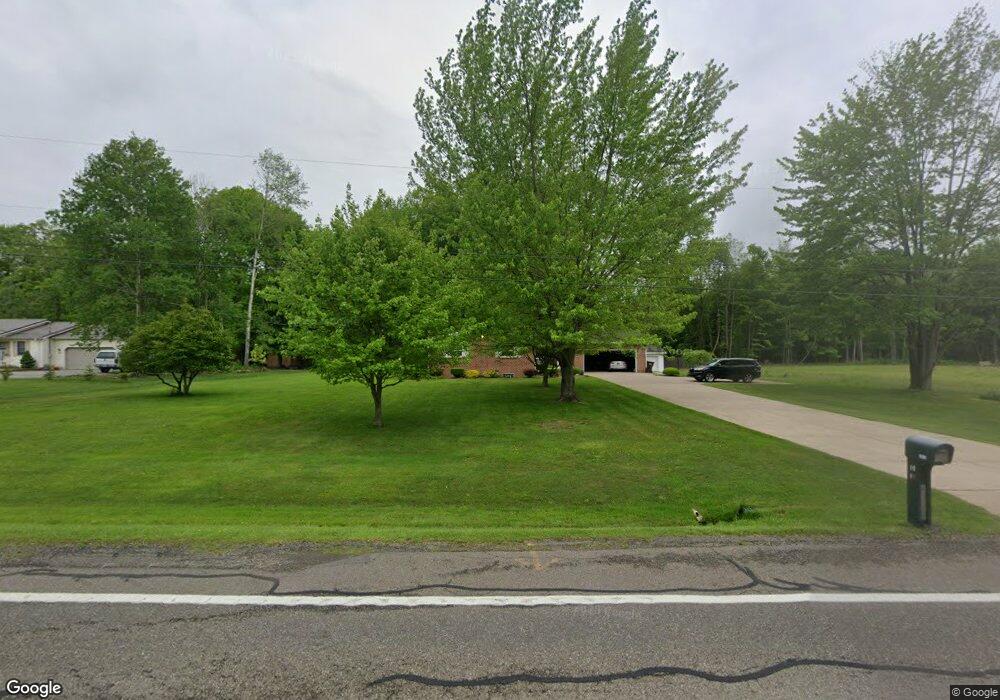
6071 Warren Rd Cortland, OH 44410
Estimated Value: $228,749 - $319,000
3
Beds
2
Baths
1,624
Sq Ft
$177/Sq Ft
Est. Value
About This Home
This home is located at 6071 Warren Rd, Cortland, OH 44410 and is currently estimated at $288,187, approximately $177 per square foot. 6071 Warren Rd is a home located in Trumbull County with nearby schools including Maplewood Middle School, Maplewood Elementary School, and Maplewood High School.
Ownership History
Date
Name
Owned For
Owner Type
Purchase Details
Closed on
Jun 5, 2009
Sold by
Detwiler Samuel T and Detwiler Julie S
Bought by
Gaffey J Brian and Gaffey Carol J
Current Estimated Value
Purchase Details
Closed on
Nov 15, 2004
Sold by
Castner Robert M and Castner Ruth M
Bought by
Detwiler Samuel T and Detwiler Julie S
Purchase Details
Closed on
Jan 1, 1990
Sold by
Dunfee Glenn W
Bought by
Robert M Castner
Create a Home Valuation Report for This Property
The Home Valuation Report is an in-depth analysis detailing your home's value as well as a comparison with similar homes in the area
Home Values in the Area
Average Home Value in this Area
Purchase History
| Date | Buyer | Sale Price | Title Company |
|---|---|---|---|
| Gaffey J Brian | $145,000 | None Available | |
| Detwiler Samuel T | $160,000 | -- | |
| Robert M Castner | -- | -- |
Source: Public Records
Tax History Compared to Growth
Tax History
| Year | Tax Paid | Tax Assessment Tax Assessment Total Assessment is a certain percentage of the fair market value that is determined by local assessors to be the total taxable value of land and additions on the property. | Land | Improvement |
|---|---|---|---|---|
| 2024 | $2,777 | $67,240 | $4,200 | $63,040 |
| 2023 | $2,777 | $67,240 | $4,200 | $63,040 |
| 2022 | $2,324 | $50,720 | $3,820 | $46,900 |
| 2021 | $2,446 | $50,720 | $3,820 | $46,900 |
| 2020 | $2,456 | $50,720 | $3,820 | $46,900 |
| 2019 | $2,312 | $45,400 | $3,540 | $41,860 |
| 2018 | $2,250 | $45,400 | $3,540 | $41,860 |
| 2017 | $2,245 | $45,400 | $3,540 | $41,860 |
| 2016 | $2,151 | $45,010 | $3,220 | $41,790 |
| 2015 | $2,146 | $45,010 | $3,220 | $41,790 |
| 2014 | $2,138 | $45,010 | $3,220 | $41,790 |
| 2013 | $2,199 | $45,010 | $3,220 | $41,790 |
Source: Public Records
Map
Nearby Homes
- 6148 Youngstown Kingsville Rd
- 4366 Greenville Rd
- 6277 Youngstown Kingsville Rd
- 6498 Stoddard Hayes Rd
- 6555 Love Warner Rd
- 2684 Griffith Dr
- 5150 Phillips Rice Rd
- 6101 Private
- 5059 Phillips Rice Rd
- 121 Fairway Dr
- 4869 Phillips Rice Rd
- 0 St Andrews Unit 5113795
- 428 Cherry Hill Ln
- 507 Tournament Trail
- 404 Cherry Hill Ln
- 525 Sycamore Trail
- 160 Saint Andrews
- 400 Tournament Trail Unit 400
- 3461 Everett Hull Rd
- 288 Butternut Cir
- 6071 Warren Rd
- 6069 Warren Rd
- 6092 Warren Rd
- 5900 Warren Rd
- 5944 Warren Rd
- 5964 Warren Rd
- 5900 Warren Rd
- 5 N State Route 5 St
- 6060 State Route 5
- 5955 Warren Rd
- 6062 State Route 5
- 3986 Greenville Rd
- 5951 Warren Rd
- 5951 Warren Rd
- 5951 State Route 5
- 5885 Warren Rd
- 5891 Warren Rd
- 5841 Warren Rd
- 5911 Warren Rd
- 5805 Warren Rd