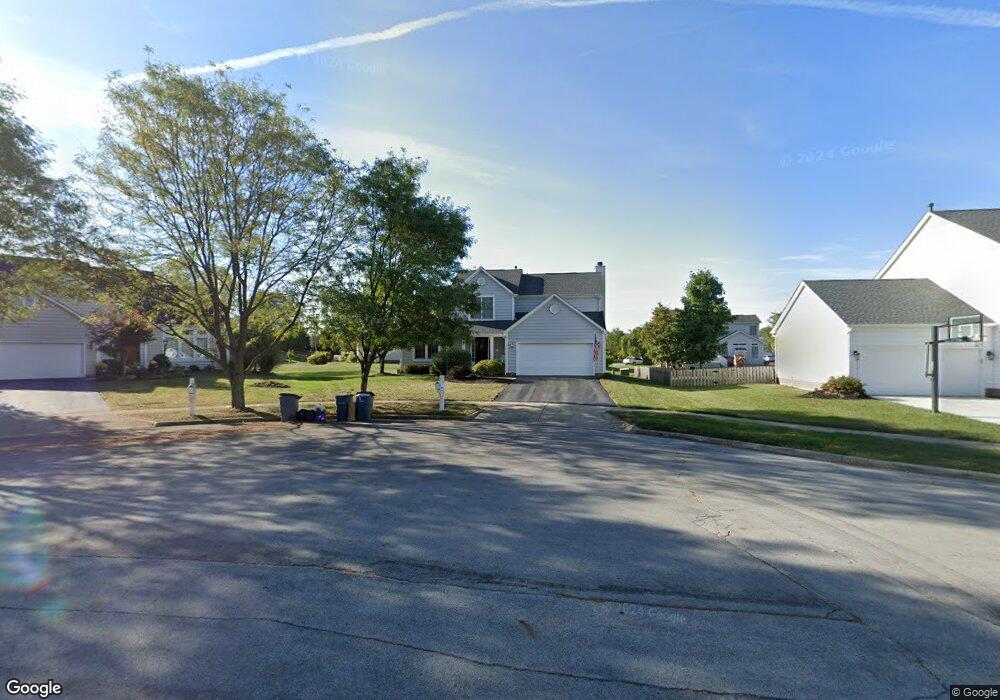
6072 Maidstone Ct Westerville, OH 43082
Estimated Value: $461,000 - $505,000
3
Beds
3
Baths
2,058
Sq Ft
$234/Sq Ft
Est. Value
About This Home
This home is located at 6072 Maidstone Ct, Westerville, OH 43082 and is currently estimated at $481,058, approximately $233 per square foot. 6072 Maidstone Ct is a home located in Delaware County with nearby schools including Fouse Elementary School, Genoa Middle School, and Westerville Central High School.
Ownership History
Date
Name
Owned For
Owner Type
Purchase Details
Closed on
Jan 12, 2005
Sold by
National Residential Nominee Services In
Bought by
Campbell Scott D and Campbell Victoria L
Current Estimated Value
Home Financials for this Owner
Home Financials are based on the most recent Mortgage that was taken out on this home.
Original Mortgage
$168,000
Interest Rate
5.88%
Mortgage Type
Fannie Mae Freddie Mac
Purchase Details
Closed on
Aug 15, 2004
Sold by
Malone Jada L and Malone Juan C
Bought by
National Residential Nominee Svcs Inc
Purchase Details
Closed on
Sep 30, 1999
Sold by
Dominion Homes Inc
Bought by
Malone Jada L and Malone Juan C
Home Financials for this Owner
Home Financials are based on the most recent Mortgage that was taken out on this home.
Original Mortgage
$189,653
Interest Rate
7.93%
Mortgage Type
FHA
Create a Home Valuation Report for This Property
The Home Valuation Report is an in-depth analysis detailing your home's value as well as a comparison with similar homes in the area
Home Values in the Area
Average Home Value in this Area
Purchase History
| Date | Buyer | Sale Price | Title Company |
|---|---|---|---|
| Campbell Scott D | $210,000 | Chicago Title | |
| National Residential Nominee Svcs Inc | -- | Chicago Title | |
| Malone Jada L | $192,149 | -- |
Source: Public Records
Mortgage History
| Date | Status | Borrower | Loan Amount |
|---|---|---|---|
| Previous Owner | Campbell Scott D | $168,000 | |
| Previous Owner | Malone Jada L | $189,653 |
Source: Public Records
Tax History
| Year | Tax Paid | Tax Assessment Tax Assessment Total Assessment is a certain percentage of the fair market value that is determined by local assessors to be the total taxable value of land and additions on the property. | Land | Improvement |
|---|---|---|---|---|
| 2024 | $7,313 | $141,370 | $33,640 | $107,730 |
| 2023 | $7,168 | $141,370 | $33,640 | $107,730 |
| 2022 | $6,507 | $98,770 | $22,050 | $76,720 |
| 2021 | $6,572 | $98,770 | $22,050 | $76,720 |
| 2020 | $6,612 | $98,770 | $22,050 | $76,720 |
| 2019 | $5,631 | $80,750 | $18,380 | $62,370 |
| 2018 | $5,459 | $80,750 | $18,380 | $62,370 |
| 2017 | $5,346 | $76,440 | $15,890 | $60,550 |
| 2016 | $5,557 | $76,440 | $15,890 | $60,550 |
| 2015 | $5,512 | $76,440 | $15,890 | $60,550 |
| 2014 | $5,446 | $76,440 | $15,890 | $60,550 |
| 2013 | $5,209 | $73,570 | $15,890 | $57,680 |
Source: Public Records
Map
Nearby Homes
- 6451 Marsella Ct
- 6544 Upper Lake Cir
- 6363 Pinehurst Pointe Unit 66363
- 6370 Pinehurst Pointe Unit 96370
- 6471 Margaret Dr
- 0 Paul Rd Unit 226003866
- 7138 Cypress Dr
- 6663 Hilmar Dr
- 6623 Henschen Cir
- 705 N State St Unit 207
- 6798 Garden View Dr
- 6136 Keats Place
- 660 Albion Place Unit 8660
- 6685 Tussic Street Rd
- 5532 Meadowood Ln
- 5833 S Old 3c Hwy
- 787 Centerpark Dr
- 266 Black Walnut Dr
- 7529 Red Maple Place Unit 17529
- 478 Burns Dr N
- 6895 Sunningdale Dr
- 6895 Sunningdale Dr Unit 2671
- 6084 Maidstone Ct
- 6060 Maidstone Ct
- 6811 Inverness St
- 6090 Maidstone Ct
- 6905 Sunningdale Dr
- 6097 Maidstone Ct
- 6085 Maidstone Ct
- 6757 Inverness St
- 6900 Sunningdale Dr
- 6794 Inverness St
- 6808 Inverness St
- 6778 Inverness St
- 6818 Inverness St
- 6896 Sunningdale Dr
- 6896 Sunningdale Dr Unit 2668
- 6766 Inverness St
- 6108 Wentworth Ct
- 6884 Sunningdale Dr
Your Personal Tour Guide
Ask me questions while you tour the home.