Estimated Value: $86,296 - $326,000
2
Beds
--
Bath
620
Sq Ft
$307/Sq Ft
Est. Value
About This Home
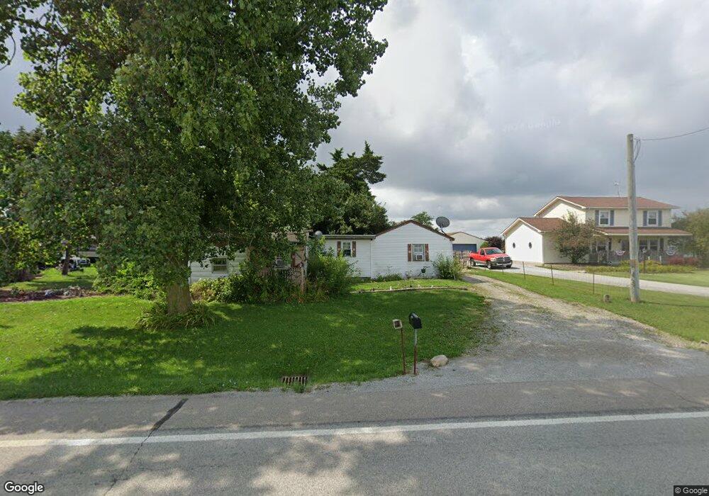
This home is located at 6072 W State Route 185, Piqua, OH 45356 and is currently estimated at $190,074, approximately $306 per square foot. 6072 W State Route 185 is a home located in Miami County with nearby schools including Covington Elementary/Junior High School, Covington Junior High School, and Covington High School.
Ownership History
Date
Name
Owned For
Owner Type
Purchase Details
Closed on
Mar 4, 2004
Sold by
Brown David M and Brown Margaret A
Bought by
Fairchild David A and Brown Melissa A
Current Estimated Value
Home Financials for this Owner
Home Financials are based on the most recent Mortgage that was taken out on this home.
Original Mortgage
$83,250
Outstanding Balance
$39,016
Interest Rate
5.71%
Mortgage Type
New Conventional
Estimated Equity
$151,058
Create a Home Valuation Report for This Property
The Home Valuation Report is an in-depth analysis detailing your home's value as well as a comparison with similar homes in the area
Home Values in the Area
Average Home Value in this Area
Purchase History
| Date | Buyer | Sale Price | Title Company |
|---|---|---|---|
| Fairchild David A | $87,649 | -- |
Source: Public Records
Mortgage History
| Date | Status | Borrower | Loan Amount |
|---|---|---|---|
| Open | Fairchild David A | $83,250 |
Source: Public Records
Tax History Compared to Growth
Tax History
| Year | Tax Paid | Tax Assessment Tax Assessment Total Assessment is a certain percentage of the fair market value that is determined by local assessors to be the total taxable value of land and additions on the property. | Land | Improvement |
|---|---|---|---|---|
| 2024 | $684 | $20,510 | $8,890 | $11,620 |
| 2023 | $684 | $20,510 | $8,890 | $11,620 |
| 2022 | $693 | $20,510 | $8,890 | $11,620 |
| 2021 | $570 | $15,760 | $6,830 | $8,930 |
| 2020 | $572 | $15,760 | $6,830 | $8,930 |
| 2019 | $570 | $15,760 | $6,830 | $8,930 |
| 2018 | $534 | $15,020 | $6,550 | $8,470 |
| 2017 | $545 | $15,020 | $6,550 | $8,470 |
| 2016 | $523 | $15,020 | $6,550 | $8,470 |
| 2015 | $495 | $14,140 | $6,160 | $7,980 |
| 2014 | $495 | $14,140 | $6,160 | $7,980 |
| 2013 | $498 | $14,140 | $6,160 | $7,980 |
Source: Public Records
Map
Nearby Homes
- 6110 Ohio 185
- 5882 W Versailles Rd
- 4528 W State Route 185
- 4510 W State Route 185
- 7648 Piqua-Clayton Rd
- 513 Spotted Doe Trail
- 8490 Bennett Dr
- 1821 Wilshire Dr
- 1337 Stratford Dr
- 0 Robert M Davis Pkwy
- 1708 Dubois Dr
- 3 Lake Ridge Dr
- 1616 Echo Lake Dr
- 731 N Pearl St
- 1207 Maplewood Dr
- 1119 Anderson St
- 698 E Broadway St
- 520 N Pearl St
- 1271 Park Ave
- 1435 Covington Ave
- 6054 W State Route 185
- 6100 W State Route 185
- 6036 W State Route 185
- 6018 W State Route 185
- 6154 W State Route 185
- 6154 Ohio 185
- 6222 Ohio 185
- 6222 W State Route 185
- 6336 W State Route 185
- 6163 W State Route 185
- 5700 W State Route 185
- 8333 N Mulberry Grv Rake Rd
- 8501 Mulberry Grove Rakestr Rd
- 8501 Mulberry Grove Rakestr Rd
- 8605 Mulberry Grove Rakestr Rd
- 7335 Rakestraw Rd
- 8285 Rakestraw Rd
- 8669 Mulberry Grove Rakestr Rd
- 6564 W State Route 185
- 8811 Mulberry Grove Rakestr Rd