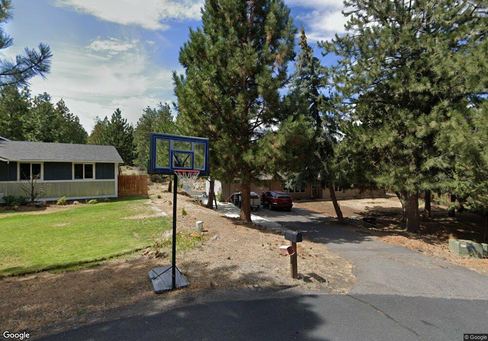
60739 Bristol Way Bend, OR 97702
Southeast Bend NeighborhoodEstimated Value: $583,957 - $625,000
3
Beds
2
Baths
1,455
Sq Ft
$411/Sq Ft
Est. Value
About This Home
This home is located at 60739 Bristol Way, Bend, OR 97702 and is currently estimated at $598,489, approximately $411 per square foot. 60739 Bristol Way is a home located in Deschutes County with nearby schools including R.E. Jewell Elementary School, High Desert Middle School, and Morning Star Christian School.
Ownership History
Date
Name
Owned For
Owner Type
Purchase Details
Closed on
Jan 26, 2007
Sold by
Halvorsen Robert M
Bought by
Halvorsen Robert M
Current Estimated Value
Purchase Details
Closed on
Dec 14, 2005
Sold by
Fletcher Maureen S
Bought by
Halvorsen Robert M
Home Financials for this Owner
Home Financials are based on the most recent Mortgage that was taken out on this home.
Original Mortgage
$175,000
Interest Rate
6.31%
Mortgage Type
Unknown
Create a Home Valuation Report for This Property
The Home Valuation Report is an in-depth analysis detailing your home's value as well as a comparison with similar homes in the area
Home Values in the Area
Average Home Value in this Area
Purchase History
| Date | Buyer | Sale Price | Title Company |
|---|---|---|---|
| Halvorsen Robert M | -- | Western Title & Escrow Co | |
| Halvorsen Robert M | $175,000 | Amerititle |
Source: Public Records
Mortgage History
| Date | Status | Borrower | Loan Amount |
|---|---|---|---|
| Previous Owner | Halvorsen Robert M | $175,000 |
Source: Public Records
Tax History
| Year | Tax Paid | Tax Assessment Tax Assessment Total Assessment is a certain percentage of the fair market value that is determined by local assessors to be the total taxable value of land and additions on the property. | Land | Improvement |
|---|---|---|---|---|
| 2025 | $3,204 | $189,630 | -- | -- |
| 2024 | $3,083 | $184,110 | -- | -- |
| 2023 | $2,858 | $178,750 | $0 | $0 |
| 2022 | $2,666 | $168,500 | $0 | $0 |
| 2021 | $2,670 | $163,600 | $0 | $0 |
| 2020 | $2,533 | $163,600 | $0 | $0 |
| 2019 | $2,463 | $158,840 | $0 | $0 |
| 2018 | $2,393 | $154,220 | $0 | $0 |
| 2017 | $2,390 | $149,730 | $0 | $0 |
| 2016 | $2,282 | $145,370 | $0 | $0 |
| 2015 | $2,220 | $141,140 | $0 | $0 |
| 2014 | $2,157 | $137,030 | $0 | $0 |
Source: Public Records
Map
Nearby Homes
- 60761 Country Club Dr
- 20589 Ambrosia Ln
- 20465 Outback
- 60625 Newcastle Dr
- 20412 Buttermilk
- 20657 SE Meadowsweet Dr
- 20375 Big Bear Ct
- 20380 Tailblock Rd
- 60716 Willow Creek Loop
- 60749 Willow Creek Loop
- 20397 Pine Vista Dr
- 60851 SE Epic Place
- 60855 SE Epic Place
- 60847 SE Epic Place
- 60852 SE Epic Place
- 60848 SE Epic Place
- 20835 SE Caldera Dr
- 60850 SE Barstow Place
- 60835 SE Barstow Place
- 60858 SE Barstow Place
- 60742 Bristol Way
- 60733 Bristol Way
- 60741 Country Club Dr
- 60762 Country Club Dr
- 60734 Bristol Way
- 20544 Whitehaven Ln
- 20521 Whitstone Cir
- 20531 Whitstone Cir
- 20541 Ambrosia Ln
- 20516 Whitstone Cir
- 20551 Ambrosia Ln
- 20570 Whitehaven Ln
- 20565 Whitehaven Ln
- 20549 Whitehaven Ln
- 20557 Whitehaven Ln
- 20559 Ambrosia Ln
- 20513 Ambrosia Ln
- 20514 Whitstone Cir
- 20550 Ambrosia Ln
- 20512 Whitstone Cir
Your Personal Tour Guide
Ask me questions while you tour the home.