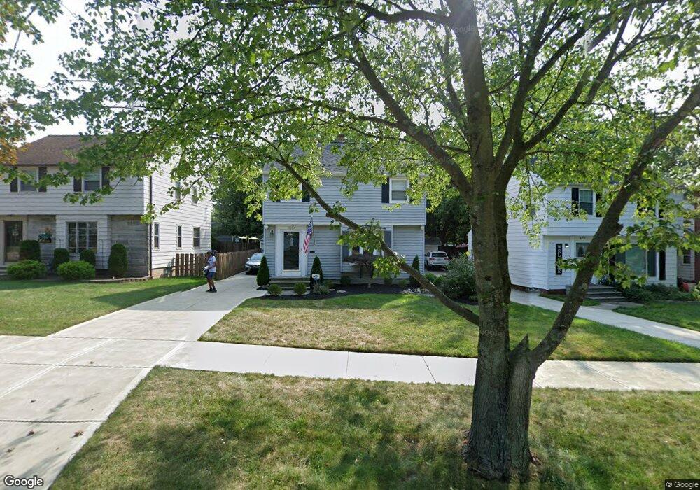
6074 Maplecliff Dr Parma Heights, OH 44130
Estimated Value: $196,000 - $237,000
3
Beds
2
Baths
1,274
Sq Ft
$168/Sq Ft
Est. Value
About This Home
This home is located at 6074 Maplecliff Dr, Parma Heights, OH 44130 and is currently estimated at $213,884, approximately $167 per square foot. 6074 Maplecliff Dr is a home located in Cuyahoga County with nearby schools including Ridge-Brook Elementary School, Greenbriar Middle School, and Valley Forge High School.
Ownership History
Date
Name
Owned For
Owner Type
Purchase Details
Closed on
Dec 7, 1984
Sold by
Slodic Mark
Bought by
Gotro Brian D and Gotro Julie
Current Estimated Value
Purchase Details
Closed on
Jun 8, 1984
Sold by
Slodic Mark
Bought by
Slodic Mark
Purchase Details
Closed on
May 23, 1977
Sold by
Volkema Charles L and Volkema Judith R
Bought by
Slodic Mark
Purchase Details
Closed on
Jan 1, 1975
Bought by
Volkema Charles L and Volkema Judith R
Create a Home Valuation Report for This Property
The Home Valuation Report is an in-depth analysis detailing your home's value as well as a comparison with similar homes in the area
Home Values in the Area
Average Home Value in this Area
Purchase History
| Date | Buyer | Sale Price | Title Company |
|---|---|---|---|
| Gotro Brian D | $59,000 | -- | |
| Slodic Mark | -- | -- | |
| Slodic Mark | $48,900 | -- | |
| Volkema Charles L | -- | -- |
Source: Public Records
Tax History
| Year | Tax Paid | Tax Assessment Tax Assessment Total Assessment is a certain percentage of the fair market value that is determined by local assessors to be the total taxable value of land and additions on the property. | Land | Improvement |
|---|---|---|---|---|
| 2025 | $4,020 | $67,095 | $11,270 | $55,825 |
| 2024 | $4,267 | $67,095 | $11,270 | $55,825 |
| 2023 | $3,462 | $46,620 | $7,980 | $38,640 |
| 2022 | $3,443 | $46,620 | $7,980 | $38,640 |
| 2021 | $3,463 | $46,620 | $7,980 | $38,640 |
| 2020 | $3,122 | $37,590 | $6,440 | $31,150 |
| 2019 | $3,038 | $107,400 | $18,400 | $89,000 |
| 2018 | $3,031 | $37,590 | $6,440 | $31,150 |
| 2017 | $3,033 | $34,300 | $5,670 | $28,630 |
| 2016 | $3,012 | $34,300 | $5,670 | $28,630 |
| 2015 | $3,113 | $34,300 | $5,670 | $28,630 |
| 2014 | $3,113 | $35,740 | $5,920 | $29,820 |
Source: Public Records
Map
Nearby Homes
- 0 Parkhill Dr Unit 5116837
- 5926 Deering Ave
- 6090 Big Creek Pkwy
- 6370 Stratford Dr
- 5906 Twin Lakes Dr
- 9924 Manorford Dr
- 5817 Queens Hwy
- 6329 Nelwood Rd
- 9913 Manorford Dr
- 11019 Westborough Rd
- 8014 Lanyard Dr
- 5873 Doxmere Dr
- 6512 Denison Blvd
- 8012 Spring Garden Rd
- 8011 Bertha Ave
- 0 Pearl Rear Rd
- 9248 Lynnhaven Rd
- 11541 Riverview Ct Unit 15
- 7610 Renwood Dr
- 7814 Bertha Ave
- 6070 Maplecliff Dr
- 6078 Maplecliff Dr
- 9982 Beaconsfield Dr
- 6066 Maplecliff Dr
- 9994 Beaconsfield Dr
- 6052 Pearl Rd
- 6048 Pearl Rd
- 10003 Chesterfield Dr
- 6071 Maplecliff Dr
- 6075 Maplecliff Dr
- 6063 Maplecliff Dr
- 10018 Beaconsfield Dr
- 6067 Maplecliff Dr
- 10017 Chesterfield Dr
- 6059 Maplecliff Dr
- 6059 Maplecliff Dr Unit SI ID1496118P
- 6044 Pearl Rd
- 10030 Beaconsfield Dr
- 10030 Beaconsfield Dr Unit D
- 6060 Pearl Rd
Your Personal Tour Guide
Ask me questions while you tour the home.