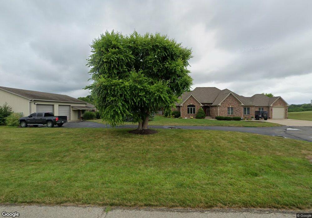
6074 N 25 W Whiteland, IN 46184
Estimated Value: $500,000 - $677,000
3
Beds
3
Baths
3,356
Sq Ft
$185/Sq Ft
Est. Value
About This Home
This home is located at 6074 N 25 W, Whiteland, IN 46184 and is currently estimated at $619,866, approximately $184 per square foot. 6074 N 25 W is a home located in Johnson County with nearby schools including Break-O-Day Elementary School, Clark-Pleasant Middle School, and Whiteland Community High School.
Ownership History
Date
Name
Owned For
Owner Type
Purchase Details
Closed on
Jul 25, 2014
Sold by
Wilson Gregory M and Wilson Kim A
Bought by
Huth Gregory A and Huth Dawn K
Current Estimated Value
Home Financials for this Owner
Home Financials are based on the most recent Mortgage that was taken out on this home.
Original Mortgage
$150,000
Outstanding Balance
$47,591
Interest Rate
4.15%
Mortgage Type
New Conventional
Estimated Equity
$572,275
Create a Home Valuation Report for This Property
The Home Valuation Report is an in-depth analysis detailing your home's value as well as a comparison with similar homes in the area
Home Values in the Area
Average Home Value in this Area
Purchase History
| Date | Buyer | Sale Price | Title Company |
|---|---|---|---|
| Huth Gregory A | -- | None Available |
Source: Public Records
Mortgage History
| Date | Status | Borrower | Loan Amount |
|---|---|---|---|
| Open | Huth Gregory A | $150,000 |
Source: Public Records
Tax History Compared to Growth
Tax History
| Year | Tax Paid | Tax Assessment Tax Assessment Total Assessment is a certain percentage of the fair market value that is determined by local assessors to be the total taxable value of land and additions on the property. | Land | Improvement |
|---|---|---|---|---|
| 2025 | $5,955 | $729,300 | $66,000 | $663,300 |
| 2024 | $5,955 | $578,000 | $66,000 | $512,000 |
| 2023 | $6,506 | $563,700 | $66,000 | $497,700 |
| 2022 | $6,519 | $556,000 | $56,000 | $500,000 |
| 2021 | $5,497 | $462,300 | $56,000 | $406,300 |
| 2020 | $5,091 | $416,700 | $53,000 | $363,700 |
| 2019 | $4,827 | $388,900 | $51,000 | $337,900 |
| 2018 | $4,889 | $401,100 | $51,000 | $350,100 |
| 2017 | $4,731 | $391,100 | $51,000 | $340,100 |
| 2016 | $3,633 | $368,500 | $51,000 | $317,500 |
| 2014 | $3,456 | $314,000 | $51,000 | $263,000 |
| 2013 | $3,456 | $308,800 | $51,000 | $257,800 |
Source: Public Records
Map
Nearby Homes
- 1119 Chateaugay Ct
- 106 Tracy Ridge Blvd
- 190 Tracy Ridge Blvd
- 731 W 600 N
- 256 Bittersweet Dr
- 821 Princeton Dr
- 12 Rypma Row
- 647 Bluestem Cir
- 250 Southlane Dr
- 53 Oakden Ct
- 57 Oakden Ct
- Liberty Plan at Crossroads at Southport
- 7331 Deerberg Dr
- Jefferson Plan at Crossroads at Southport
- 7338 Deerberg Dr
- Rushmore Plan at Crossroads at Southport
- Lincoln Plan at Crossroads at Southport
- Washington Plan at Crossroads at Southport
- 76 Fernleaf Dr
- 6540 N Us Highway 31
- 6116 N 25 W
- 6010 N 25 W
- 1080 Hilltop Commons Blvd
- 1076 Hilltop Commons Blvd
- 318 W 600 N
- 1075 Hilltop Commons Blvd
- 1072 Hilltop Commons Blvd
- 55 Hilltop Commons Blvd
- 181 Hilltop Commons Blvd
- 54 Hilltop Commons Blvd
- 1068 Hilltop Commons Blvd
- 1067 Hilltop Commons Blvd
- 1064 Hilltop Commons Blvd
- 180 Arabian Ct
- 362 W 600 N
- 164 Arabian Ct
- 901 Nicole Way
- 1063 Hilltop Commons Blvd
- 251 W 600 N
- 1060 Hilltop Commons Blvd