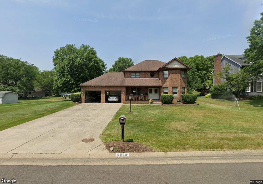
6075 Anchorport Cir NW Canton, OH 44718
Lake Cable NeighborhoodEstimated Value: $338,397 - $413,000
3
Beds
3
Baths
2,112
Sq Ft
$175/Sq Ft
Est. Value
About This Home
This home is located at 6075 Anchorport Cir NW, Canton, OH 44718 and is currently estimated at $370,349, approximately $175 per square foot. 6075 Anchorport Cir NW is a home located in Stark County with nearby schools including Strausser Elementary School, Jackson Memorial Middle School, and Jackson High School.
Ownership History
Date
Name
Owned For
Owner Type
Purchase Details
Closed on
Jul 25, 2003
Sold by
Kosmides John and Kosmides Anna M
Bought by
Kosmides John and Kosmides Anna M
Current Estimated Value
Purchase Details
Closed on
Jul 20, 1988
Create a Home Valuation Report for This Property
The Home Valuation Report is an in-depth analysis detailing your home's value as well as a comparison with similar homes in the area
Home Values in the Area
Average Home Value in this Area
Purchase History
| Date | Buyer | Sale Price | Title Company |
|---|---|---|---|
| Kosmides John | -- | -- | |
| -- | $22,900 | -- |
Source: Public Records
Tax History Compared to Growth
Tax History
| Year | Tax Paid | Tax Assessment Tax Assessment Total Assessment is a certain percentage of the fair market value that is determined by local assessors to be the total taxable value of land and additions on the property. | Land | Improvement |
|---|---|---|---|---|
| 2025 | -- | $101,850 | $25,270 | $76,580 |
| 2024 | -- | $101,850 | $25,270 | $76,580 |
| 2023 | $4,017 | $80,720 | $20,690 | $60,030 |
| 2022 | $1,998 | $80,720 | $20,690 | $60,030 |
| 2021 | $4,014 | $80,720 | $20,690 | $60,030 |
| 2020 | $3,791 | $70,080 | $17,820 | $52,260 |
| 2019 | $3,652 | $70,080 | $17,820 | $52,260 |
| 2018 | $3,670 | $70,080 | $17,820 | $52,260 |
| 2017 | $3,482 | $63,250 | $16,420 | $46,830 |
| 2016 | $3,505 | $63,250 | $16,420 | $46,830 |
| 2015 | $3,548 | $63,250 | $16,420 | $46,830 |
| 2014 | $1,260 | $55,580 | $14,420 | $41,160 |
| 2013 | $1,605 | $55,580 | $14,420 | $41,160 |
Source: Public Records
Map
Nearby Homes
- 6104 Shipslanding Ave NW
- 6394 Bayside St NW
- 6257 Island Dr NW
- 6296 Margate Cir NW
- 6279 Palmer Dr NW
- 6513 Forestwood St NW
- 5691 Governors Ave NW
- 6311 Sorrento Ave NW
- 5820 Kildare Cir NW
- 6594 Shipslanding Ave NW
- 6451 Shenandoah Ave NW
- 6640 Palmer Dr NW
- 5550 West Blvd NW
- 6720 Hogan Way NW Unit 10
- 6572 Portage St NW
- 7034 Celina St NW
- 5858 Springlake Rd NW
- 5764 Oak Dr NW
- 5433 Fleetwood Ave NW
- Lot 1 NW Lake O'Springs Ave
- 6093 Anchorport Cir NW
- 6417 Harbor Dr NW
- 6435 Harbor Dr NW
- 6080 Shipslanding Ave NW
- 6111 Anchorport Cir NW
- 6092 Anchorport Cir NW
- 6449 Harbor Dr NW
- 6074 Anchorport Cir NW
- 6056 Anchorport Cir NW
- 6385 Harbor Dr NW
- 6110 Anchorport Cir NW
- 6122 Shipslanding Ave NW
- 6125 Anchorport Cir NW
- 6373 Harbor Dr NW
- 6061 Sandhurst Ave NW
- 6079 Shipslanding Ave NW
- 6061 Shipslanding Ave NW
- 6416 Harbor Dr NW
- 6140 Shipslanding Ave NW
- 6132 Anchorport Cir NW