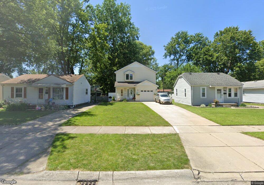
6078 Hazel St Taylor, MI 48180
Estimated Value: $174,000 - $223,000
3
Beds
2
Baths
1,532
Sq Ft
$133/Sq Ft
Est. Value
About This Home
This home is located at 6078 Hazel St, Taylor, MI 48180 and is currently estimated at $203,976, approximately $133 per square foot. 6078 Hazel St is a home located in Wayne County with nearby schools including Holland Elementary School, Hoover Middle School, and Taylor High School.
Ownership History
Date
Name
Owned For
Owner Type
Purchase Details
Closed on
Aug 3, 2021
Sold by
Freist Michael Joseph
Bought by
Freist Nicole Jean
Current Estimated Value
Home Financials for this Owner
Home Financials are based on the most recent Mortgage that was taken out on this home.
Original Mortgage
$94,000
Outstanding Balance
$85,159
Interest Rate
2.8%
Estimated Equity
$118,817
Purchase Details
Closed on
Jan 24, 2008
Sold by
Palmer Casey
Bought by
Wolverine Bank Fsb
Purchase Details
Closed on
Aug 2, 2004
Sold by
Wellman Nellie S
Bought by
Palmer Casey
Purchase Details
Closed on
Aug 29, 2003
Sold by
Wellman Nellie S and Estate Of Mabel Lucy Carr
Bought by
Wellman Nellie S
Purchase Details
Closed on
Apr 29, 1938
Sold by
Equitable Trust Co
Bought by
Carr Eugene
Create a Home Valuation Report for This Property
The Home Valuation Report is an in-depth analysis detailing your home's value as well as a comparison with similar homes in the area
Home Values in the Area
Average Home Value in this Area
Purchase History
| Date | Buyer | Sale Price | Title Company |
|---|---|---|---|
| Freist Nicole Jean | -- | None Available | |
| Wolverine Bank Fsb | $91,000 | None Available | |
| Palmer Casey | $15,000 | Multiple | |
| Wellman Nellie S | -- | -- | |
| Carr Eugene | -- | -- |
Source: Public Records
Mortgage History
| Date | Status | Borrower | Loan Amount |
|---|---|---|---|
| Open | Freist Nicole Jean | $94,000 |
Source: Public Records
Tax History Compared to Growth
Tax History
| Year | Tax Paid | Tax Assessment Tax Assessment Total Assessment is a certain percentage of the fair market value that is determined by local assessors to be the total taxable value of land and additions on the property. | Land | Improvement |
|---|---|---|---|---|
| 2025 | $1,955 | $110,100 | $0 | $0 |
| 2024 | $1,955 | $94,600 | $0 | $0 |
| 2023 | $2,336 | $84,800 | $0 | $0 |
| 2022 | $1,866 | $70,700 | $0 | $0 |
| 2021 | $2,055 | $65,300 | $0 | $0 |
| 2020 | $2,034 | $63,000 | $0 | $0 |
| 2019 | $202,996 | $54,800 | $0 | $0 |
| 2018 | $1,602 | $46,600 | $0 | $0 |
| 2017 | $859 | $46,300 | $0 | $0 |
| 2016 | $1,994 | $44,900 | $0 | $0 |
| 2015 | $3,620 | $36,200 | $0 | $0 |
| 2013 | $3,720 | $38,900 | $0 | $0 |
| 2012 | $1,691 | $37,900 | $7,000 | $30,900 |
Source: Public Records
Map
Nearby Homes
- 5970 John Daly St
- 5993 John Daly St
- 6107 John Daly St
- 6368 Hazel St
- 6370 Hampden St
- 6211 Inkster Rd
- 6221 Inkster Rd
- 5526 Sylvia St
- 6075 Duncan St
- 6319 Duncan St
- 6179 Fellrath St
- 26215 Beverly Rd
- 26532 Powers Ave
- 6338 Marvin St
- 5961 Marvin St
- 4863 Glenis St
- 27523 Powers St
- 6363 Mcguire St
- 26106 Powers Ave
- 25965 Currier St