Estimated Value: $363,000 - $396,952
4
Beds
3
Baths
2,533
Sq Ft
$150/Sq Ft
Est. Value
About This Home
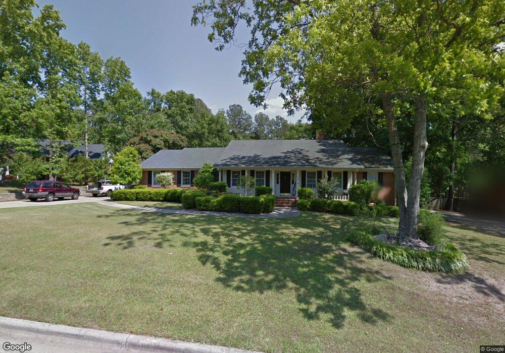
This home is located at 608 Branett Way, Evans, GA 30809 and is currently estimated at $380,238, approximately $150 per square foot. 608 Branett Way is a home located in Columbia County with nearby schools including Evans Elementary School, John F. Kennedy Middle School, and Evans Middle School.
Ownership History
Date
Name
Owned For
Owner Type
Purchase Details
Closed on
Jan 25, 2002
Sold by
Hitt Thomas W and Hitt Margaret E
Bought by
Moore Jamie W
Current Estimated Value
Home Financials for this Owner
Home Financials are based on the most recent Mortgage that was taken out on this home.
Original Mortgage
$155,800
Outstanding Balance
$63,848
Interest Rate
7.08%
Estimated Equity
$316,390
Purchase Details
Closed on
Mar 26, 2001
Sold by
Hitt Thomas W
Bought by
Hitt Margaret E
Home Financials for this Owner
Home Financials are based on the most recent Mortgage that was taken out on this home.
Original Mortgage
$130,320
Interest Rate
6.6%
Create a Home Valuation Report for This Property
The Home Valuation Report is an in-depth analysis detailing your home's value as well as a comparison with similar homes in the area
Home Values in the Area
Average Home Value in this Area
Purchase History
| Date | Buyer | Sale Price | Title Company |
|---|---|---|---|
| Moore Jamie W | $164,000 | -- | |
| Hitt Margaret E | -- | -- |
Source: Public Records
Mortgage History
| Date | Status | Borrower | Loan Amount |
|---|---|---|---|
| Open | Moore Jamie W | $155,800 | |
| Previous Owner | Hitt Margaret E | $130,320 |
Source: Public Records
Tax History Compared to Growth
Tax History
| Year | Tax Paid | Tax Assessment Tax Assessment Total Assessment is a certain percentage of the fair market value that is determined by local assessors to be the total taxable value of land and additions on the property. | Land | Improvement |
|---|---|---|---|---|
| 2025 | $3,946 | $164,980 | $27,104 | $137,876 |
| 2024 | $4,073 | $162,656 | $26,004 | $136,652 |
| 2023 | $4,073 | $157,075 | $24,704 | $132,371 |
| 2022 | $3,411 | $131,006 | $21,304 | $109,702 |
| 2021 | $3,284 | $120,616 | $18,904 | $101,712 |
| 2020 | $3,273 | $117,734 | $18,804 | $98,930 |
| 2019 | $3,215 | $115,636 | $18,904 | $96,732 |
| 2018 | $2,766 | $99,110 | $17,304 | $81,806 |
| 2017 | $2,647 | $94,506 | $15,704 | $78,802 |
| 2016 | $2,421 | $89,639 | $16,880 | $72,759 |
| 2015 | $2,351 | $86,888 | $14,280 | $72,608 |
| 2014 | $2,262 | $82,568 | $11,880 | $70,688 |
Source: Public Records
Map
Nearby Homes
- 4560 Mulberry Creek Dr
- 2975 Rosewood Dr
- 726 Whitney Shoals Rd
- 854 Sparkleberry Rd
- 4648 Leeward Dr
- 4670 La Pointe
- 4664 La Pointe
- 4489 Woodberry Ct
- 586 Gibbs Rd
- 4614 Stoneridge Ct
- 525 Pheasant Run Dr
- 4421 Hereford Farm Rd
- 604 Barberry Ct
- 599 Windward Ct
- 464 Rachel Dr
- 4586 Oxford Ct
- 646 Wellington Dr
- 829 Woodberry Dr
- 489 Connemara Trail
- 604 Kimberley Place
- 606 Branett Way
- 610 Branett Way
- 605 Chandler Ct
- 607 Chandler Ct
- 604 Branett Way
- 607 Branett Way
- 609 Branett Way
- 603 Chandler Ct
- 612 Branett Way
- 611 Branett Way
- 605 Branett Way
- 609 Chandler Ct
- 602 Branett Way
- 601 Chandler Ct
- 603 Branett Way
- 595 Graystone Place
- 606 Chandler Ct
- 597 Graystone Place
- 593 Graystone Place
- 604 Chandler Ct