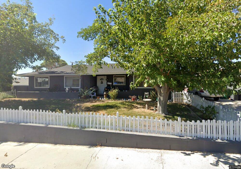
608 Bryant Ct Boulder City, NV 89005
Estimated Value: $525,000 - $591,909
4
Beds
3
Baths
2,339
Sq Ft
$239/Sq Ft
Est. Value
About This Home
This home is located at 608 Bryant Ct, Boulder City, NV 89005 and is currently estimated at $558,977, approximately $238 per square foot. 608 Bryant Ct is a home located in Clark County with nearby schools including Andrew Mitchell Elementary School, Martha P. King Elementary School, and Elton M. & Madelaine E. Garrett Junior High School.
Ownership History
Date
Name
Owned For
Owner Type
Purchase Details
Closed on
Jan 16, 1998
Sold by
Page Gregory A and Page Carol M
Bought by
Letwinch Joseph T and Letwinch Diana G
Current Estimated Value
Home Financials for this Owner
Home Financials are based on the most recent Mortgage that was taken out on this home.
Original Mortgage
$179,200
Outstanding Balance
$26,556
Interest Rate
6.97%
Mortgage Type
VA
Estimated Equity
$532,421
Purchase Details
Closed on
Aug 12, 1996
Sold by
Page Gregory and Page Carol
Bought by
Page Gregory and Page Carol
Create a Home Valuation Report for This Property
The Home Valuation Report is an in-depth analysis detailing your home's value as well as a comparison with similar homes in the area
Home Values in the Area
Average Home Value in this Area
Purchase History
| Date | Buyer | Sale Price | Title Company |
|---|---|---|---|
| Letwinch Joseph T | $174,000 | United Title | |
| Page Gregory | -- | -- |
Source: Public Records
Mortgage History
| Date | Status | Borrower | Loan Amount |
|---|---|---|---|
| Open | Letwinch Joseph T | $179,200 |
Source: Public Records
Tax History
| Year | Tax Paid | Tax Assessment Tax Assessment Total Assessment is a certain percentage of the fair market value that is determined by local assessors to be the total taxable value of land and additions on the property. | Land | Improvement |
|---|---|---|---|---|
| 2026 | $1,612 | $95,989 | $56,000 | $39,989 |
| 2025 | $1,565 | $92,542 | $52,500 | $40,042 |
| 2024 | $1,520 | $92,542 | $52,500 | $40,042 |
| 2023 | $1,520 | $75,899 | $39,900 | $35,999 |
| 2022 | $1,547 | $67,344 | $35,000 | $32,344 |
| 2021 | $1,433 | $65,023 | $35,000 | $30,023 |
| 2020 | $1,330 | $58,193 | $29,050 | $29,143 |
| 2019 | $1,247 | $56,798 | $28,700 | $28,098 |
| 2018 | $1,119 | $55,205 | $28,700 | $26,505 |
| 2017 | $1,168 | $47,362 | $21,000 | $26,362 |
| 2016 | $1,045 | $46,305 | $21,000 | $25,305 |
| 2015 | $1,044 | $41,861 | $17,500 | $24,361 |
| 2014 | $1,014 | $42,495 | $17,500 | $24,995 |
Source: Public Records
Map
Nearby Homes
- 610 Bryant Ct
- 606 Bryant Ct
- 611 Northridge Dr
- 609 Northridge Dr
- 613 Northridge Dr
- 612 Bryant Ct
- 604 Bryant Ct
- 607 Northridge Dr
- 607 Bryant Ct
- 609 Bryant Ct
- 605 Bryant Ct
- 615 Northridge Dr
- 605 Northridge Dr
- 614 Bryant Ct
- 611 Bryant Ct
- 602 Bryant Ct
- 603 Bryant Ct
- 624 Don Vincente Dr
- 600 Bryant Ct
- 301 Sioux Ct
Your Personal Tour Guide
Ask me questions while you tour the home.