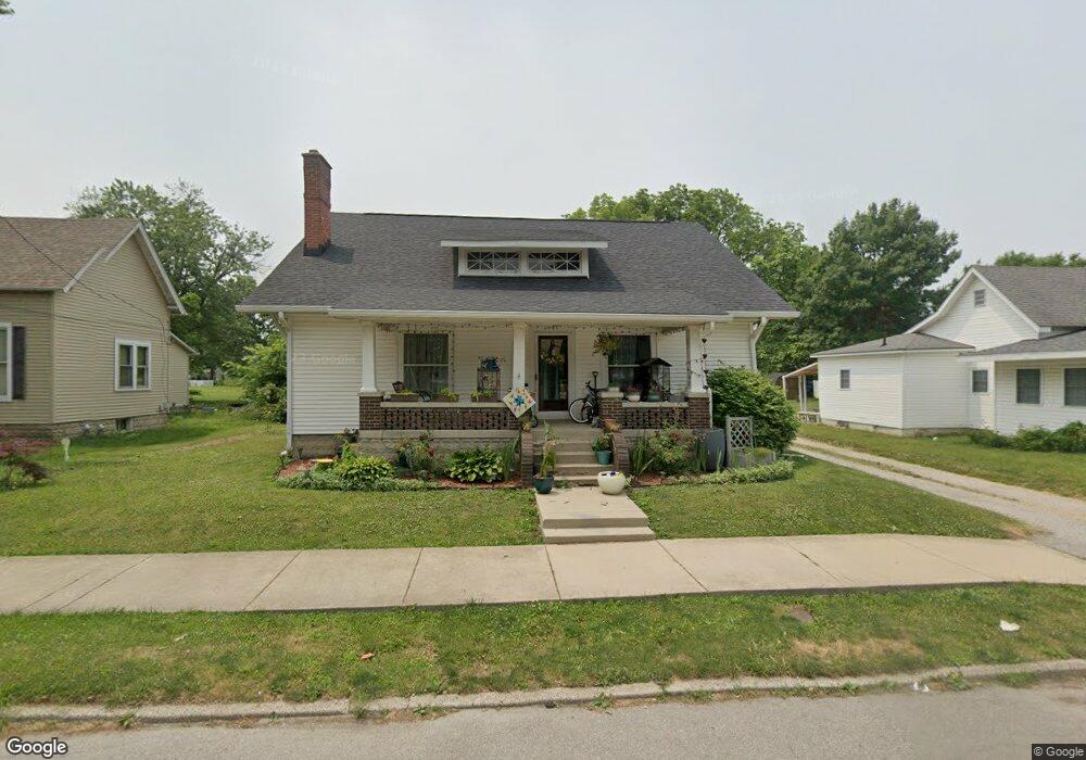
608 Catterlin St Frankfort, IN 46041
Estimated Value: $170,000 - $204,000
2
Beds
1
Bath
1,556
Sq Ft
$120/Sq Ft
Est. Value
About This Home
This home is located at 608 Catterlin St, Frankfort, IN 46041 and is currently estimated at $186,851, approximately $120 per square foot. 608 Catterlin St is a home located in Clinton County with nearby schools including Frankfort Senior High School and Frankfort Covenant Academy.
Ownership History
Date
Name
Owned For
Owner Type
Purchase Details
Closed on
Mar 15, 2021
Sold by
Brant Anita L
Bought by
Hernandez Ashley N and Hernandez Simon
Current Estimated Value
Home Financials for this Owner
Home Financials are based on the most recent Mortgage that was taken out on this home.
Original Mortgage
$55,300
Outstanding Balance
$46,982
Interest Rate
4.75%
Mortgage Type
Adjustable Rate Mortgage/ARM
Estimated Equity
$139,869
Purchase Details
Closed on
Apr 8, 2013
Sold by
The Avanelle J Brinkley Revocable Trus
Bought by
Brant Anita L
Home Financials for this Owner
Home Financials are based on the most recent Mortgage that was taken out on this home.
Original Mortgage
$54,800
Interest Rate
5%
Mortgage Type
Adjustable Rate Mortgage/ARM
Create a Home Valuation Report for This Property
The Home Valuation Report is an in-depth analysis detailing your home's value as well as a comparison with similar homes in the area
Home Values in the Area
Average Home Value in this Area
Purchase History
| Date | Buyer | Sale Price | Title Company |
|---|---|---|---|
| Hernandez Ashley N | -- | None Available | |
| Brant Anita L | $68,500 | The Farmers Bank | |
| Brant Anita L | -- | None Available |
Source: Public Records
Mortgage History
| Date | Status | Borrower | Loan Amount |
|---|---|---|---|
| Open | Hernandez Ashley N | $55,300 | |
| Previous Owner | Brant Anita L | $54,800 |
Source: Public Records
Tax History Compared to Growth
Tax History
| Year | Tax Paid | Tax Assessment Tax Assessment Total Assessment is a certain percentage of the fair market value that is determined by local assessors to be the total taxable value of land and additions on the property. | Land | Improvement |
|---|---|---|---|---|
| 2024 | $1,783 | $160,800 | $11,600 | $149,200 |
| 2023 | $1,565 | $139,500 | $11,600 | $127,900 |
| 2022 | $1,280 | $115,200 | $11,600 | $103,600 |
| 2021 | $612 | $72,900 | $11,600 | $61,300 |
| 2020 | $624 | $72,900 | $11,600 | $61,300 |
| 2019 | $591 | $72,900 | $11,600 | $61,300 |
| 2018 | $588 | $72,900 | $11,600 | $61,300 |
| 2017 | $570 | $71,900 | $11,300 | $60,600 |
| 2016 | $524 | $69,200 | $11,300 | $57,900 |
| 2014 | $347 | $68,600 | $11,300 | $57,300 |
Source: Public Records
Map
Nearby Homes
- 657 Burlington Ave
- 521 N Young St
- 4067 S County Rd O Ew
- 255 N East St
- 1306 E Washington St
- 457 N Main St
- 0 State Rd
- --- State Rd
- 1605 E Morrison St
- 1105 E Wabash St
- 1079 E Wabash St
- 1209 E Wabash St
- 1352 E Wabash St
- 1058 E South St
- 1106 E South St
- 509 Gentry St
- 1510 E Walnut St
- 752 Gentry St
- 1207 Short Columbia St
- 1722 E Clinton St
- 602 Catterlin St
- 654 Catterlin St
- 558 Catterlin St
- 656 Catterlin St
- 609 Catterlin St
- 605 Catterlin St
- 657 Catterlin St
- 653 Catterlin St
- 601 Catterlin St
- 552 Catterlin St
- 658 Catterlin St
- 659 Catterlin St
- 759 Woodland Dr
- 551 Catterlin St
- 508 Catterlin St
- 661 Catterlin St Unit 661 1/2
- 509 Catterlin St
- 500 Catterlin St
- 758 E Jefferson St
- 800 E Jefferson St