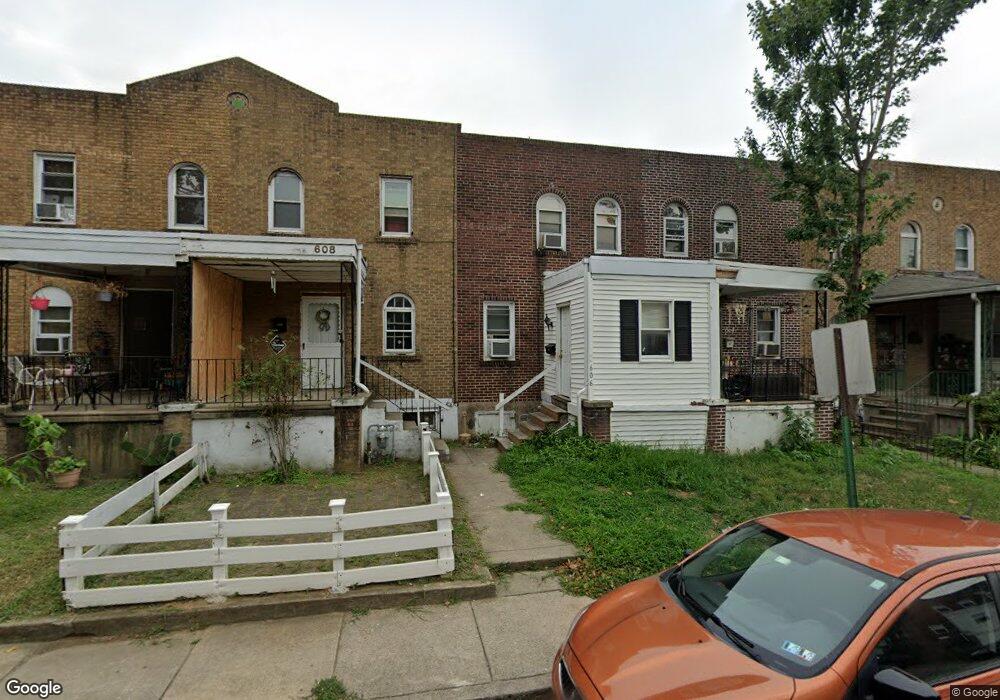
608 Copley Rd Upper Darby, PA 19082
Estimated Value: $109,000 - $132,000
2
Beds
1
Bath
818
Sq Ft
$143/Sq Ft
Est. Value
About This Home
This home is located at 608 Copley Rd, Upper Darby, PA 19082 and is currently estimated at $117,099, approximately $143 per square foot. 608 Copley Rd is a home located in Delaware County with nearby schools including Upper Darby Kdg Center, Upper Darby High School, and Vision Academy Charter School.
Ownership History
Date
Name
Owned For
Owner Type
Purchase Details
Closed on
Sep 10, 2020
Sold by
Bathija Manor and Bathija Sita
Bought by
Bathija Manor
Current Estimated Value
Purchase Details
Closed on
Dec 12, 2005
Sold by
Stevens Aaron and Stevens Brittny
Bought by
Bathija Manor and Bathija Sita
Home Financials for this Owner
Home Financials are based on the most recent Mortgage that was taken out on this home.
Original Mortgage
$53,600
Interest Rate
5.93%
Mortgage Type
Purchase Money Mortgage
Purchase Details
Closed on
May 19, 2003
Sold by
Wood Justin and Wood Cheri
Bought by
Stevens Aaron and Stevens Brittny
Purchase Details
Closed on
Nov 22, 1999
Sold by
Henry William J and Henry Janice L
Bought by
Wood Justin and Wood Cheri
Home Financials for this Owner
Home Financials are based on the most recent Mortgage that was taken out on this home.
Original Mortgage
$31,500
Interest Rate
7.26%
Mortgage Type
Balloon
Create a Home Valuation Report for This Property
The Home Valuation Report is an in-depth analysis detailing your home's value as well as a comparison with similar homes in the area
Home Values in the Area
Average Home Value in this Area
Purchase History
| Date | Buyer | Sale Price | Title Company |
|---|---|---|---|
| Bathija Manor | -- | None Available | |
| Bathija Manor | $67,000 | None Available | |
| Stevens Aaron | $48,500 | -- | |
| Wood Justin | -- | -- |
Source: Public Records
Mortgage History
| Date | Status | Borrower | Loan Amount |
|---|---|---|---|
| Closed | Bathija Manor | $53,600 | |
| Previous Owner | Wood Justin | $31,500 |
Source: Public Records
Tax History Compared to Growth
Tax History
| Year | Tax Paid | Tax Assessment Tax Assessment Total Assessment is a certain percentage of the fair market value that is determined by local assessors to be the total taxable value of land and additions on the property. | Land | Improvement |
|---|---|---|---|---|
| 2025 | $2,588 | $61,190 | $14,050 | $47,140 |
| 2024 | $2,588 | $61,190 | $14,050 | $47,140 |
| 2023 | $2,563 | $61,190 | $14,050 | $47,140 |
| 2022 | $2,495 | $61,190 | $14,050 | $47,140 |
| 2021 | $3,364 | $61,190 | $14,050 | $47,140 |
| 2020 | $2,285 | $35,320 | $12,780 | $22,540 |
| 2019 | $2,245 | $35,320 | $12,780 | $22,540 |
| 2018 | $2,219 | $35,320 | $0 | $0 |
| 2017 | $2,161 | $35,320 | $0 | $0 |
| 2016 | $194 | $35,320 | $0 | $0 |
| 2015 | $194 | $35,320 | $0 | $0 |
| 2014 | $194 | $35,320 | $0 | $0 |
Source: Public Records
Map
Nearby Homes
- 7139 Guilford Rd
- 607 Littlecroft Rd
- 669 Long Ln
- 404 Croyden Rd
- 419 Gilpin Rd
- 7120 Clinton Rd
- 346 Long Ln
- 7155 Radbourne Rd
- 7162 Radbourne Rd
- 433 Copley Rd
- 504 Woodcliffe Rd
- 426 Hampden Rd
- 418 Hampden Rd
- 513 Woodcliffe Rd
- 432 Grace Rd
- 6982 Clinton Rd
- 424 Woodcliffe Rd
- 577 Snowden Rd
- 92 Springton Rd
- 6948 Clinton Rd