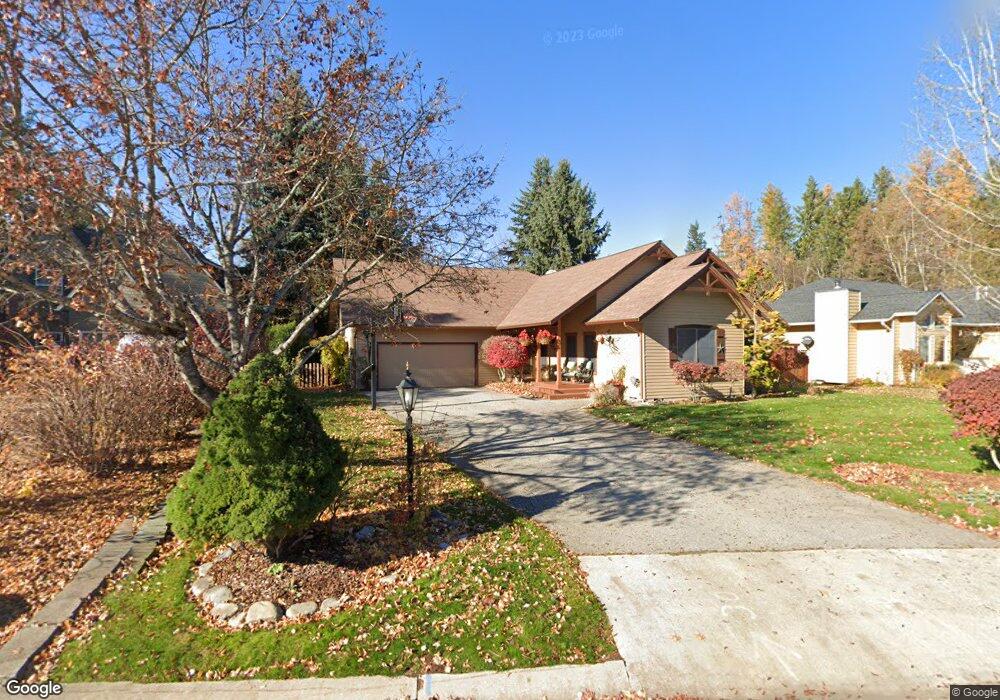
608 Creekside Ln Sandpoint, ID 83864
Estimated Value: $807,000 - $994,000
4
Beds
3
Baths
3,128
Sq Ft
$290/Sq Ft
Est. Value
About This Home
This home is located at 608 Creekside Ln, Sandpoint, ID 83864 and is currently estimated at $906,331, approximately $289 per square foot. 608 Creekside Ln is a home located in Bonner County with nearby schools including Washington Elementary School, Sandpoint Middle School, and Sandpoint High School.
Ownership History
Date
Name
Owned For
Owner Type
Purchase Details
Closed on
Nov 14, 2022
Sold by
Norris Therese M
Bought by
Therese Norris Family Trust
Current Estimated Value
Purchase Details
Closed on
Apr 26, 2007
Sold by
Kruh Brian A and Kruh Karen S
Bought by
Norris Timothy C and Norris Theresa M
Home Financials for this Owner
Home Financials are based on the most recent Mortgage that was taken out on this home.
Original Mortgage
$261,000
Interest Rate
6.11%
Mortgage Type
New Conventional
Create a Home Valuation Report for This Property
The Home Valuation Report is an in-depth analysis detailing your home's value as well as a comparison with similar homes in the area
Home Values in the Area
Average Home Value in this Area
Purchase History
| Date | Buyer | Sale Price | Title Company |
|---|---|---|---|
| Therese Norris Family Trust | -- | -- | |
| Norris Timothy C | -- | -- |
Source: Public Records
Mortgage History
| Date | Status | Borrower | Loan Amount |
|---|---|---|---|
| Previous Owner | Norris Timothy C | $261,000 |
Source: Public Records
Tax History
| Year | Tax Paid | Tax Assessment Tax Assessment Total Assessment is a certain percentage of the fair market value that is determined by local assessors to be the total taxable value of land and additions on the property. | Land | Improvement |
|---|---|---|---|---|
| 2025 | $3,757 | $766,143 | $339,000 | $427,143 |
| 2024 | $4,273 | $764,000 | $339,000 | $425,000 |
| 2023 | $3,401 | $754,231 | $248,000 | $506,231 |
| 2022 | $4,103 | $682,878 | $222,000 | $460,878 |
| 2021 | $3,691 | $460,060 | $123,000 | $337,060 |
| 2020 | $3,698 | $442,995 | $123,000 | $319,995 |
| 2019 | $4,199 | $451,237 | $123,000 | $328,237 |
| 2018 | $3,971 | $441,513 | $123,000 | $318,513 |
| 2017 | $3,971 | $407,012 | $0 | $0 |
| 2016 | $4,822 | $358,010 | $0 | $0 |
| 2015 | $4,849 | $358,010 | $0 | $0 |
| 2014 | $4,897 | $366,710 | $0 | $0 |
Source: Public Records
Map
Nearby Homes
- 141 Madera Dr
- 1309 Westwood Ln
- 424 S Olive Ave Unit 303
- 424 S Olive Ave Unit 203
- 509 S Olive Ave
- 1623 Gondola Ct
- 1619 Gondola Ct
- 1215 Church St
- 1607 Gondola Ct
- 1619 Mosshart St
- 436 S Lavina Ave
- 523 N Division Ave
- 1718 Larch St
- 1210 Main St
- 724 Pine St
- 215 N Forest Ave
- 1721 Larch St
- 706 Main St
- Lot 1 Fir St
- Lot 2 Fir St
- 602 Creekside Ln
- 614 Creekside Ln
- 620 Creekside Ln
- 605 Creekside Ln
- 611 Creekside Ln
- 522 Creekside Ln
- 25 Creekside Ln
- NNA Creekside Ln
- Lot 25 Creekside Ln
- 617 Creekside Ln
- 516 Creekside Ln
- 626 Creekside Ln
- 623 Creekside Ln
- 1903 Mountain Meadows Way
- 1910 Mountain Meadows Way
- 702 Creekside Ln
- 703 Creekside Ln
- 513 Creekside Ln
- 502 Creekside Ln
- 708 Creekside Ln
Your Personal Tour Guide
Ask me questions while you tour the home.