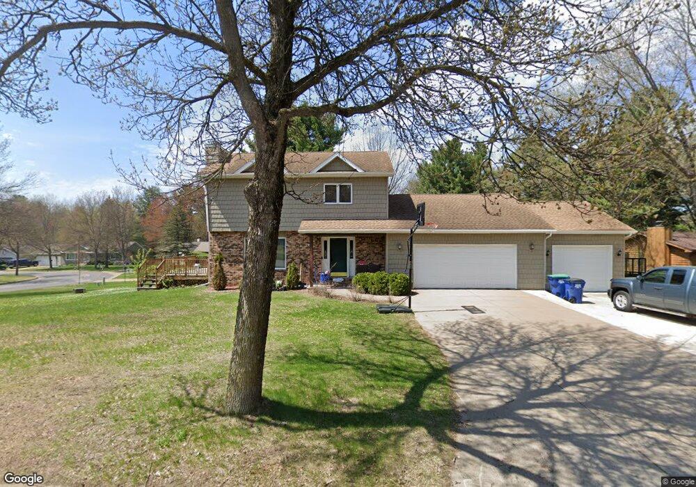
608 S 44th Ave Wausau, WI 54401
Estimated Value: $341,292 - $433,000
3
Beds
2
Baths
2,014
Sq Ft
$185/Sq Ft
Est. Value
About This Home
This home is located at 608 S 44th Ave, Wausau, WI 54401 and is currently estimated at $372,823, approximately $185 per square foot. 608 S 44th Ave is a home located in Marathon County with nearby schools including Stettin Elementary School, John Muir Middle School, and West High School.
Ownership History
Date
Name
Owned For
Owner Type
Purchase Details
Closed on
Jul 29, 2011
Sold by
Garbacz Frank S and Garbacz Linda
Bought by
Woodard Timothy J
Current Estimated Value
Home Financials for this Owner
Home Financials are based on the most recent Mortgage that was taken out on this home.
Original Mortgage
$121,520
Outstanding Balance
$83,982
Interest Rate
4.53%
Mortgage Type
Future Advance Clause Open End Mortgage
Estimated Equity
$288,841
Create a Home Valuation Report for This Property
The Home Valuation Report is an in-depth analysis detailing your home's value as well as a comparison with similar homes in the area
Home Values in the Area
Average Home Value in this Area
Purchase History
| Date | Buyer | Sale Price | Title Company |
|---|---|---|---|
| Woodard Timothy J | $151,900 | None Available |
Source: Public Records
Mortgage History
| Date | Status | Borrower | Loan Amount |
|---|---|---|---|
| Open | Woodard Timothy J | $121,520 |
Source: Public Records
Tax History Compared to Growth
Tax History
| Year | Tax Paid | Tax Assessment Tax Assessment Total Assessment is a certain percentage of the fair market value that is determined by local assessors to be the total taxable value of land and additions on the property. | Land | Improvement |
|---|---|---|---|---|
| 2024 | $5,605 | $304,200 | $29,600 | $274,600 |
| 2023 | $4,549 | $192,100 | $26,800 | $165,300 |
| 2022 | $4,519 | $189,600 | $26,800 | $162,800 |
| 2021 | $4,352 | $189,600 | $26,800 | $162,800 |
| 2020 | $4,512 | $189,600 | $26,800 | $162,800 |
| 2019 | $4,316 | $170,900 | $21,200 | $149,700 |
| 2018 | $4,324 | $165,600 | $21,200 | $144,400 |
| 2017 | $4,039 | $165,600 | $21,200 | $144,400 |
| 2016 | $3,917 | $165,600 | $21,200 | $144,400 |
| 2015 | $4,160 | $165,600 | $21,200 | $144,400 |
| 2014 | $3,915 | $163,800 | $23,200 | $140,600 |
Source: Public Records
Map
Nearby Homes
- 210 S 45th Ave
- 206 N 44th Ave
- 4615 Rib River Trail
- 310 Lisbeth Rd
- 5713 Birchwood Dr
- 210 Bluestone Dr
- 303 Rimrock Rd
- 3401 Christian Ave
- 6007 Birchwood Dr
- 212 Windtree Dr
- 2812 Hubbill Ave
- 6011 Stettin Dr
- 6603 Conner Davis Dr
- 6607 Morgan Creek Dr
- 116 S 68th Ave
- 2102 Wegner St
- 227815 Sharptail Rd
- 2117 Sherman St
- 1708 Pardee St
- 10.80 Acres N 72nd Ave
- 604 Butler Place
- 604 S 44th Ave
- 611 S 44th Ave
- 612 S 44th Ave
- 608 Butler Place
- 4413 Stettin Dr
- 609 Brooks Place
- 607 S 44th Ave
- 610 Brooks Place
- 616 S 44th Ave
- 16 Brooks Place Unit Lot 16
- 4501 Stettin Dr
- 612 Butler Place
- 603 S 44th Ave
- 615 Brooks Place Unit 617
- 615 Brooks Place Unit 615
- 615 Brooks Place
- 620 S 44th Ave
- 0 Brooks Place
- 622 Brooks Place