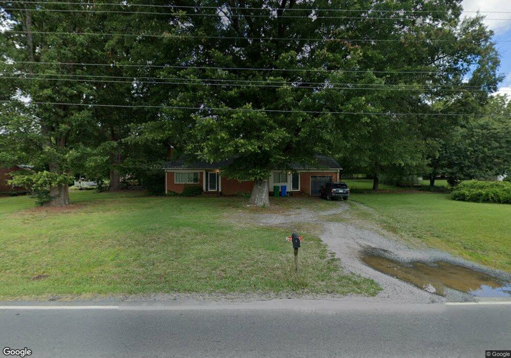
608 S Central Ave Locust, NC 28097
Estimated Value: $228,000 - $275,000
3
Beds
1
Bath
1,394
Sq Ft
$185/Sq Ft
Est. Value
About This Home
This home is located at 608 S Central Ave, Locust, NC 28097 and is currently estimated at $258,106, approximately $185 per square foot. 608 S Central Ave is a home located in Stanly County with nearby schools including Locust Elementary School, West Stanly Middle School, and West Stanly High School.
Ownership History
Date
Name
Owned For
Owner Type
Purchase Details
Closed on
May 29, 2015
Sold by
Hartsell Richard Jackson
Bought by
Morton Ernest Lester and Morton Ginger Paula
Current Estimated Value
Home Financials for this Owner
Home Financials are based on the most recent Mortgage that was taken out on this home.
Original Mortgage
$90,000
Outstanding Balance
$72,769
Interest Rate
3.79%
Mortgage Type
Purchase Money Mortgage
Estimated Equity
$185,337
Purchase Details
Closed on
Mar 10, 2015
Sold by
Hartsell Richard Jackson
Bought by
Hartsell Richard Jackson and Frances Ramelle Hartsell Family Trust
Create a Home Valuation Report for This Property
The Home Valuation Report is an in-depth analysis detailing your home's value as well as a comparison with similar homes in the area
Home Values in the Area
Average Home Value in this Area
Purchase History
| Date | Buyer | Sale Price | Title Company |
|---|---|---|---|
| Morton Ernest Lester | $90,000 | Attorney | |
| Hartsell Richard Jackson | -- | None Available |
Source: Public Records
Mortgage History
| Date | Status | Borrower | Loan Amount |
|---|---|---|---|
| Open | Morton Ernest Lester | $90,000 |
Source: Public Records
Tax History Compared to Growth
Tax History
| Year | Tax Paid | Tax Assessment Tax Assessment Total Assessment is a certain percentage of the fair market value that is determined by local assessors to be the total taxable value of land and additions on the property. | Land | Improvement |
|---|---|---|---|---|
| 2025 | $1,585 | $172,334 | $36,630 | $135,704 |
| 2024 | $1,235 | $113,317 | $21,645 | $91,672 |
| 2023 | $1,355 | $113,317 | $21,645 | $91,672 |
| 2022 | $1,344 | $113,317 | $21,645 | $91,672 |
| 2021 | $1,332 | $113,317 | $21,645 | $91,672 |
| 2020 | $1,163 | $93,313 | $18,981 | $74,332 |
| 2019 | $1,174 | $93,313 | $18,981 | $74,332 |
| 2018 | $1,054 | $93,313 | $18,981 | $74,332 |
| 2017 | $1,054 | $93,313 | $18,981 | $74,332 |
| 2016 | $976 | $86,353 | $17,649 | $68,704 |
| 2015 | $1,093 | $86,353 | $17,649 | $68,704 |
| 2014 | -- | $86,353 | $17,649 | $68,704 |
Source: Public Records
Map
Nearby Homes
- 708 Redah Ave
- 402 Church St
- 540 Church St
- 169 Abigail Ln
- 606 Elm St
- 27 Berea Baptist Church Rd
- 103 Berea Baptist Church Rd
- 105 Berea Baptist Church Rd
- 211 Drive Inn Rd
- 174 Willow Creek Dr
- 124 Hickory Ridge Dr
- 128 Hickory Ridge Dr
- 134 Kerri Dawn Ln
- 417 Kiser Ln
- 146 Kerri Dawn Ln
- 159 Kingston Dr
- 00 S Beverly Dr
- 110 Forest Dr
- 24990 Birdhouse Ln Unit 4
- 319 N Central Ave
- 612 S Central Ave
- 602 S Central Ave
- 100 Carmel Dr
- 618 S Central Ave
- 514 S Central Ave
- 517 S Central Ave
- 513 S Central Ave
- 513 S Central Ave Unit 7
- 530 Nc Hwy 200
- 510 S Central Ave
- 101 Carmel Dr
- 507 S Central Ave
- 131 Abbington Place Unit 19
- 131 Abbington Place Unit 4
- 436 Nc 200 Hwy
- 123 Abbington Place Unit 20
- 141 Abbington Place Unit 18
- 12 Abbington Place Unit 12
- 18 Abbington Place Unit 18
- 8 Abbington Place Unit 8