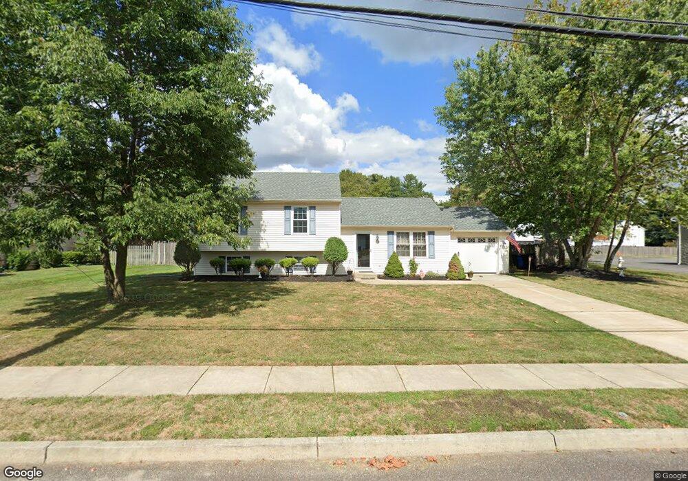
608 State Rd Mantua, NJ 08051
Estimated Value: $353,000 - $433,193
3
Beds
3
Baths
1,832
Sq Ft
$212/Sq Ft
Est. Value
About This Home
This home is located at 608 State Rd, Mantua, NJ 08051 and is currently estimated at $388,548, approximately $212 per square foot. 608 State Rd is a home located in Gloucester County with nearby schools including Centre City School, J. Mason Tomlin Elementary School, and Clearview Regional Middle School.
Ownership History
Date
Name
Owned For
Owner Type
Purchase Details
Closed on
Jun 16, 2008
Sold by
Rickerd Clinton E and Rickerd Kelly L
Bought by
Short Steven J and Short Coleen A
Current Estimated Value
Home Financials for this Owner
Home Financials are based on the most recent Mortgage that was taken out on this home.
Original Mortgage
$186,400
Outstanding Balance
$119,918
Interest Rate
6.1%
Mortgage Type
Purchase Money Mortgage
Estimated Equity
$268,630
Purchase Details
Closed on
Dec 13, 1995
Sold by
Royal Home Builders Inc
Bought by
Rickerd Clinton E and Rickerd Kelly L
Home Financials for this Owner
Home Financials are based on the most recent Mortgage that was taken out on this home.
Original Mortgage
$119,650
Interest Rate
7.33%
Mortgage Type
FHA
Create a Home Valuation Report for This Property
The Home Valuation Report is an in-depth analysis detailing your home's value as well as a comparison with similar homes in the area
Home Values in the Area
Average Home Value in this Area
Purchase History
| Date | Buyer | Sale Price | Title Company |
|---|---|---|---|
| Short Steven J | $233,000 | Commonwealth Land Title Insu | |
| Rickerd Clinton E | $120,350 | Congress Title Corp |
Source: Public Records
Mortgage History
| Date | Status | Borrower | Loan Amount |
|---|---|---|---|
| Open | Short Steven J | $186,400 | |
| Previous Owner | Rickerd Clinton E | $119,650 |
Source: Public Records
Tax History Compared to Growth
Tax History
| Year | Tax Paid | Tax Assessment Tax Assessment Total Assessment is a certain percentage of the fair market value that is determined by local assessors to be the total taxable value of land and additions on the property. | Land | Improvement |
|---|---|---|---|---|
| 2025 | $7,928 | $307,900 | $82,600 | $225,300 |
| 2024 | $7,845 | $307,900 | $82,600 | $225,300 |
| 2023 | $7,845 | $307,900 | $82,600 | $225,300 |
| 2022 | $6,443 | $184,200 | $57,100 | $127,100 |
| 2021 | $6,491 | $184,200 | $57,100 | $127,100 |
| 2020 | $6,440 | $184,200 | $57,100 | $127,100 |
| 2019 | $6,331 | $184,200 | $57,100 | $127,100 |
| 2018 | $6,241 | $184,200 | $57,100 | $127,100 |
| 2017 | $6,147 | $184,200 | $57,100 | $127,100 |
| 2016 | $6,077 | $184,200 | $57,100 | $127,100 |
| 2015 | $5,928 | $184,200 | $57,100 | $127,100 |
| 2014 | $5,729 | $184,200 | $57,100 | $127,100 |
Source: Public Records
Map
Nearby Homes
- 30 Woodstream Ct
- 284 Columbus Dr
- 17 Oakton Dr
- 41 Woodbrook Dr Unit C041
- 48 Forest Ct Unit C048
- 485 Harrison Ave
- 119 Monroe Ave
- 36 Bluebird Rd
- 204 W Landing Rd
- 679 Santa fe Dr
- 325 Bridgeton Pike
- 188 Mockingbird Ln
- 153 Whippoorwill Way
- 1011 Crestmont Dr Unit 1011
- 155 Whippoorwill Way
- 96 Crestmont Dr Unit C096
- 203 Tony Cir Unit 203
- 241 Tony Cir Unit 241
- 1433 Tristram Cir
- 604 Sangreal Ct