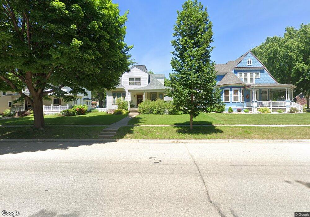
608 W Main St Luverne, MN 56156
Estimated Value: $192,358 - $241,000
3
Beds
2
Baths
2,028
Sq Ft
$109/Sq Ft
Est. Value
About This Home
This home is located at 608 W Main St, Luverne, MN 56156 and is currently estimated at $221,590, approximately $109 per square foot. 608 W Main St is a home located in Rock County with nearby schools including Luverne Elementary School and Luverne Senior High School.
Ownership History
Date
Name
Owned For
Owner Type
Purchase Details
Closed on
Feb 15, 2017
Sold by
Fay Servicing Llc
Bought by
Guy Timothy and Guy Renee
Current Estimated Value
Home Financials for this Owner
Home Financials are based on the most recent Mortgage that was taken out on this home.
Original Mortgage
$50,000
Outstanding Balance
$33,381
Interest Rate
4.09%
Mortgage Type
New Conventional
Estimated Equity
$188,209
Purchase Details
Closed on
Mar 10, 2016
Sold by
Goldberg Michele V
Bought by
Us Bank Na
Purchase Details
Closed on
Sep 9, 2005
Sold by
Israelson Raney M and Israelson Janet S
Bought by
Harvey Robert Scott and Harvey Michele Virginia
Home Financials for this Owner
Home Financials are based on the most recent Mortgage that was taken out on this home.
Original Mortgage
$10,000
Interest Rate
6.01%
Mortgage Type
Stand Alone Second
Create a Home Valuation Report for This Property
The Home Valuation Report is an in-depth analysis detailing your home's value as well as a comparison with similar homes in the area
Home Values in the Area
Average Home Value in this Area
Purchase History
| Date | Buyer | Sale Price | Title Company |
|---|---|---|---|
| Guy Timothy | $40,000 | -- | |
| Us Bank Na | -- | -- | |
| Harvey Robert Scott | $91,000 | None Available |
Source: Public Records
Mortgage History
| Date | Status | Borrower | Loan Amount |
|---|---|---|---|
| Open | Guy Timothy | $50,000 | |
| Previous Owner | Harvey Robert Scott | $10,000 | |
| Previous Owner | Harvey Robert Scott | $76,449 |
Source: Public Records
Tax History
| Year | Tax Paid | Tax Assessment Tax Assessment Total Assessment is a certain percentage of the fair market value that is determined by local assessors to be the total taxable value of land and additions on the property. | Land | Improvement |
|---|---|---|---|---|
| 2025 | $1,792 | $163,400 | $10,500 | $152,900 |
| 2024 | $1,792 | $155,900 | $8,800 | $147,100 |
| 2023 | $1,596 | $142,800 | $8,800 | $134,000 |
| 2022 | $1,508 | $122,700 | $5,900 | $116,800 |
| 2021 | $1,446 | $115,800 | $5,900 | $109,900 |
| 2020 | $1,318 | $112,300 | $5,900 | $106,400 |
| 2019 | $1,296 | $102,300 | $5,900 | $96,400 |
| 2018 | $1,322 | $102,300 | $5,900 | $96,400 |
| 2017 | $904 | $102,300 | $5,900 | $96,400 |
| 2016 | $950 | $96,400 | $5,400 | $91,000 |
| 2015 | $1,004 | $0 | $0 | $0 |
| 2014 | -- | $0 | $0 | $0 |
Source: Public Records
Map
Nearby Homes
- 117 N Cottage Grove Ave
- 219 N Donaldson St
- 431 W Luverne St
- 436 W Luverne St
- 129 SW Park St
- 413 W Bishop St
- 408 W Bishop St
- 518 NE Park St
- 111 & 111 1/2 W Warren St St
- 200 S Freeman Ave Unit 206
- 200 S Freeman Ave Unit 105
- 127 E Lincoln St
- 109 E Luverne St Unit 337
- 109 E Luverne St Unit 220
- 420 N Freeman Ave
- 516 S Donaldson St
- 109 E Brown St
- 505 N Cedar St
- 210 W Adams Ave
- 631 N Cedar St
- 612 W Main St
- 602 W Main St
- 111 N Donaldson St
- 616 W Main St
- 513 W Lincoln St
- 618 W Main St
- 115 N Donaldson St
- 515 W Lincoln St
- 609 W Main St
- 609 W Main St
- 102 S Donaldson St
- 518 W Main St
- 615 W Main St
- 517 W Lincoln St
- 114 N Donaldson St
- 619 W Main St
- 519 W Main St
- 514 W Main St
- 108 S Donaldson St
- 435 W Lincoln St
Your Personal Tour Guide
Ask me questions while you tour the home.