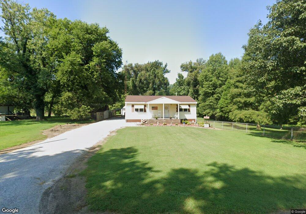
6080 Main St Owensboro, KY 42301
Estimated Value: $127,000 - $166,000
3
Beds
1
Bath
912
Sq Ft
$156/Sq Ft
Est. Value
About This Home
This home is located at 6080 Main St, Owensboro, KY 42301 and is currently estimated at $142,146, approximately $155 per square foot. 6080 Main St is a home with nearby schools including West Louisville Elementary School, F.T. Burns Middle School, and Apollo High School.
Ownership History
Date
Name
Owned For
Owner Type
Purchase Details
Closed on
Feb 20, 2025
Sold by
Daugherty Joseph A
Bought by
Calhoun Nicholas R
Current Estimated Value
Home Financials for this Owner
Home Financials are based on the most recent Mortgage that was taken out on this home.
Original Mortgage
$102,660
Outstanding Balance
$100,599
Interest Rate
0.68%
Mortgage Type
Construction
Estimated Equity
$41,547
Create a Home Valuation Report for This Property
The Home Valuation Report is an in-depth analysis detailing your home's value as well as a comparison with similar homes in the area
Home Values in the Area
Average Home Value in this Area
Purchase History
| Date | Buyer | Sale Price | Title Company |
|---|---|---|---|
| Calhoun Nicholas R | $100,500 | Attorney Only |
Source: Public Records
Mortgage History
| Date | Status | Borrower | Loan Amount |
|---|---|---|---|
| Open | Calhoun Nicholas R | $102,660 |
Source: Public Records
Tax History Compared to Growth
Tax History
| Year | Tax Paid | Tax Assessment Tax Assessment Total Assessment is a certain percentage of the fair market value that is determined by local assessors to be the total taxable value of land and additions on the property. | Land | Improvement |
|---|---|---|---|---|
| 2025 | -- | $77,600 | $0 | $0 |
| 2024 | $8 | $77,600 | $0 | $0 |
| 2023 | $810 | $75,000 | $0 | $0 |
| 2022 | $828 | $75,000 | $0 | $0 |
| 2021 | $835 | $75,000 | $0 | $0 |
| 2020 | $842 | $75,000 | $0 | $0 |
| 2019 | $826 | $75,000 | $0 | $0 |
| 2018 | $1,684 | $75,000 | $0 | $0 |
| 2017 | $836 | $75,000 | $0 | $0 |
| 2016 | $169 | $13,700 | $0 | $0 |
| 2015 | -- | $50,600 | $0 | $0 |
| 2014 | -- | $50,600 | $0 | $0 |
Source: Public Records
Map
Nearby Homes
- 20771 Kentucky 416
- 20788 Kentucky 416
- 20773 Kentucky 416
- 16745 Kentucky 416
- 16613 Kentucky 351
- 9285 Stanley-Birk City Rd
- 9263 Stanley Birk City Rd
- 9320 Hobbs Rd
- 1018 Alves Ferry Rd
- 15217 Kentucky 351
- 20091 Upper Delaware Rd
- 2065 Northwood Dr
- 6427 Ridge Brook Cove
- 6310 Ridge Brook Cove
- 14831 State Route 1078 S
- 614 Kentucky 1554
- 5189 Fulton Yates Rd
- 17181 Upper Delaware Rd
- 9401 U S 60
- 5538 Mulberry Place