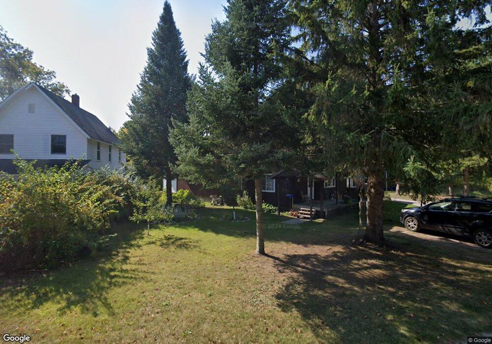
6082 W Edgar St Pellston, MI 49769
Estimated Value: $119,008 - $183,000
--
Bed
--
Bath
--
Sq Ft
0.35
Acres
About This Home
This home is located at 6082 W Edgar St, Pellston, MI 49769 and is currently estimated at $147,669. 6082 W Edgar St is a home located in Emmet County with nearby schools including Pellston Elementary School and Pellston Middle/High School.
Ownership History
Date
Name
Owned For
Owner Type
Purchase Details
Closed on
Feb 13, 2020
Sold by
St Francis X Federal Credit Union
Bought by
Givens Mark
Current Estimated Value
Home Financials for this Owner
Home Financials are based on the most recent Mortgage that was taken out on this home.
Original Mortgage
$55,000
Outstanding Balance
$26,740
Interest Rate
3.6%
Mortgage Type
New Conventional
Estimated Equity
$120,929
Purchase Details
Closed on
Sep 24, 2015
Sold by
Estate Of Rosanna Givens
Bought by
St Francis X Federal Credit Union
Purchase Details
Closed on
Jul 29, 2011
Sold by
Givens Tricia L
Bought by
Givens Mark W
Purchase Details
Closed on
Jun 27, 2011
Sold by
Givens Michael L and Givens Tammy
Bought by
Givens Rosanna
Purchase Details
Closed on
Jun 15, 2011
Sold by
Givens John and Givens Kimberley
Bought by
Givens Rosanna
Purchase Details
Closed on
Mar 24, 2011
Sold by
Givens Rosanna
Bought by
Givens John and Givens Mark
Purchase Details
Closed on
Jun 19, 2001
Sold by
Givens John W
Bought by
Givens Rosanna
Purchase Details
Closed on
Jul 1, 1983
Bought by
Givens
Create a Home Valuation Report for This Property
The Home Valuation Report is an in-depth analysis detailing your home's value as well as a comparison with similar homes in the area
Home Values in the Area
Average Home Value in this Area
Purchase History
| Date | Buyer | Sale Price | Title Company |
|---|---|---|---|
| Givens Mark | $62,671 | -- | |
| St Francis X Federal Credit Union | $44,277 | None Available | |
| Givens Mark W | -- | -- | |
| Givens Rosanna | -- | -- | |
| Givens Rosanna | -- | -- | |
| Givens John | -- | -- | |
| Givens Rosanna | -- | -- | |
| Givens | $500 | -- |
Source: Public Records
Mortgage History
| Date | Status | Borrower | Loan Amount |
|---|---|---|---|
| Open | Givens Mark | $55,000 |
Source: Public Records
Tax History Compared to Growth
Tax History
| Year | Tax Paid | Tax Assessment Tax Assessment Total Assessment is a certain percentage of the fair market value that is determined by local assessors to be the total taxable value of land and additions on the property. | Land | Improvement |
|---|---|---|---|---|
| 2025 | $1,334 | $50,500 | $50,500 | $0 |
| 2024 | $1,334 | $46,500 | $46,500 | $0 |
| 2023 | $1,243 | $42,500 | $42,500 | $0 |
| 2022 | $1,243 | $38,700 | $38,700 | $0 |
| 2021 | $1,333 | $38,700 | $38,700 | $0 |
| 2020 | $730 | $35,800 | $35,800 | $0 |
| 2019 | -- | $29,700 | $29,700 | $0 |
| 2018 | -- | $28,100 | $28,100 | $0 |
| 2017 | -- | $23,800 | $23,800 | $0 |
| 2016 | -- | $22,000 | $22,000 | $0 |
| 2015 | -- | $19,300 | $0 | $0 |
| 2014 | -- | $19,700 | $0 | $0 |
Source: Public Records
Map
Nearby Homes
- 000 Vacant U S 31
- 6457 State St
- 6421 Airport Crossing Rd Unit 1
- 6672 Industrial Dr
- 0 Reed Rd Unit 474270
- TBD Teal Rd
- 9160 Silver Strand Rd
- 4333 U S 31
- 9470 Silver Strand Rd
- 9670 Silver Strand Rd
- 9485 Ingleside Rd
- 3016 W Burt Lake Rd
- 10999 Koepke Rd
- 10222 W Munro Lake Dr
- 5383 N Conway Rd
- 1975 &1995 Club House Dr
- 1975 + 1995 Club House Dr
- 5100 N Bay Way
- 6430 Admirals Point Dr
- 6167 Lambert Dr
- 6094 W Edgar St
- 6066 W Edgar St
- 6106 W Edgar St
- 6020 W Edgar St
- 6087 W Main St
- 127 Jackson St
- 6069 W Main St
- 6105 W Main St
- 6046 W Edgar St
- 6049 W Main St
- 6105 W Edgar St
- 6123 W Main St
- 6011 W Main St
- 6030 W Edgar St
- 6150 W Edgar St
- 6001 W Edgar St
- 6001 W Main St
- 6149 W Main St
- 6076 W Main St
- 6088 W Main St