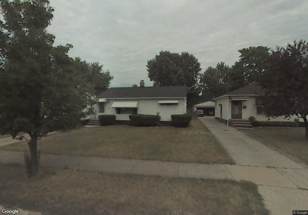
6083 Morrow Dr Brookpark, OH 44142
Estimated Value: $193,013 - $234,000
3
Beds
1
Bath
936
Sq Ft
$230/Sq Ft
Est. Value
About This Home
This home is located at 6083 Morrow Dr, Brookpark, OH 44142 and is currently estimated at $215,503, approximately $230 per square foot. 6083 Morrow Dr is a home located in Cuyahoga County with nearby schools including Berea-Midpark Middle School, Berea-Midpark High School, and Huber Heights Preparatory Academy Parma Academy.
Ownership History
Date
Name
Owned For
Owner Type
Purchase Details
Closed on
Sep 28, 2023
Sold by
Blystone Stephanie K
Bought by
Blystone Mathew and Blystone Stephanie K
Current Estimated Value
Purchase Details
Closed on
Jul 9, 2019
Sold by
Sadosky Greory J
Bought by
Blystone Stephanie K
Purchase Details
Closed on
Apr 21, 1987
Sold by
Bender Bruce J
Bought by
Sadosky Gregory J
Purchase Details
Closed on
Mar 13, 1984
Sold by
Bender Bruce and Bonnie Sue
Bought by
Bender Bruce J
Purchase Details
Closed on
Aug 17, 1982
Sold by
Bender Burce
Bought by
Bender Bruce and Bonnie Sue
Purchase Details
Closed on
May 20, 1980
Sold by
Hess Scott Hooper and D A
Bought by
Bender Burce
Purchase Details
Closed on
Jan 1, 1975
Bought by
Hess Scott Hooper and D A
Create a Home Valuation Report for This Property
The Home Valuation Report is an in-depth analysis detailing your home's value as well as a comparison with similar homes in the area
Home Values in the Area
Average Home Value in this Area
Purchase History
We collect this data history from publicly available records. To have your information removed, we recommend requesting removal directly through your county’s website.
| Date | Buyer | Sale Price | Title Company |
|---|---|---|---|
| Blystone Mathew | -- | None Listed On Document | |
| Blystone Stephanie K | -- | None Available | |
| Sadosky Gregory J | $58,000 | -- | |
| Bender Bruce J | -- | -- | |
| Bender Bruce | -- | -- | |
| Bender Burce | $51,500 | -- | |
| Hess Scott Hooper | -- | -- |
Source: Public Records
Tax History
| Year | Tax Paid | Tax Assessment Tax Assessment Total Assessment is a certain percentage of the fair market value that is determined by local assessors to be the total taxable value of land and additions on the property. | Land | Improvement |
|---|---|---|---|---|
| 2025 | $2,889 | $57,610 | $12,425 | $45,185 |
| 2024 | $2,906 | $57,610 | $12,425 | $45,185 |
| 2023 | $2,428 | $39,870 | $9,030 | $30,840 |
| 2022 | $2,411 | $39,865 | $9,030 | $30,835 |
| 2021 | $2,397 | $39,870 | $9,030 | $30,840 |
| 2020 | $2,162 | $31,640 | $7,180 | $24,470 |
| 2019 | $2,098 | $90,400 | $20,500 | $69,900 |
| 2018 | $2,089 | $31,640 | $7,180 | $24,470 |
| 2017 | $2,014 | $28,180 | $6,720 | $21,460 |
| 2016 | $1,997 | $28,180 | $6,720 | $21,460 |
| 2015 | $1,874 | $28,180 | $6,720 | $21,460 |
| 2014 | $1,874 | $28,180 | $6,720 | $21,460 |
Source: Public Records
Map
Nearby Homes
- 6115 Morrow Dr
- 5884 Michael Dr
- 14122 Donald Dr
- 14316 Parkman Blvd
- 14306 Parkman Blvd
- 5653 Gateway Ln Unit C303
- 14396 Park Dr
- 13515 Heatherwood Dr
- 13665 Starlite Dr
- 15424 Holland Rd
- 15425 Richard Dr
- 15654 Rademaker Dr
- 5770 Pemberton Dr
- 6330 Sandfield Dr
- 15497 Hummel Rd
- 6377 Ledgebrook Dr
- 16159 Bowfin Blvd
- 6330 Stonecrest Dr
- 6525 Sandfield Dr
- 6252 Anita Dr
- 6071 Morrow Dr
- 6077 Morrow Dr
- 6065 Morrow Dr
- 6059 Morrow Dr
- 6089 Morrow Dr
- 6053 Morrow Dr
- 6070 Michael Dr
- 6076 Michael Dr
- 6064 Michael Dr
- 6082 Michael Dr
- 6058 Michael Dr
- 6070 Morrow Dr
- 6095 Morrow Dr
- 6047 Morrow Dr
- 6076 Morrow Dr
- 6064 Morrow Dr
- 6088 Michael Dr
- 6052 Michael Dr
- 6082 Morrow Dr
- 6058 Morrow Dr
Your Personal Tour Guide
Ask me questions while you tour the home.