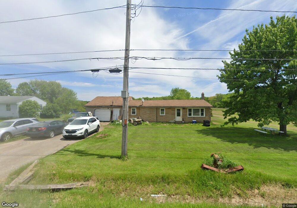
6084 State Route 534 Windsor, OH 44099
Estimated Value: $83,000 - $197,000
4
Beds
1
Bath
1,160
Sq Ft
$108/Sq Ft
Est. Value
About This Home
This home is located at 6084 State Route 534, Windsor, OH 44099 and is currently estimated at $124,978, approximately $107 per square foot. 6084 State Route 534 is a home located in Ashtabula County with nearby schools including Grand Valley Elementary School, Grand Valley Middle School, and Grand Valley High School.
Ownership History
Date
Name
Owned For
Owner Type
Purchase Details
Closed on
Mar 17, 2006
Sold by
Maheu Frank
Bought by
Hall Nicholas
Current Estimated Value
Home Financials for this Owner
Home Financials are based on the most recent Mortgage that was taken out on this home.
Original Mortgage
$54,000
Outstanding Balance
$30,896
Interest Rate
6.38%
Mortgage Type
Construction
Estimated Equity
$94,082
Purchase Details
Closed on
Jul 19, 2001
Sold by
Chambers Timothy E
Bought by
Triangle 1 Enterp Inc
Create a Home Valuation Report for This Property
The Home Valuation Report is an in-depth analysis detailing your home's value as well as a comparison with similar homes in the area
Home Values in the Area
Average Home Value in this Area
Purchase History
| Date | Buyer | Sale Price | Title Company |
|---|---|---|---|
| Hall Nicholas | $40,400 | Geauga Title Insurance Agenc | |
| Triangle 1 Enterp Inc | $31,500 | -- |
Source: Public Records
Mortgage History
| Date | Status | Borrower | Loan Amount |
|---|---|---|---|
| Open | Hall Nicholas | $54,000 |
Source: Public Records
Tax History Compared to Growth
Tax History
| Year | Tax Paid | Tax Assessment Tax Assessment Total Assessment is a certain percentage of the fair market value that is determined by local assessors to be the total taxable value of land and additions on the property. | Land | Improvement |
|---|---|---|---|---|
| 2024 | $1,504 | $19,710 | $2,660 | $17,050 |
| 2023 | $850 | $19,710 | $2,660 | $17,050 |
| 2022 | $748 | $14,670 | $2,030 | $12,640 |
| 2021 | $755 | $14,670 | $2,030 | $12,640 |
| 2020 | $682 | $14,670 | $2,030 | $12,640 |
| 2019 | $956 | $19,850 | $2,940 | $16,910 |
| 2018 | $919 | $19,850 | $2,940 | $16,910 |
| 2017 | $909 | $19,850 | $2,940 | $16,910 |
| 2016 | $904 | $18,410 | $2,730 | $15,680 |
| 2015 | $899 | $18,410 | $2,730 | $15,680 |
| 2014 | $872 | $18,410 | $2,730 | $15,680 |
| 2013 | $908 | $18,840 | $1,860 | $16,980 |
Source: Public Records
Map
Nearby Homes
- 5700 State Route 534
- 5769 Hurlburt Rd
- 6563 Hyde Rd
- 5723 Stoneville Rd
- 5484 State Route 534
- V/L Windsor-Mechanicsville Rd
- 0 New Hudson Rd
- 0 Laskey Rd Unit 5117810
- 4976 Ireland Rd
- 5834 U S 322
- 4381 Higley Rd
- 10714 Plank Rd
- 15720 Us Highway 6
- 8494 Murphy Rd
- 5252 State Route 45
- 12175 Hunt Rd
- 26 Grand Valley
- 4772 Ohio 45
- 9368 Madison Rd
- 0 Vl Sunset St
- 6070 State Route 534
- 6024 State Route 534
- 6025 State Route 534
- 5961 State Route 534
- 6000 State Route 534
- 5956 State Route 534
- 5691 Mead Hollow Rd
- 5926 State Route 534
- 5900 State Route 534
- 6165 State Route 534
- 6250 State Route 534
- 5745 Mead Hollow Rd
- 6251 State Route 534
- 6308 State Route 534
- 5748 Mead Hollow Rd
- 5774 Mead Hollow Rd
- 6309 State Route 534
- 5825 Mead Hollow Rd
- 5804 Mead Hollow Rd
- 5853 State Route 534