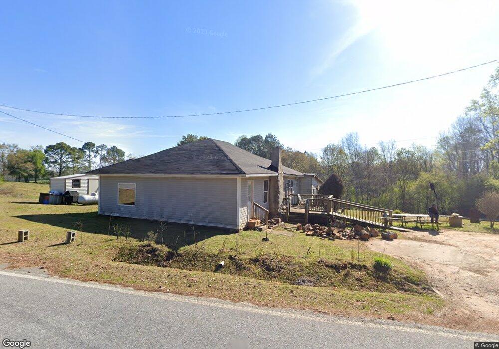
6085 Red Land Rd Franklin, GA 30217
Estimated Value: $116,000 - $247,000
3
Beds
1
Bath
1,280
Sq Ft
$134/Sq Ft
Est. Value
About This Home
This home is located at 6085 Red Land Rd, Franklin, GA 30217 and is currently estimated at $171,760, approximately $134 per square foot. 6085 Red Land Rd is a home located in Heard County with nearby schools including Heard County High School.
Ownership History
Date
Name
Owned For
Owner Type
Purchase Details
Closed on
Sep 24, 2007
Sold by
Harrison Clarence
Bought by
Putzek Roofing Inc
Current Estimated Value
Purchase Details
Closed on
Apr 5, 1983
Sold by
Wilkerson Tyronne
Bought by
Harrison Clarence
Purchase Details
Closed on
Jan 1, 1901
Bought by
Wilkerson Tyronne
Create a Home Valuation Report for This Property
The Home Valuation Report is an in-depth analysis detailing your home's value as well as a comparison with similar homes in the area
Home Values in the Area
Average Home Value in this Area
Purchase History
| Date | Buyer | Sale Price | Title Company |
|---|---|---|---|
| Putzek Roofing Inc | $35,000 | -- | |
| Harrison Clarence | $15,000 | -- | |
| Wilkerson Tyronne | -- | -- |
Source: Public Records
Tax History Compared to Growth
Tax History
| Year | Tax Paid | Tax Assessment Tax Assessment Total Assessment is a certain percentage of the fair market value that is determined by local assessors to be the total taxable value of land and additions on the property. | Land | Improvement |
|---|---|---|---|---|
| 2024 | $660 | $32,753 | $3,727 | $29,026 |
| 2023 | $516 | $24,730 | $3,106 | $21,624 |
| 2022 | $454 | $21,738 | $1,926 | $19,812 |
| 2021 | $384 | $17,469 | $1,926 | $15,543 |
| 2020 | $392 | $17,673 | $1,926 | $15,747 |
| 2019 | $392 | $17,673 | $1,926 | $15,747 |
| 2018 | $400 | $17,673 | $1,926 | $15,747 |
| 2017 | $339 | $15,030 | $1,738 | $13,292 |
| 2016 | $339 | $15,030 | $1,738 | $13,292 |
| 2015 | -- | $13,868 | $3,211 | $10,658 |
| 2014 | -- | $13,873 | $3,211 | $10,662 |
| 2013 | -- | $13,916 | $3,210 | $10,706 |
Source: Public Records
Map
Nearby Homes
- 4383 Ga Highway 34
- 4383 Georgia 34
- 6110 Ga Highway 34
- 6215 Georgia 34
- 1555 Straylott Rd
- 0 Lipham Rd Unit 10505011
- 2485 Georgia 34
- 14.8 + - Ac Bethel Rd W
- 18+/- Ac Bethel Rd W
- 2758 Straylott Rd
- 14.8 +/- AC Bethel Rd W
- 18 +/- AC Bethel Rd W
- 57+/- Ac Victory Rd
- 57+/- AC Victory Rd
- 0 Drummond Rd Unit 10576586
- 0 Drummond Rd Unit 7642521
- 24.5+/- Ac Awebreys Gin Rd
- 13.9 + - Ac Awebreys Gin Rd
- 13.9 +/- AC Awbreys Gin Rd
- 24.5+/- AC Awbreys Gin Rd
- 111 Kelly Cir
- 5136 Ga Highway 34
- 23 Kelly Cir
- 49 Kelly Cir
- 121 Kelly Cir
- 145 Kelly Cir
- 191 Kelly Cir
- 5795 Red Land Rd
- 5795 Red Land Rd
- 5995 Red Land Rd
- 105 Straylott Rd
- 215 Straylott Rd
- 0 Straylott Rd Unit 3253637
- 0 Straylott Rd Unit 100 3288718
- 0 Straylott Rd Unit 20116790
- 0 Straylott Rd Unit 10068699
- 0 Straylott Rd Unit 10034258
- 0 Straylott Rd Unit 7006722
- 0 Straylott Rd Unit 8882966
- 0 Straylott Rd Unit 8700405