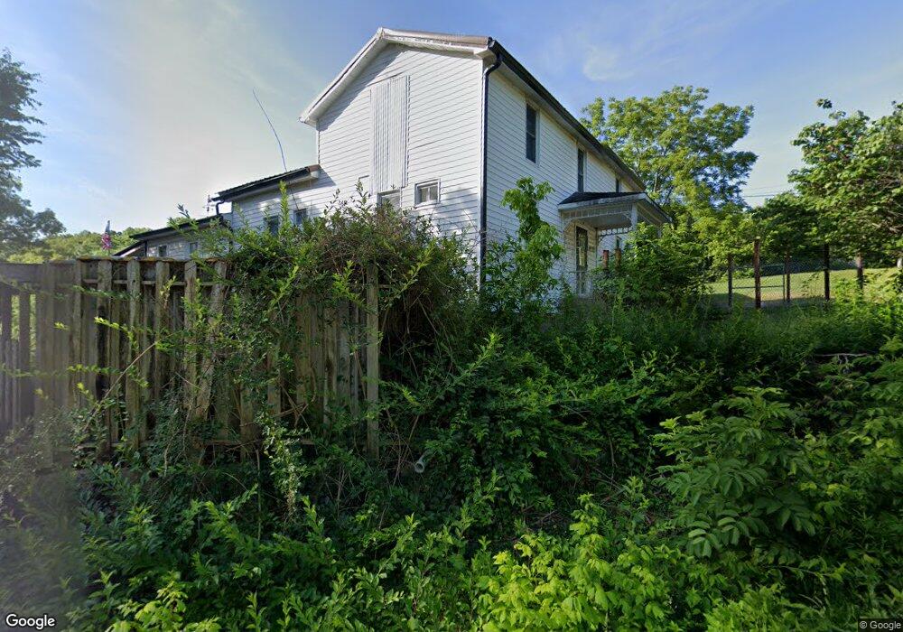
6086 Dry Branch Rd Saint Clair, MO 63077
Estimated Value: $218,000 - $568,000
3
Beds
2
Baths
2,056
Sq Ft
$159/Sq Ft
Est. Value
About This Home
This home is located at 6086 Dry Branch Rd, Saint Clair, MO 63077 and is currently estimated at $326,878, approximately $158 per square foot. 6086 Dry Branch Rd is a home located in Franklin County with nearby schools including St. Clair Elementary School, Edgar Murray Elementary School, and St. Clair Junior High School.
Ownership History
Date
Name
Owned For
Owner Type
Purchase Details
Closed on
Dec 29, 2020
Sold by
Suntrup Mary S
Bought by
Suntrup Mary S
Current Estimated Value
Home Financials for this Owner
Home Financials are based on the most recent Mortgage that was taken out on this home.
Original Mortgage
$69,600
Interest Rate
2.7%
Mortgage Type
New Conventional
Purchase Details
Closed on
Aug 4, 2006
Sold by
Suntrup Mary S and Suntrup Glen A
Bought by
Suntrup Marcia
Home Financials for this Owner
Home Financials are based on the most recent Mortgage that was taken out on this home.
Original Mortgage
$77,350
Interest Rate
6.78%
Mortgage Type
New Conventional
Create a Home Valuation Report for This Property
The Home Valuation Report is an in-depth analysis detailing your home's value as well as a comparison with similar homes in the area
Home Values in the Area
Average Home Value in this Area
Purchase History
| Date | Buyer | Sale Price | Title Company |
|---|---|---|---|
| Suntrup Mary S | -- | None Available | |
| Suntrup Marcia | -- | None Available |
Source: Public Records
Mortgage History
| Date | Status | Borrower | Loan Amount |
|---|---|---|---|
| Closed | Suntrup Mary S | $69,600 | |
| Closed | Suntrup Marcia | $77,350 |
Source: Public Records
Tax History Compared to Growth
Tax History
| Year | Tax Paid | Tax Assessment Tax Assessment Total Assessment is a certain percentage of the fair market value that is determined by local assessors to be the total taxable value of land and additions on the property. | Land | Improvement |
|---|---|---|---|---|
| 2024 | $1,473 | $27,016 | $0 | $0 |
| 2023 | $1,473 | $27,016 | $0 | $0 |
| 2022 | $1,469 | $26,860 | $0 | $0 |
| 2021 | $1,467 | $26,860 | $0 | $0 |
| 2020 | $1,346 | $23,636 | $0 | $0 |
| 2019 | $1,335 | $23,651 | $0 | $0 |
| 2018 | $1,229 | $21,508 | $0 | $0 |
| 2017 | $1,228 | $21,508 | $0 | $0 |
| 2016 | $1,116 | $19,517 | $0 | $0 |
| 2015 | $1,025 | $19,517 | $0 | $0 |
| 2014 | $1,031 | $19,598 | $0 | $0 |
Source: Public Records
Map
Nearby Homes
- 5546 Dry Branch Rd
- 000 Westwood Rd
- 665 Anaconda Rd
- 1615 N Service Rd W
- 205 Harmony Hills Rd
- 3080 Westwood Rd
- 0 Lollar Branch Rd Unit 24419048
- 0 St Clair Station Ln Unit MIS25068128
- 0 Highland Fling
- 887 Hagen Dr
- 00 Lollar Branch Rd
- 1921 W Springfield Rd
- 0 Peacock Rd
- 000
- 1305 Fox Run Ln
- 202 Steamboat Springs Rd
- Lot B Pea Ridge Farms Dr
- 0 Lot C Pea Ridge Farms Dr
- 0 Lot 1 Pea Ridge Farms Dr
- 1502 Redwood Dr
- 0Tract 4 Dry Branch Rd
- 0Tract 2 Dry Branch Rd
- 0Tract 1 Dry Branch Rd
- 0Tract 6 Dry Branch Rd
- 0Tract 12 Dry Branch Rd
- 0Tract 5 Dry Branch Rd
- 0Tract 3 Dry Branch Rd
- 6104 Dry Branch Rd
- 6067 Dry Branch Rd
- 754 Saint Louis Inn Rd
- 6032 Dry Branch Rd
- 6065 Dry Branch Rd
- 6028 Dry Branch Rd
- 776 Saint Louis Inn Rd
- 6187 Dry Branch Rd
- 753 Saint Louis Inn Rd
- 6189 Dry Branch Rd
- 715 Saint Louis Inn Rd
- 694 Saint Louis Inn Rd
- 697 Saint Louis Inn Rd