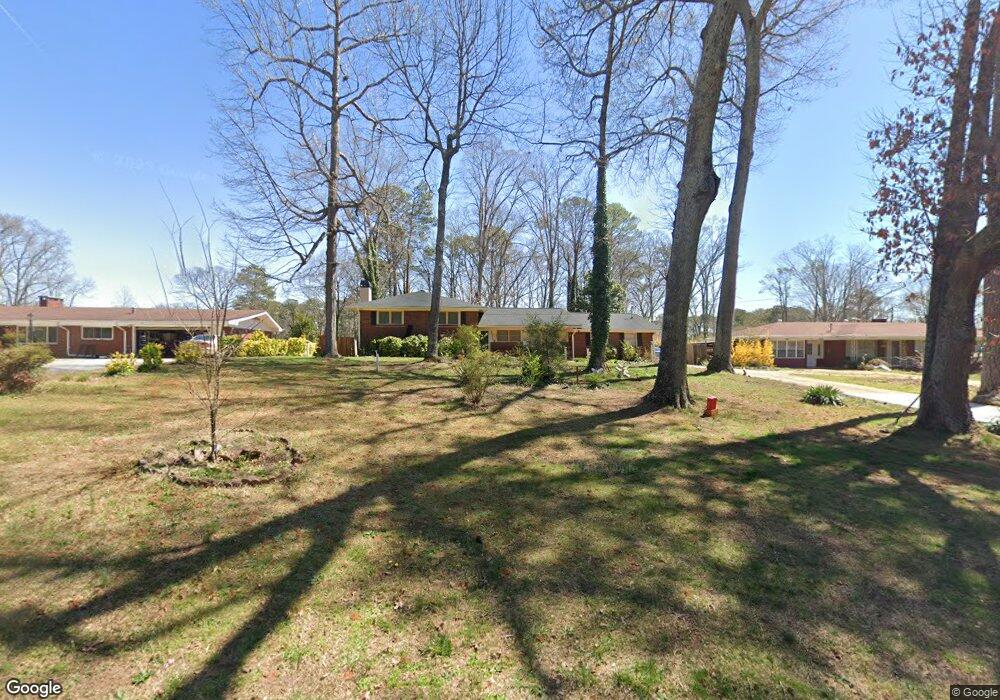
6086 Phillips Dr Morrow, GA 30260
Estimated Value: $246,984 - $258,000
4
Beds
3
Baths
1,815
Sq Ft
$139/Sq Ft
Est. Value
About This Home
This home is located at 6086 Phillips Dr, Morrow, GA 30260 and is currently estimated at $251,496, approximately $138 per square foot. 6086 Phillips Dr is a home located in Clayton County with nearby schools including Haynie Elementary School, Babb Middle School, and Forest Park High School.
Ownership History
Date
Name
Owned For
Owner Type
Purchase Details
Closed on
Aug 16, 2021
Sold by
Thomas Cynthia A
Bought by
Calhoun Maurice L
Current Estimated Value
Purchase Details
Closed on
May 6, 1998
Sold by
Butterfield Timothy H
Bought by
Thomas Cynthia A
Home Financials for this Owner
Home Financials are based on the most recent Mortgage that was taken out on this home.
Original Mortgage
$96,900
Interest Rate
7.1%
Mortgage Type
New Conventional
Purchase Details
Closed on
Mar 5, 1993
Sold by
Secretary Of Hud
Bought by
Butterfield Timothy H
Home Financials for this Owner
Home Financials are based on the most recent Mortgage that was taken out on this home.
Original Mortgage
$81,988
Interest Rate
7.57%
Mortgage Type
FHA
Create a Home Valuation Report for This Property
The Home Valuation Report is an in-depth analysis detailing your home's value as well as a comparison with similar homes in the area
Home Values in the Area
Average Home Value in this Area
Purchase History
| Date | Buyer | Sale Price | Title Company |
|---|---|---|---|
| Calhoun Maurice L | $220,000 | -- | |
| Thomas Cynthia A | $102,000 | -- | |
| Butterfield Timothy H | -- | -- |
Source: Public Records
Mortgage History
| Date | Status | Borrower | Loan Amount |
|---|---|---|---|
| Previous Owner | Thomas Cynthia A | $96,900 | |
| Previous Owner | Butterfield Timothy H | $81,988 |
Source: Public Records
Tax History
| Year | Tax Paid | Tax Assessment Tax Assessment Total Assessment is a certain percentage of the fair market value that is determined by local assessors to be the total taxable value of land and additions on the property. | Land | Improvement |
|---|---|---|---|---|
| 2025 | $2,057 | $70,240 | $8,000 | $62,240 |
| 2024 | $1,958 | $66,160 | $8,000 | $58,160 |
| 2023 | $2,452 | $62,120 | $8,000 | $54,120 |
| 2022 | $1,126 | $42,640 | $8,000 | $34,640 |
| 2021 | $988 | $38,440 | $8,000 | $30,440 |
| 2020 | $1,079 | $40,740 | $8,000 | $32,740 |
| 2019 | $935 | $36,263 | $8,000 | $28,263 |
| 2018 | $903 | $35,360 | $8,000 | $27,360 |
| 2017 | $655 | $28,356 | $8,000 | $20,356 |
| 2016 | $668 | $28,707 | $8,000 | $20,707 |
| 2015 | $385 | $0 | $0 | $0 |
| 2014 | $384 | $21,017 | $9,600 | $11,417 |
Source: Public Records
Map
Nearby Homes
- 1140 Foxcroft Dr
- 6057 Pinecreek Rd
- 1124 Ponderosa Park Dr
- 6250 Graceland Cir
- 927 Slash Pine Rd
- 6437 Stone Way Unit O5
- 1329 Woodstone Trace
- 1331 Woodstone Trace
- 1337 Woodstone Trace
- 1025 Lynwood Place
- 6436 Stone Terrace Unit J10
- 6423 Woodstone Terrace
- 0 SE Old Rex Morrow Rd Unit 142 8001665
- 913 Longleaf Dr
- 6421 Woodstone Terrace
- 6440 Woodstone Terrace
- 6425 Woodstone Way
- 6429 Woodstone Way
- 1388 Wood Cir S Unit 4
- 1394 Wood Cir S
- 6098 Phillips Dr
- 6076 Phillips Dr
- 6110 Phillips Dr Unit 1
- 6062 Phillips Dr
- 6085 Phillips Dr
- 6097 Phillips Dr
- 6054 Phillips Dr
- 6120 Phillips Dr
- 6115 Phillips Dr
- 6119 Navaho Trail
- 6131 Navaho Trail
- 6109 Navaho Trail
- 6048 Foxcroft Ct
- 6050 Foxcroft Ct
- 6044 Phillips Dr Unit 1
- 6130 Phillips Dr
- 6143 Navaho Trail
- 6095 Navaho Trail
- 6125 Phillips Dr
- 6046 Foxcroft Ct
Your Personal Tour Guide
Ask me questions while you tour the home.