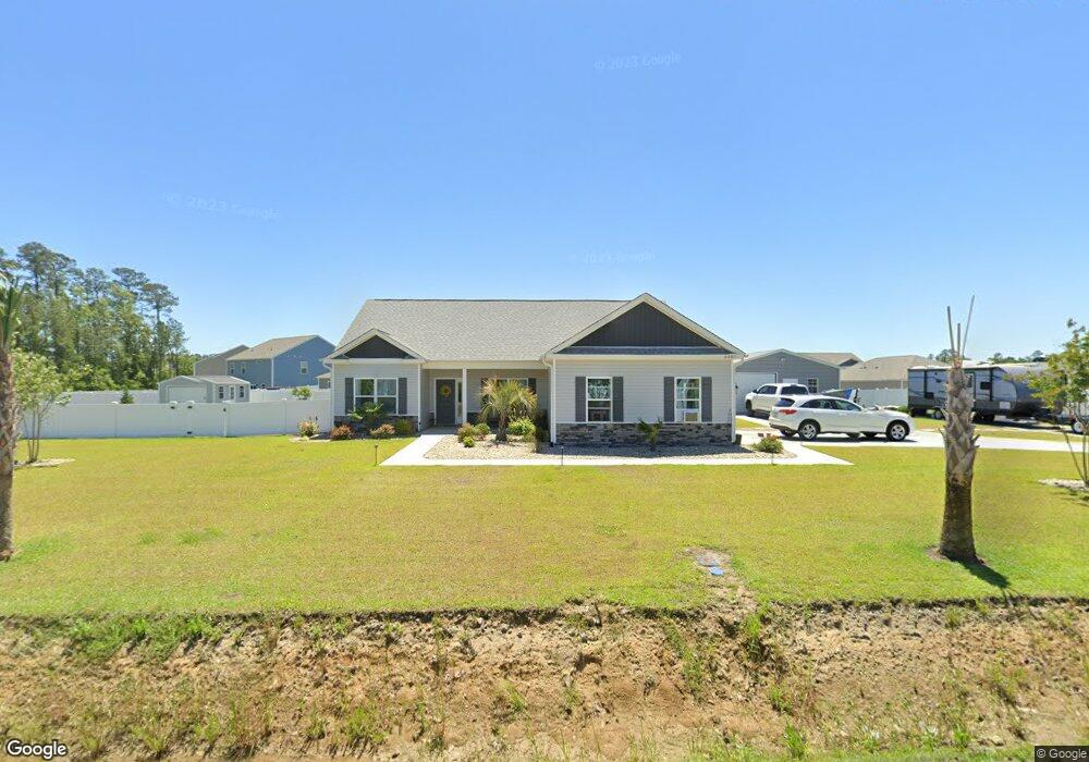
6087 Kates Bay Hwy Conway, SC 29527
Estimated Value: $352,702 - $390,000
3
Beds
1
Bath
1,576
Sq Ft
$234/Sq Ft
Est. Value
About This Home
This home is located at 6087 Kates Bay Hwy, Conway, SC 29527 and is currently estimated at $369,176, approximately $234 per square foot. 6087 Kates Bay Hwy is a home with nearby schools including Pee Dee Elementary School, Whittemore Park Middle School, and Conway High School.
Ownership History
Date
Name
Owned For
Owner Type
Purchase Details
Closed on
Apr 1, 2025
Sold by
Chick Craig L
Bought by
Colabella Susan A
Current Estimated Value
Home Financials for this Owner
Home Financials are based on the most recent Mortgage that was taken out on this home.
Original Mortgage
$250,000
Outstanding Balance
$249,780
Interest Rate
6.63%
Mortgage Type
New Conventional
Estimated Equity
$119,396
Purchase Details
Closed on
Oct 28, 2020
Sold by
C & R Builders Llc
Bought by
Chick Craig L and Chick Laura Anne
Purchase Details
Closed on
Jul 11, 2018
Sold by
Diamond Shores Llc
Bought by
C
Create a Home Valuation Report for This Property
The Home Valuation Report is an in-depth analysis detailing your home's value as well as a comparison with similar homes in the area
Home Values in the Area
Average Home Value in this Area
Purchase History
| Date | Buyer | Sale Price | Title Company |
|---|---|---|---|
| Colabella Susan A | $385,000 | -- | |
| Chick Craig L | $238,089 | -- | |
| C | $225,000 | -- | |
| Diamond Shores Llc | -- | -- |
Source: Public Records
Mortgage History
| Date | Status | Borrower | Loan Amount |
|---|---|---|---|
| Open | Colabella Susan A | $250,000 |
Source: Public Records
Tax History Compared to Growth
Tax History
| Year | Tax Paid | Tax Assessment Tax Assessment Total Assessment is a certain percentage of the fair market value that is determined by local assessors to be the total taxable value of land and additions on the property. | Land | Improvement |
|---|---|---|---|---|
| 2024 | $1,166 | $11,896 | $1,750 | $10,146 |
| 2023 | $1,166 | $9,410 | $1,800 | $7,600 |
| 2021 | $3,342 | $24,698 | $4,737 | $19,961 |
| 2020 | $212 | $1,723 | $1,723 | $0 |
| 2019 | $212 | $1,723 | $1,723 | $0 |
| 2018 | $0 | $0 | $0 | $0 |
Source: Public Records
Map
Nearby Homes
- 297 Harvest Ridge Way
- 1031 Corn Husk Loop
- 380 Harvest Ridge Way
- 5703 Kates Bay Hwy
- 508 Scarlet Sage Dr
- 512 Scarlet Sage Dr
- 132 Coralberry Dr
- 128 Coralberry Dr
- 131 Coralberry Dr
- 553 Fox Chase Dr
- 540 Scarlet Sage Dr
- 123 Coralberry Dr
- 544 Scarlet Sage Dr
- 109 Rena Ln Unit Lot 3
- 524 Scarlet Sage Dr
- 206 Red Buckeye Dr
- DEVON Plan at Dove Crossing
- ARIA Plan at Dove Crossing
- KERRY Plan at Dove Crossing
- CAMERON Plan at Dove Crossing
- 6095 Cates Bay Hwy
- 6081 Cates Bay Hwy
- 264 Harvest Ridge Way
- 281 Harvest Ridge Way
- 281 Harvest Ridge Way Unit Lot 133- Macon A
- 6088 Kates Bay Hwy
- 6100 Kates Bay Hwy
- 6080 Kates Bay Hwy
- 253 Harvest Rdg Way
- 6114 Kates Bay Hwy
- 249 Harvest Rdg Way
- 6115 Cates Bay Hwy
- 300 Harvest Ridge Way
- 6000 Kates Bay Hwy
- 309 Harvest Ridge Way
- 240 Harvest Ridge Way Unit Lot 105- Aria A
- 111 Spring Wheat Way
- 111 Spring Wheat Way Unit Lot 125- Aria A
- 115 Spring Wheat Way
- 119 Spring Wheat Way