Estimated Value: $205,000 - $234,969
Studio
2
Baths
1,612
Sq Ft
$134/Sq Ft
Est. Value
About This Home
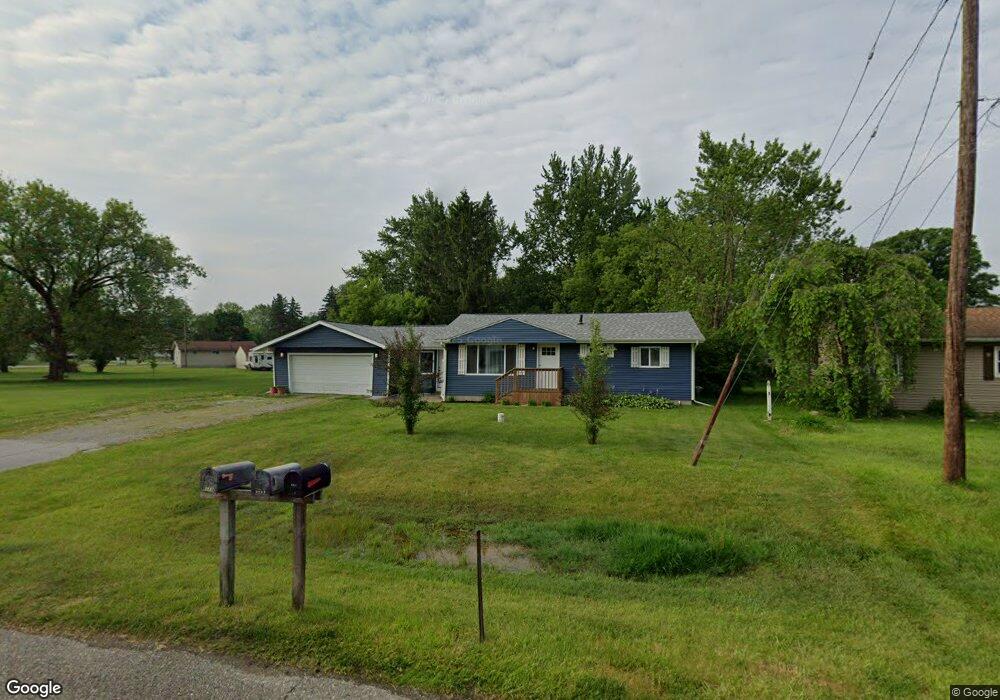
This home is located at 6088 Crown Point Unit Bldg-Unit, Flint, MI 48506 and is currently estimated at $215,492, approximately $133 per square foot. 6088 Crown Point Unit Bldg-Unit is a home located in Genesee County with nearby schools including Weston Elementary School, Leota Fiedler Elementary School, and Kate Dowdall Elementary School.
Ownership History
Date
Name
Owned For
Owner Type
Purchase Details
Closed on
Jul 13, 2022
Sold by
Tara Boudreaux
Bought by
Modlin Nicholas
Current Estimated Value
Purchase Details
Closed on
Aug 3, 2018
Sold by
Starline Capital Management Llc
Bought by
Boudreaux Tara
Purchase Details
Closed on
Oct 30, 2017
Sold by
Dunning Ryan
Bought by
Starline Capital Management Llc
Purchase Details
Closed on
Oct 24, 2017
Sold by
Beckman Susan and Estate Of Sharon Louise Januch
Bought by
Dunning Ryan
Create a Home Valuation Report for This Property
The Home Valuation Report is an in-depth analysis detailing your home's value as well as a comparison with similar homes in the area
Home Values in the Area
Average Home Value in this Area
Purchase History
| Date | Buyer | Sale Price | Title Company |
|---|---|---|---|
| Modlin Nicholas | $205,000 | None Listed On Document | |
| Boudreaux Tara | $147,000 | West Michigan Realtors Title | |
| Starline Capital Management Llc | $40,943 | None Available | |
| Dunning Ryan | $40,000 | None Available |
Source: Public Records
Tax History Compared to Growth
Tax History
| Year | Tax Paid | Tax Assessment Tax Assessment Total Assessment is a certain percentage of the fair market value that is determined by local assessors to be the total taxable value of land and additions on the property. | Land | Improvement |
|---|---|---|---|---|
| 2025 | $3,644 | $100,400 | $0 | $0 |
| 2024 | $991 | $92,200 | $0 | $0 |
| 2023 | $946 | $82,200 | $0 | $0 |
| 2022 | $2,195 | $76,400 | $0 | $0 |
| 2021 | $2,175 | $69,000 | $0 | $0 |
| 2020 | $643 | $62,400 | $0 | $0 |
| 2019 | $633 | $54,500 | $0 | $0 |
| 2018 | $1,566 | $39,300 | $0 | $0 |
| 2017 | $1,762 | $37,900 | $0 | $0 |
| 2016 | $2,242 | $36,500 | $0 | $0 |
| 2015 | $1,539 | $34,400 | $0 | $0 |
| 2014 | $336 | $30,400 | $0 | $0 |
| 2012 | -- | $28,800 | $28,800 | $0 |
Source: Public Records
Map
Nearby Homes
- 6077 Crown Point
- 4062 N Belsay Rd
- 6054 E Pierson Rd
- 3454 Eastdale Dr
- 3365 Eastdale Dr
- 6443 Richfield Rd
- 6363 Bluejay Dr
- 3201 Gehring Dr
- 3485 N Vassar Rd
- 3251 Lynne Ave
- 5107 Hartland Dr
- 3414 N Genesee Rd
- 5068 Roberts Dr
- 5141 N Vassar Rd
- 4455 N Genesee Rd
- 0 Whisper Ridge Ct
- 3430 Blue Lake Dr
- 0 Sugar Maple Farms Unit 50195365
- 3294 Comer Dr
- 3413 Blue Lake Dr
- 6088 Crown Point
- 6080 Crown Point St
- 6080 Crown Point
- 6085 Freedom Ln
- 4073 Independence Dr
- 6072 Crown Point
- 4053 Independence Dr
- 6087 Crown Point St
- 6069 Freedom Ln
- 6087 Crown Point
- 4091 Independence Dr
- 6062 Crown Point
- 6061 Crown Point
- 6059 Freedom Ln
- 6069 Crown Point
- 4099 Independence Dr
- 6056 Crown Point
- 4037 Independence Dr
- 4084 Independence Dr
- 6084 Freedom Ln