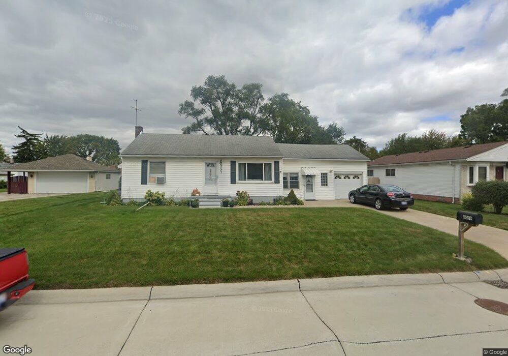
6089 Adams Ave Warren, MI 48092
Northwest Warren NeighborhoodEstimated Value: $170,033 - $218,000
2
Beds
2
Baths
858
Sq Ft
$226/Sq Ft
Est. Value
About This Home
This home is located at 6089 Adams Ave, Warren, MI 48092 and is currently estimated at $193,758, approximately $225 per square foot. 6089 Adams Ave is a home located in Macomb County with nearby schools including Green Acres Elementary School, Beer Middle School, and Warren Mott High School.
Ownership History
Date
Name
Owned For
Owner Type
Purchase Details
Closed on
Jul 25, 2025
Sold by
Ragnoli Paul A
Bought by
Ragnoli Paul A and Clark Andrea
Current Estimated Value
Purchase Details
Closed on
May 7, 2025
Sold by
Ragnoli Alexy P and Ragnoli Paul A
Bought by
Ragnoli Paul A
Purchase Details
Closed on
Sep 12, 2022
Sold by
Ragnoli Paul A and Ragnoli Alexa P
Bought by
Ragnoli Paul A and Ragnoli Alexa P
Purchase Details
Closed on
Feb 15, 2021
Sold by
Ragnoli Paul A and Ragnoli Robert E
Bought by
Ragnoli Paul A and Ragnoli Robert E
Create a Home Valuation Report for This Property
The Home Valuation Report is an in-depth analysis detailing your home's value as well as a comparison with similar homes in the area
Home Values in the Area
Average Home Value in this Area
Purchase History
| Date | Buyer | Sale Price | Title Company |
|---|---|---|---|
| Ragnoli Paul A | -- | None Listed On Document | |
| Ragnoli Paul A | -- | None Listed On Document | |
| Ragnoli Paul A | -- | None Listed On Document | |
| Ragnoli Paul A | -- | None Listed On Document | |
| Ragnoli Paul A | -- | None Listed On Document | |
| Ragnoli Paul A | -- | None Available |
Source: Public Records
Tax History
| Year | Tax Paid | Tax Assessment Tax Assessment Total Assessment is a certain percentage of the fair market value that is determined by local assessors to be the total taxable value of land and additions on the property. | Land | Improvement |
|---|---|---|---|---|
| 2025 | $2,360 | $86,400 | $0 | $0 |
| 2024 | $23 | $79,730 | $0 | $0 |
| 2023 | $3,616 | $69,650 | $0 | $0 |
| 2022 | $2,115 | $64,240 | $0 | $0 |
| 2021 | $2,152 | $60,120 | $0 | $0 |
| 2020 | $2,562 | $57,070 | $0 | $0 |
| 2019 | $2,462 | $53,600 | $0 | $0 |
| 2018 | $2,471 | $52,120 | $0 | $0 |
| 2017 | $2,415 | $49,050 | $13,450 | $35,600 |
| 2016 | $2,401 | $49,050 | $0 | $0 |
| 2015 | -- | $42,200 | $0 | $0 |
| 2012 | -- | $35,820 | $0 | $0 |
Source: Public Records
Map
Nearby Homes
- 6217 Adams Ave
- 6222 Peck Ave
- 6027 Peck Ave
- 32436 Saint Annes Dr
- 5612 Streefkerk Dr
- 32075 Saint Annes Dr
- 33121 Defour Dr
- 5441 Arden Ave
- 5273 Marie Ln
- 5211 Streefkerk Dr
- 32416 Exeter Dr
- 5093 Northlawn Dr
- 32549 Ruehle
- 32694 Ruehle Ave
- 4812 Berwyn Dr
- 4896 Chicago Rd
- 5010 Kelly Dr
- 32930 Chalfonte Dr
- 32458 Linderman Ave
- 5575 E 14 Mile Rd
- 6073 Adams Ave
- 6225 Adams Ave
- 6204 Peck Ave Unit Bldg-Unit
- 6090 Peck Ave
- 6065 Adams Ave
- 6074 Peck Ave
- 6233 Adams Ave
- 6066 Peck Ave
- 6090 Adams Ave
- 6218 Adams Ave
- 6226 Peck Ave
- 6082 Adams Ave
- 6061 Adams Ave
- 6058 Peck Ave
- 6230 Adams Ave
- 6066 Adams Ave
- 6254 Adams Ave
- 6246 Peck Ave
- 6257 Adams Ave
- 6040 Peck Ave
Your Personal Tour Guide
Ask me questions while you tour the home.