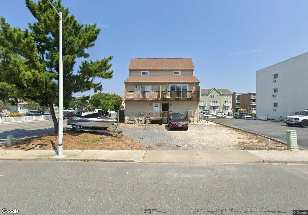
608B Dory Rd Ocean City, MD 21842
Estimated Value: $600,000 - $789,000
Studio
3
Baths
1,782
Sq Ft
$379/Sq Ft
Est. Value
About This Home
This home is located at 608B Dory Rd, Ocean City, MD 21842 and is currently estimated at $675,926, approximately $379 per square foot. 608B Dory Rd is a home located in Worcester County with nearby schools including Ocean City Elementary School, Stephen Decatur Middle School, and Berlin Intermediate School.
Ownership History
Date
Name
Owned For
Owner Type
Purchase Details
Closed on
Oct 25, 2013
Sold by
Mcelhaney Scott
Bought by
Lentz Steven
Current Estimated Value
Home Financials for this Owner
Home Financials are based on the most recent Mortgage that was taken out on this home.
Original Mortgage
$285,900
Outstanding Balance
$214,305
Interest Rate
4.36%
Mortgage Type
VA
Estimated Equity
$461,621
Purchase Details
Closed on
Mar 31, 1987
Sold by
West Jack R
Bought by
Turpin Ralph M
Create a Home Valuation Report for This Property
The Home Valuation Report is an in-depth analysis detailing your home's value as well as a comparison with similar homes in the area
Purchase History
| Date | Buyer | Sale Price | Title Company |
|---|---|---|---|
| Lentz Steven | $279,900 | Real Estate Title & Escrow | |
| Turpin Ralph M | $125,000 | -- |
Source: Public Records
Mortgage History
| Date | Status | Borrower | Loan Amount |
|---|---|---|---|
| Open | Lentz Steven | $285,900 |
Source: Public Records
Tax History
| Year | Tax Paid | Tax Assessment Tax Assessment Total Assessment is a certain percentage of the fair market value that is determined by local assessors to be the total taxable value of land and additions on the property. | Land | Improvement |
|---|---|---|---|---|
| 2025 | $5,823 | $426,467 | $0 | $0 |
| 2024 | $5,105 | $365,833 | $0 | $0 |
| 2023 | $4,302 | $305,200 | $150,000 | $155,200 |
| 2022 | $8,275 | $297,467 | $0 | $0 |
| 2021 | $4,094 | $289,733 | $0 | $0 |
| 2020 | $4,000 | $282,000 | $150,000 | $132,000 |
| 2019 | $4,000 | $282,000 | $150,000 | $132,000 |
| 2018 | $4,205 | $282,000 | $150,000 | $132,000 |
| 2017 | $4,404 | $314,200 | $0 | $0 |
| 2016 | $4,404 | $310,200 | $0 | $0 |
| 2015 | $4,333 | $306,200 | $0 | $0 |
| 2014 | $4,333 | $302,200 | $0 | $0 |
Source: Public Records
Map
Nearby Homes
- 617 Salt Spray Rd Unit B
- 617 Salt Spray Rd Unit D
- 615 Salt Spray Rd
- 615 Salt Spray Rd
- 615 Salt Spray Rd
- 616 Salt Spray Rd Unit 7
- 616 Salt Spray Rd Unit 6
- 712B Mooring Rd
- 700 Mooring Rd
- 9203 Rusty Anchor Rd
- 703 94th St Unit 1
- 726 Mooring Rd
- 708 Bradley Rd Unit A1
- 707 94th St Unit 302
- 8904 Rusty Anchor Rd
- 8906 Rusty Anchor Rd Unit 8
- 712 Bradley Rd Unit E
- 8908 Rusty Anchor Rd
- 722 Mooring Rd
- 613C 94th St
- 608A Dory Rd
- 608 Dory Rd
- 608 Dory Rd Unit B
- 0 Rusty Anchor Rd Unit 1 1000795606
- 302 Dory Rd Unit 302
- 606 Dory Rd Unit 303
- 606 Dory Rd Unit 201
- 606 Dory Rd Unit 202
- 606 Dory Rd Unit 305
- 606 Dory Rd Unit 301
- 606 Dory Rd Unit 203
- 606 Dory Rd Unit 101
- 606 Dory Rd Unit 103
- 606 Dory Rd Unit 304
- 606 Dory Rd Unit 204
- 606 Dory Rd Unit 205
- 606 Dory Rd Unit 102
- 606 Dory Rd Unit 302
- 606 Dory Rd Unit 105
- 606 Dory Rd Unit C
Your Personal Tour Guide
Ask me questions while you tour the home.