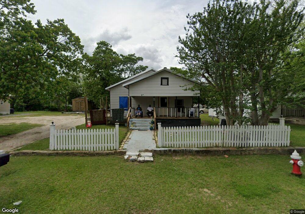
609 1st St Moultrie, GA 31768
Estimated Value: $45,729 - $63,000
Studio
1
Bath
1,271
Sq Ft
$45/Sq Ft
Est. Value
About This Home
This home is located at 609 1st St, Moultrie, GA 31768 and is currently estimated at $57,182, approximately $44 per square foot. 609 1st St is a home located in Colquitt County with nearby schools including C.A. Gray Junior High School, Willie J. Williams Middle School, and Colquitt County High School.
Ownership History
Date
Name
Owned For
Owner Type
Purchase Details
Closed on
Feb 21, 2017
Sold by
Hett Frank R
Bought by
Stokes Travis Tyshon
Current Estimated Value
Purchase Details
Closed on
Jun 2, 2015
Sold by
Paolitti Freddie N
Bought by
Hett Frank R
Purchase Details
Closed on
Aug 10, 2010
Sold by
Federal Home Loan Mortgage Corporation
Bought by
Paolitti Freddie N
Purchase Details
Closed on
Jul 7, 2009
Sold by
Bank Of America Na
Bought by
Federal Home Loan Mortgage Corp
Create a Home Valuation Report for This Property
The Home Valuation Report is an in-depth analysis detailing your home's value as well as a comparison with similar homes in the area
Purchase History
| Date | Buyer | Sale Price | Title Company |
|---|---|---|---|
| Stokes Travis Tyshon | -- | -- | |
| Stokes Travis Tyshon | $5,000 | -- | |
| Hett Frank R | $757 | -- | |
| Paolitti Freddie N | -- | -- | |
| Federal Home Loan Mortgage Corp | $31,379 | -- | |
| Bank Of America Na | $31,379 | -- |
Source: Public Records
Tax History
| Year | Tax Paid | Tax Assessment Tax Assessment Total Assessment is a certain percentage of the fair market value that is determined by local assessors to be the total taxable value of land and additions on the property. | Land | Improvement |
|---|---|---|---|---|
| 2025 | $173 | $6,020 | $1,280 | $4,740 |
| 2024 | $173 | $6,547 | $1,280 | $5,267 |
| 2023 | $198 | $7,286 | $1,280 | $6,006 |
| 2022 | $234 | $6,988 | $1,280 | $5,708 |
| 2021 | $213 | $6,288 | $1,280 | $5,008 |
| 2016 | $513 | $12,843 | $1,280 | $11,563 |
Source: Public Records
Map
Nearby Homes
- 503 2nd St NW
- 316 5th Ave NW
- 521 5th Ave NW
- 427 8th St NW
- 610 1st Ave NW
- 408 9th St NW
- 720 9th St NW
- 310 1st Ave SW
- 00 1st Ave SW
- 518 1st Ave SW Unit 3
- 40 SE Packer Pride Dr Unit 135
- 40 SE Packer Pride Dr
- 722 Martin Luther King jr Dr
- 4 5th St SE
- 2 5th St SE
- 1 5th St SE
- 407 1st Ave SE
- 3 5th St SE
- 1021 11th Ave NW
- 618 2nd Ave SW
Your Personal Tour Guide
Ask me questions while you tour the home.