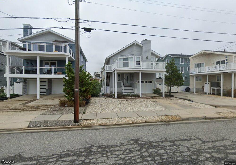
609 22nd St Avalon, NJ 08202
Estimated Value: $1,707,065 - $2,206,000
Studio
--
Bath
1,788
Sq Ft
$1,093/Sq Ft
Est. Value
About This Home
This home is located at 609 22nd St, Avalon, NJ 08202 and is currently estimated at $1,954,016, approximately $1,092 per square foot. 609 22nd St is a home located in Cape May County with nearby schools including Avalon Elementary School.
Ownership History
Date
Name
Owned For
Owner Type
Purchase Details
Closed on
Sep 21, 2020
Sold by
Much Donald W
Bought by
Much Rt
Current Estimated Value
Purchase Details
Closed on
Dec 22, 1999
Sold by
Davis Linda Ruth
Bought by
Much Donald W and Much Theresa C
Home Financials for this Owner
Home Financials are based on the most recent Mortgage that was taken out on this home.
Original Mortgage
$240,000
Interest Rate
7.71%
Purchase Details
Closed on
Dec 21, 1998
Sold by
Souder Jerry
Bought by
Davis Linda
Home Financials for this Owner
Home Financials are based on the most recent Mortgage that was taken out on this home.
Original Mortgage
$170,000
Interest Rate
6.84%
Purchase Details
Closed on
Apr 25, 1998
Sold by
Wabash Partners Lp
Bought by
Souder Jerry and Godshall Virginia B
Home Financials for this Owner
Home Financials are based on the most recent Mortgage that was taken out on this home.
Original Mortgage
$250,000
Interest Rate
7.04%
Purchase Details
Closed on
Apr 30, 1992
Sold by
Westhead Donad and Ruth Anne
Bought by
Souder Jerry and Souder Georgine
Create a Home Valuation Report for This Property
The Home Valuation Report is an in-depth analysis detailing your home's value as well as a comparison with similar homes in the area
Home Values in the Area
Average Home Value in this Area
Purchase History
| Date | Buyer | Sale Price | Title Company |
|---|---|---|---|
| Much Rt | -- | None Available | |
| Much Donald W | $388,000 | -- | |
| Davis Linda | $270,000 | -- | |
| Souder Jerry | $395,000 | -- | |
| Souder Jerry | $250,000 | -- |
Source: Public Records
Mortgage History
| Date | Status | Borrower | Loan Amount |
|---|---|---|---|
| Previous Owner | Much Donald W | $240,000 | |
| Previous Owner | Davis Linda | $170,000 | |
| Previous Owner | Souder Jerry | $250,000 |
Source: Public Records
Tax History
| Year | Tax Paid | Tax Assessment Tax Assessment Total Assessment is a certain percentage of the fair market value that is determined by local assessors to be the total taxable value of land and additions on the property. | Land | Improvement |
|---|---|---|---|---|
| 2025 | $4,386 | $714,300 | $450,000 | $264,300 |
| 2024 | $4,386 | $714,300 | $450,000 | $264,300 |
| 2023 | $4,350 | $714,300 | $450,000 | $264,300 |
| 2022 | $4,057 | $714,300 | $450,000 | $264,300 |
| 2021 | $3,907 | $714,300 | $450,000 | $264,300 |
| 2020 | $3,757 | $714,300 | $450,000 | $264,300 |
| 2019 | $3,643 | $714,300 | $450,000 | $264,300 |
| 2018 | $3,486 | $714,300 | $450,000 | $264,300 |
| 2017 | $4,426 | $796,100 | $550,000 | $246,100 |
| 2016 | $4,379 | $796,100 | $550,000 | $246,100 |
| 2015 | $4,307 | $796,100 | $550,000 | $246,100 |
| 2014 | $4,259 | $796,100 | $550,000 | $246,100 |
Source: Public Records
Map
Nearby Homes
- 447 24th St
- 415 20th St
- 890 21st St
- 389 22nd St
- 386 24th St
- 386 24th St Unit Upper
- 2425 Harbor Ave Unit 2425
- 1668 Ocean Dr Unit B1
- 16 4th Ave
- 211 23rd St
- 212 25th St Unit End Unit
- 178 19th St
- 285 14th St Unit 285
- 285 14th St
- 2023 Dune Dr Unit R6
- 2934 Ocean Dr Unit North
- 174 23rd St
- 161 24th St
- 118 22nd St
- 179 27th St
- 619 22nd St
- 601 22nd St
- 601 22nd St
- 627 22nd St Unit 627
- 2168 6th Ave
- 2168 6th Ave Unit 2168
- 612 21st St
- 629 22nd St
- 629 22nd St Unit West
- 620 21st St
- 2166 6th Ave
- 641 22nd St
- 641 22nd St
- 2138 6th Ave
- 620 22nd St
- 636 21st St Unit 636
- 636 21st St Unit 1st Floor
- 604 22nd St
- 628 21st St
- 628 21st St Unit 1st floor
Your Personal Tour Guide
Ask me questions while you tour the home.