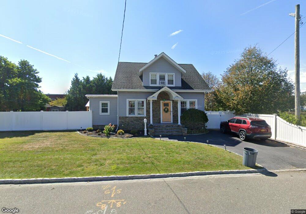
609 Adams Ave Lindenhurst, NY 11757
Estimated Value: $560,000 - $681,000
4
Beds
2
Baths
1,688
Sq Ft
$379/Sq Ft
Est. Value
About This Home
This home is located at 609 Adams Ave, Lindenhurst, NY 11757 and is currently estimated at $639,598, approximately $378 per square foot. 609 Adams Ave is a home located in Suffolk County with nearby schools including Harding Avenue Elementary School, Lindenhurst Middle School, and Lindenhurst Senior High School.
Ownership History
Date
Name
Owned For
Owner Type
Purchase Details
Closed on
Jun 23, 2017
Sold by
Mandel Eileen
Bought by
Jimenez Anthony
Current Estimated Value
Home Financials for this Owner
Home Financials are based on the most recent Mortgage that was taken out on this home.
Original Mortgage
$358,388
Outstanding Balance
$301,154
Interest Rate
4.4%
Mortgage Type
FHA
Estimated Equity
$338,444
Purchase Details
Closed on
Mar 24, 2006
Purchase Details
Closed on
May 10, 1996
Sold by
Sommers David and Sommers Geraldine
Bought by
Mandel Eileen
Create a Home Valuation Report for This Property
The Home Valuation Report is an in-depth analysis detailing your home's value as well as a comparison with similar homes in the area
Home Values in the Area
Average Home Value in this Area
Purchase History
| Date | Buyer | Sale Price | Title Company |
|---|---|---|---|
| Jimenez Anthony | $365,000 | None Available | |
| -- | -- | -- | |
| Mandel Eileen | -- | Commonwealth Land Title Ins |
Source: Public Records
Mortgage History
| Date | Status | Borrower | Loan Amount |
|---|---|---|---|
| Open | Jimenez Anthony | $358,388 |
Source: Public Records
Tax History Compared to Growth
Tax History
| Year | Tax Paid | Tax Assessment Tax Assessment Total Assessment is a certain percentage of the fair market value that is determined by local assessors to be the total taxable value of land and additions on the property. | Land | Improvement |
|---|---|---|---|---|
| 2024 | $11,089 | $2,990 | $450 | $2,540 |
| 2023 | $10,036 | $2,990 | $450 | $2,540 |
| 2022 | $9,001 | $2,990 | $450 | $2,540 |
| 2021 | $9,001 | $2,990 | $450 | $2,540 |
| 2020 | $9,311 | $2,990 | $450 | $2,540 |
| 2019 | $10,243 | $0 | $0 | $0 |
| 2018 | -- | $2,990 | $450 | $2,540 |
| 2017 | $8,958 | $2,990 | $450 | $2,540 |
| 2016 | $8,973 | $2,990 | $450 | $2,540 |
| 2015 | -- | $2,990 | $450 | $2,540 |
| 2014 | -- | $2,990 | $450 | $2,540 |
Source: Public Records
Map
Nearby Homes
- 621 Adams Ave
- 614 S Wellwood Ave
- 1 E Montauk Hwy
- 612 Adams Ave
- 618 S Wellwood Ave
- 39 E Montauk Hwy
- 622 S Wellwood Ave
- 629 Adams Ave
- 47 E Montauk Hwy
- 615 S Wellwood Ave
- 615 S Wellwood Ave Unit 1
- 47 Montauk Hwy
- 611 Madison Ave
- 630 Adams Ave
- 626 S Wellwood Ave
- 613 Madison Ave
- 619 Madison Ave
- 51 E Montauk Hwy
- 24 Montauk Hwy
- 630 S Wellwood Ave