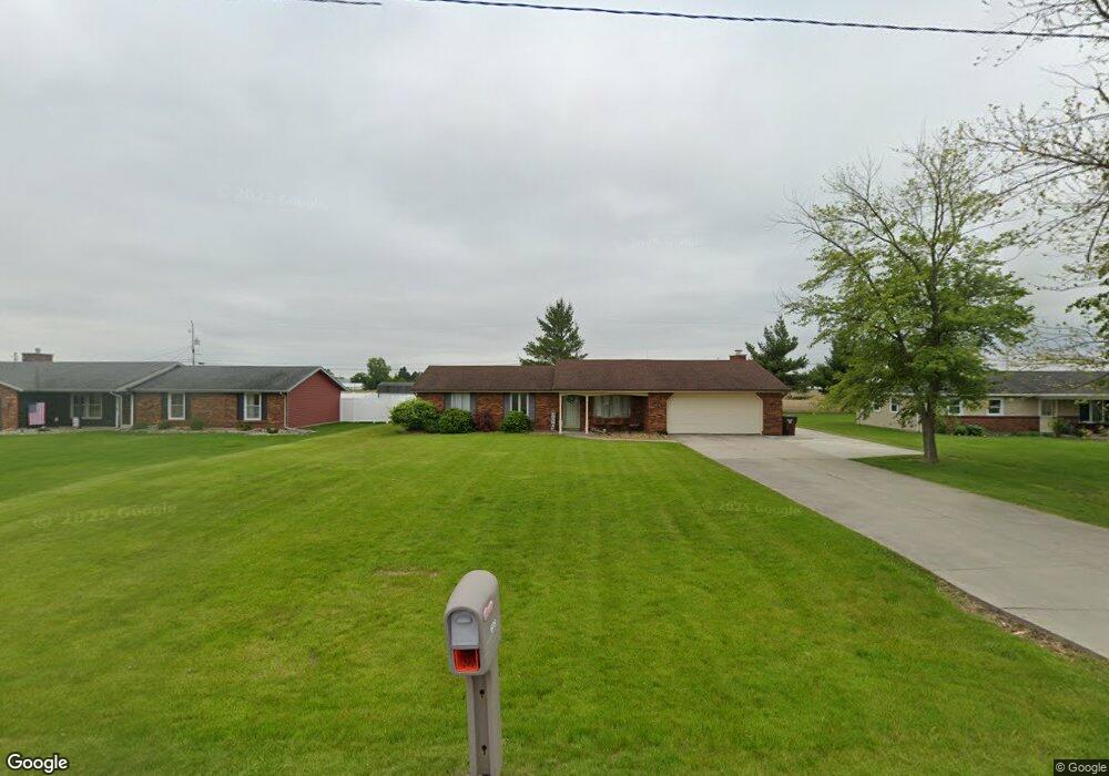
609 Airport Rd Paulding, OH 45879
Estimated Value: $163,499 - $190,000
3
Beds
2
Baths
1,624
Sq Ft
$112/Sq Ft
Est. Value
About This Home
This home is located at 609 Airport Rd, Paulding, OH 45879 and is currently estimated at $181,125, approximately $111 per square foot. 609 Airport Rd is a home located in Paulding County with nearby schools including Paulding High School.
Ownership History
Date
Name
Owned For
Owner Type
Purchase Details
Closed on
Dec 2, 2022
Sold by
Rus Kelsi L and Rus Tobby
Bought by
Rus Kelsi L and Rus Tobby
Current Estimated Value
Purchase Details
Closed on
May 6, 2022
Sold by
Manz Mitchell A and Manz Allison
Bought by
Manz Kelsi A
Purchase Details
Closed on
Dec 20, 2017
Sold by
Hammon Rodney A and Hammon Carrie L
Bought by
Manz Michell A
Home Financials for this Owner
Home Financials are based on the most recent Mortgage that was taken out on this home.
Original Mortgage
$72,000
Interest Rate
3.95%
Mortgage Type
New Conventional
Purchase Details
Closed on
Jun 26, 2015
Sold by
Buchman Anthony J and Buchman Jane J
Bought by
Hammon Rodney A and Hammon Carrie L
Home Financials for this Owner
Home Financials are based on the most recent Mortgage that was taken out on this home.
Original Mortgage
$47,200
Interest Rate
5.5%
Mortgage Type
Purchase Money Mortgage
Purchase Details
Closed on
Jun 22, 2015
Sold by
Gallup Teresa and Gallup James
Bought by
Hammon Rodney A and Hammon Carrie L
Home Financials for this Owner
Home Financials are based on the most recent Mortgage that was taken out on this home.
Original Mortgage
$47,200
Interest Rate
5.5%
Mortgage Type
Purchase Money Mortgage
Purchase Details
Closed on
Jun 19, 2015
Sold by
Buchman Joel R and Reguindin Andrew C
Bought by
Hammon Rodnoey A and Hammon Carrie L
Home Financials for this Owner
Home Financials are based on the most recent Mortgage that was taken out on this home.
Original Mortgage
$47,200
Interest Rate
5.5%
Mortgage Type
Purchase Money Mortgage
Purchase Details
Closed on
Jun 13, 2015
Sold by
Brien Melanie E O and Brien David R O
Bought by
Hammon Rodney A and Hammon Carrie L
Home Financials for this Owner
Home Financials are based on the most recent Mortgage that was taken out on this home.
Original Mortgage
$47,200
Interest Rate
5.5%
Mortgage Type
Purchase Money Mortgage
Purchase Details
Closed on
Jan 7, 2003
Sold by
Gallup Teresa
Bought by
Hammon Rodney A and Hammon Carrie L
Purchase Details
Closed on
Apr 30, 1999
Sold by
Clark Douglas P
Bought by
Hammon Rodney A and Hammon Carrie L
Purchase Details
Closed on
Mar 11, 1997
Bought by
Hammon Rodney A and Hammon Carrie L
Create a Home Valuation Report for This Property
The Home Valuation Report is an in-depth analysis detailing your home's value as well as a comparison with similar homes in the area
Home Values in the Area
Average Home Value in this Area
Purchase History
| Date | Buyer | Sale Price | Title Company |
|---|---|---|---|
| Rus Kelsi L | -- | -- | |
| Rus Kelsi L | -- | None Listed On Document | |
| Manz Kelsi A | $30,000 | Miller Matthew A | |
| Manz Kelsi A | $30,000 | None Listed On Document | |
| Manz Michell A | $90,000 | None Available | |
| Hammon Rodney A | $59,000 | None Available | |
| Hammon Rodney A | $59,000 | None Available | |
| Hammon Rodnoey A | $59,000 | None Available | |
| Hammon Rodney A | $59,000 | None Available | |
| Hammon Rodney A | -- | -- | |
| Hammon Rodney A | $91,500 | -- | |
| Hammon Rodney A | $84,000 | -- |
Source: Public Records
Mortgage History
| Date | Status | Borrower | Loan Amount |
|---|---|---|---|
| Previous Owner | Manz Michell A | $72,000 | |
| Previous Owner | Hammon Rodney A | $47,200 |
Source: Public Records
Tax History
| Year | Tax Paid | Tax Assessment Tax Assessment Total Assessment is a certain percentage of the fair market value that is determined by local assessors to be the total taxable value of land and additions on the property. | Land | Improvement |
|---|---|---|---|---|
| 2025 | $2,511 | $58,000 | $6,480 | $51,520 |
| 2024 | $2,511 | $42,950 | $4,800 | $38,150 |
| 2023 | $1,932 | $42,950 | $4,800 | $38,150 |
| 2022 | $1,872 | $42,950 | $4,800 | $38,150 |
| 2021 | $1,524 | $31,120 | $4,800 | $26,320 |
| 2020 | $1,362 | $31,120 | $4,800 | $26,320 |
| 2019 | $1,374 | $29,860 | $4,800 | $25,060 |
| 2018 | $1,342 | $29,860 | $4,800 | $25,060 |
| 2017 | $1,378 | $29,860 | $4,800 | $25,060 |
| 2016 | $1,378 | $29,860 | $4,800 | $25,060 |
| 2015 | $977 | $30,810 | $4,800 | $26,010 |
| 2014 | $972 | $30,810 | $4,800 | $26,010 |
| 2013 | $1,052 | $30,810 | $4,800 | $26,010 |
Source: Public Records
Map
Nearby Homes
- 13688 Kay St
- 1065 Emerald Rd
- 830 N Walnut St
- 741 Tom Tim Dr
- 780 N Williams St
- 516 N Williams St
- 406 N Cherry St
- 301 N Main St
- 215 N Dewitt St
- 614 W Jackson St
- 780 W Jackson St
- 701 E Wayne St
- 520 W Wayne St
- 15010 U S 127
- 717 W Harrison St
- 714 W Wayne St
- 742 E Perry St
- 11051 Road 93
- 225 2nd St
- 17341 Road 139
- 611 Airport Rd
- 601 Airport Rd
- 617 Airport Rd
- 623 Airport Rd
- 635 Airport Rd
- 1288 Emerald Rd
- 1280 Emerald Rd
- 1280 Emerald Rd
- 1274 Emerald Rd
- 13257 Road 162
- 1254 Emerald Rd
- 12737 Road 162
- 1250 Emerald Rd
- 12705 Road 162
- 1248 Emerald Rd
- 1242 Emerald Rd
- 1236 Emerald Rd
- 1230 Emerald Rd
- 13284 Road 115
- 1228 Emerald Rd
Your Personal Tour Guide
Ask me questions while you tour the home.