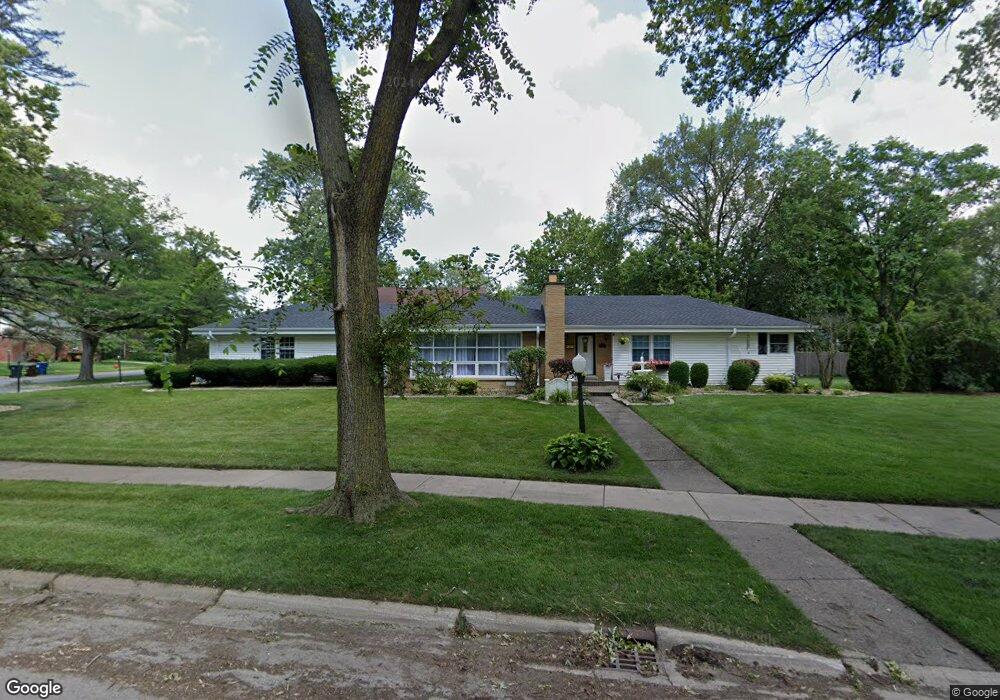
609 Burns Ave Flossmoor, IL 60422
Estimated Value: $314,455 - $334,000
3
Beds
2
Baths
1,824
Sq Ft
$178/Sq Ft
Est. Value
About This Home
This home is located at 609 Burns Ave, Flossmoor, IL 60422 and is currently estimated at $325,114, approximately $178 per square foot. 609 Burns Ave is a home located in Cook County with nearby schools including Western Avenue Elementary School, Parker Junior High School, and Homewood-Flossmoor High School.
Ownership History
Date
Name
Owned For
Owner Type
Purchase Details
Closed on
Feb 14, 1997
Sold by
Brown Beverly
Bought by
First Community Bank & Trust and Trust #97-0007
Current Estimated Value
Purchase Details
Closed on
Sep 8, 1994
Sold by
Roester Inc
Bought by
Brown Beverly
Home Financials for this Owner
Home Financials are based on the most recent Mortgage that was taken out on this home.
Original Mortgage
$139,200
Interest Rate
8.65%
Purchase Details
Closed on
Mar 16, 1994
Sold by
Bradley Kathryn I and Bradley Love Kathryn I
Bought by
Roester Inc
Create a Home Valuation Report for This Property
The Home Valuation Report is an in-depth analysis detailing your home's value as well as a comparison with similar homes in the area
Home Values in the Area
Average Home Value in this Area
Purchase History
| Date | Buyer | Sale Price | Title Company |
|---|---|---|---|
| First Community Bank & Trust | -- | -- | |
| Brown Beverly | $175,000 | -- | |
| Roester Inc | $80,666 | -- |
Source: Public Records
Mortgage History
| Date | Status | Borrower | Loan Amount |
|---|---|---|---|
| Previous Owner | Brown Beverly | $139,200 |
Source: Public Records
Tax History
| Year | Tax Paid | Tax Assessment Tax Assessment Total Assessment is a certain percentage of the fair market value that is determined by local assessors to be the total taxable value of land and additions on the property. | Land | Improvement |
|---|---|---|---|---|
| 2025 | $4,688 | $26,000 | $9,107 | $16,893 |
| 2024 | $4,688 | $26,000 | $9,107 | $16,893 |
| 2023 | $5,744 | $26,000 | $9,107 | $16,893 |
| 2022 | $5,744 | $18,204 | $7,865 | $10,339 |
| 2021 | $5,860 | $18,203 | $7,865 | $10,338 |
| 2020 | $5,873 | $18,203 | $7,865 | $10,338 |
| 2019 | $7,521 | $21,501 | $7,037 | $14,464 |
| 2018 | $9,013 | $21,501 | $7,037 | $14,464 |
| 2017 | $9,022 | $21,769 | $7,037 | $14,732 |
| 2016 | $8,720 | $19,675 | $6,209 | $13,466 |
| 2015 | $8,675 | $19,675 | $6,209 | $13,466 |
| 2014 | $7,590 | $19,675 | $6,209 | $13,466 |
| 2013 | $6,764 | $17,354 | $6,209 | $11,145 |
Source: Public Records
Map
Nearby Homes
- 625 Bruce Ave
- 2619 Alexander St
- 18530 Stedhall Rd
- 18509 Stedhall Rd
- 18511 Argyle Ave
- 18450 Stedhall Rd
- 625 Perth Ave
- 18441 Stewart Ave
- 2807 Willow Rd Unit 103
- 18400 Cherry Creek Dr Unit 105
- 725 Braemar Rd
- 18404 Perth Ave
- 846 Park Dr
- 712 Gardner Rd
- 18310 Cherry Creek Dr Unit 2
- 2323 Clyde Terrace
- 2303 Hutchison Rd
- 3013 Carmel Dr
- 2440 183rd St
- 1002 Douglas Ave
- 608 Bruce Ave
- 621 Burns Ave
- 620 Bruce Ave
- 608 Burns Ave
- 2632 Heather Rd
- 2644 Heather Rd
- 2626 Heather Rd
- 618 Burns Ave
- 18551 Stedhall Rd
- 2620 Heather Rd
- 607 Bruce Ave
- 630 Bruce Ave
- 613 Bruce Ave
- 2705 Heather Rd
- 631 Burns Ave
- 2614 Heather Rd
- 18545 Stedhall Rd
- 619 Bruce Ave
- 2700 Heather Rd
- 626 Burns Ave
Your Personal Tour Guide
Ask me questions while you tour the home.