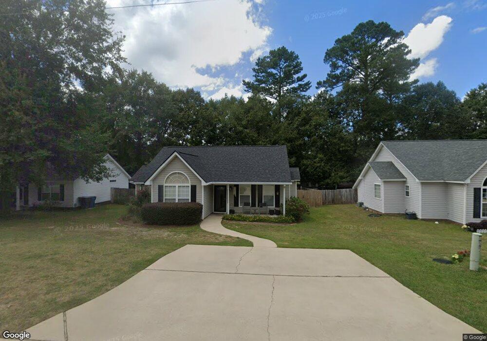
609 Burnside Dr Columbia, SC 29209
The Hamptons NeighborhoodEstimated Value: $236,236 - $247,000
3
Beds
2
Baths
1,300
Sq Ft
$185/Sq Ft
Est. Value
About This Home
This home is located at 609 Burnside Dr, Columbia, SC 29209 and is currently estimated at $240,059, approximately $184 per square foot. 609 Burnside Dr is a home located in Richland County with nearby schools including Meadowfield Elementary School, Hand Middle School, and Dreher High School.
Ownership History
Date
Name
Owned For
Owner Type
Purchase Details
Closed on
Feb 8, 2021
Sold by
Smith Mary Nicole
Bought by
Dew Elizabeth L
Current Estimated Value
Home Financials for this Owner
Home Financials are based on the most recent Mortgage that was taken out on this home.
Original Mortgage
$137,517
Outstanding Balance
$122,780
Interest Rate
2.6%
Mortgage Type
New Conventional
Estimated Equity
$117,279
Purchase Details
Closed on
Aug 6, 2015
Sold by
Fisher J Samuel R
Bought by
Smith Mary N
Home Financials for this Owner
Home Financials are based on the most recent Mortgage that was taken out on this home.
Original Mortgage
$117,727
Interest Rate
4.04%
Mortgage Type
New Conventional
Purchase Details
Closed on
May 2, 2011
Sold by
Firetag Adam S and Firetag Julie B
Bought by
Fisher Samuel R
Home Financials for this Owner
Home Financials are based on the most recent Mortgage that was taken out on this home.
Original Mortgage
$113,546
Interest Rate
4.87%
Mortgage Type
FHA
Purchase Details
Closed on
Mar 5, 2008
Sold by
Firetag Ronald A
Bought by
Firetag Julie B
Home Financials for this Owner
Home Financials are based on the most recent Mortgage that was taken out on this home.
Original Mortgage
$108,000
Interest Rate
5.46%
Mortgage Type
Purchase Money Mortgage
Purchase Details
Closed on
Mar 6, 2006
Sold by
Firetag Brandie L
Bought by
Firetag Ronald A
Purchase Details
Closed on
Jul 12, 2004
Sold by
R A Powell Llc
Bought by
Firetag Adam S and Firetag Brandie L
Home Financials for this Owner
Home Financials are based on the most recent Mortgage that was taken out on this home.
Original Mortgage
$50,000
Interest Rate
6.25%
Mortgage Type
Purchase Money Mortgage
Purchase Details
Closed on
Apr 5, 2004
Sold by
Bradford Llc
Bought by
R A Powell Llc
Home Financials for this Owner
Home Financials are based on the most recent Mortgage that was taken out on this home.
Original Mortgage
$75,000
Interest Rate
5.55%
Mortgage Type
Purchase Money Mortgage
Create a Home Valuation Report for This Property
The Home Valuation Report is an in-depth analysis detailing your home's value as well as a comparison with similar homes in the area
Home Values in the Area
Average Home Value in this Area
Purchase History
| Date | Buyer | Sale Price | Title Company |
|---|---|---|---|
| Dew Elizabeth L | $153,500 | None Available | |
| Dew Elizabeth L | $153,500 | None Listed On Document | |
| Smith Mary N | $50,769 | -- | |
| Fisher Samuel R | $116,500 | -- | |
| Firetag Julie B | $32,000 | -- | |
| Firetag Ronald A | $33,000 | None Available | |
| Firetag Adam S | $110,000 | -- | |
| R A Powell Llc | $20,800 | -- |
Source: Public Records
Mortgage History
| Date | Status | Borrower | Loan Amount |
|---|---|---|---|
| Open | Dew Elizabeth L | $137,517 | |
| Closed | Dew Elizabeth L | $137,517 | |
| Previous Owner | Smith Mary N | $117,727 | |
| Previous Owner | Fisher Samuel R | $113,546 | |
| Previous Owner | Firetag Julie B | $108,000 | |
| Previous Owner | Firetag Adam S | $50,000 | |
| Previous Owner | R A Powell Llc | $75,000 |
Source: Public Records
Tax History
| Year | Tax Paid | Tax Assessment Tax Assessment Total Assessment is a certain percentage of the fair market value that is determined by local assessors to be the total taxable value of land and additions on the property. | Land | Improvement |
|---|---|---|---|---|
| 2024 | $1,262 | $176,600 | $0 | $0 |
| 2023 | $1,217 | $6,140 | $0 | $0 |
| 2022 | $1,113 | $153,500 | $25,000 | $128,500 |
| 2021 | $962 | $5,140 | $0 | $0 |
| 2020 | $1,015 | $5,140 | $0 | $0 |
| 2019 | $1,022 | $5,140 | $0 | $0 |
| 2018 | $969 | $4,760 | $0 | $0 |
| 2017 | $943 | $4,760 | $0 | $0 |
| 2016 | $910 | $4,760 | $0 | $0 |
| 2015 | $3,159 | $4,480 | $0 | $0 |
| 2014 | $855 | $112,000 | $0 | $0 |
| 2013 | -- | $4,480 | $0 | $0 |
Source: Public Records
Map
Nearby Homes
- 759 Burnside Dr
- 1006 Coatesdale Rd
- 404 Hampton Forest Dr
- 612 Lake Forest Rd
- 411 Hampton Forest Dr
- 231 Forest Green Dr
- 833 Forest Park Rd Unit 115
- 164 Springway Dr
- 1273 Rockwood Rd
- 1191 Rockwood Rd
- 423 Planters Dr
- 600 Rockwood Rd
- 639 Veterans Rd
- 174 Preston Green Dr
- 6965 Shelley Rd
- 6627 Christie Rd
- 225 E Lake Trail
- 6525 Macon Rd
- 813 Greenlawn Dr
- 6427 Christie Rd
- 605 Burnside Dr
- 615 Burnside Dr
- 619 Burnside Dr
- 601 Burnside Dr
- 751 Burnside Dr
- 610 Burnside Dr
- 606 Burnside Dr
- 616 Burnside Dr
- 747 Burnside Dr
- 623 Burnside Dr
- 763 Burnside Dr
- 600 Burnside Dr
- 620 Burnside Dr
- 743 Burnside Dr
- 563 Burnside Dr
- 627 Burnside Dr
- 566 Burnside Dr
- 801 Burnside Dr
- 739 Burnside Dr
- 559 Burnside Dr
Your Personal Tour Guide
Ask me questions while you tour the home.