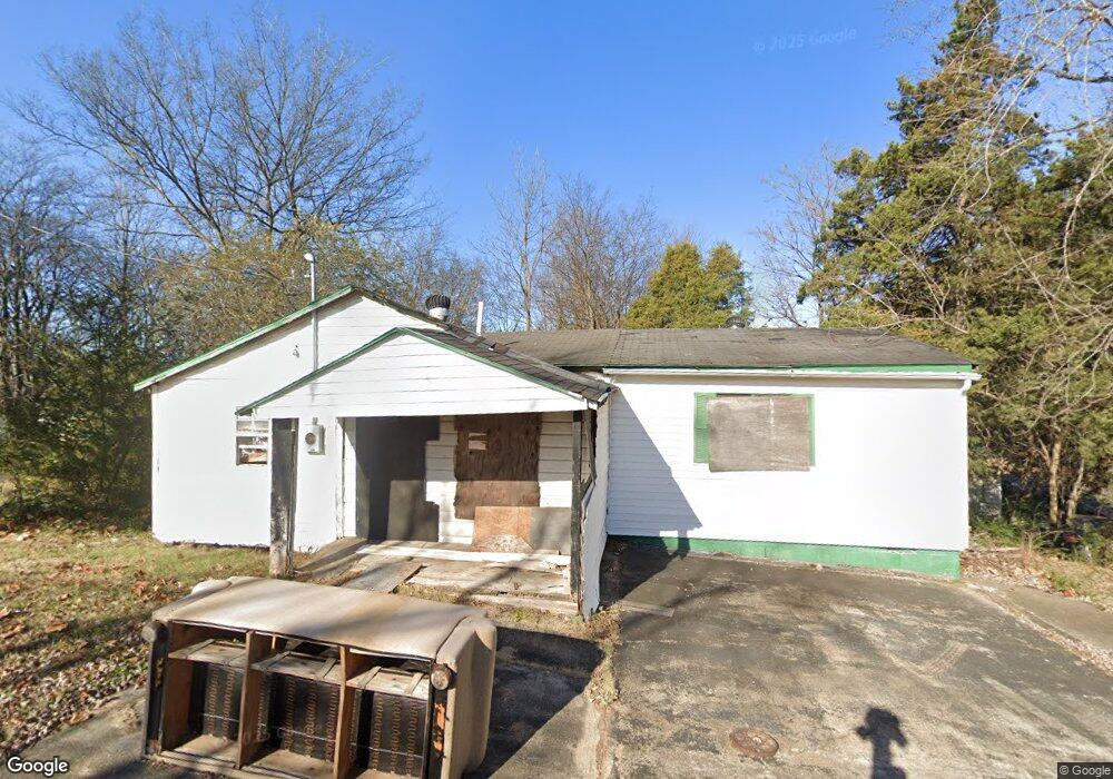
609 Flint St Poplar Bluff, MO 63901
Estimated Value: $40,685 - $77,000
Studio
--
Bath
933
Sq Ft
$70/Sq Ft
Est. Value
About This Home
This home is located at 609 Flint St, Poplar Bluff, MO 63901 and is currently estimated at $65,171, approximately $69 per square foot. 609 Flint St is a home with nearby schools including Poplar Bluff Fifth & Sixth Grade Center, Lake Road Elementary School, and Poplar Bluff Junior High School.
Ownership History
Date
Name
Owned For
Owner Type
Purchase Details
Closed on
Jan 22, 2024
Sold by
Pinkston Robert Henry and Pinkston Bob
Bought by
Negrete Adrian
Current Estimated Value
Purchase Details
Closed on
Mar 15, 2005
Sold by
Spencer Thomas N
Bought by
Pinkston Bob and Pinkston Kathryn
Home Financials for this Owner
Home Financials are based on the most recent Mortgage that was taken out on this home.
Original Mortgage
$10,000
Interest Rate
5.66%
Mortgage Type
Purchase Money Mortgage
Create a Home Valuation Report for This Property
The Home Valuation Report is an in-depth analysis detailing your home's value as well as a comparison with similar homes in the area
Home Values in the Area
Average Home Value in this Area
Purchase History
| Date | Buyer | Sale Price | Title Company |
|---|---|---|---|
| Negrete Adrian | -- | None Listed On Document | |
| Pinkston Bob | -- | None Available |
Source: Public Records
Mortgage History
| Date | Status | Borrower | Loan Amount |
|---|---|---|---|
| Previous Owner | Pinkston Bob | $10,000 |
Source: Public Records
Tax History
| Year | Tax Paid | Tax Assessment Tax Assessment Total Assessment is a certain percentage of the fair market value that is determined by local assessors to be the total taxable value of land and additions on the property. | Land | Improvement |
|---|---|---|---|---|
| 2025 | $96 | $2,040 | $0 | $0 |
| 2024 | $1 | $1,930 | $0 | $0 |
| 2023 | $93 | $1,930 | $0 | $0 |
| 2022 | $109 | $2,270 | $0 | $0 |
| 2021 | $201 | $4,160 | $0 | $0 |
| 2020 | $188 | $3,850 | $0 | $0 |
| 2019 | $188 | $3,850 | $0 | $0 |
| 2018 | $188 | $3,850 | $0 | $0 |
| 2017 | -- | $3,850 | $0 | $0 |
| 2016 | -- | $3,850 | $0 | $0 |
| 2015 | -- | $3,850 | $0 | $0 |
| 2014 | -- | $3,610 | $0 | $0 |
| 2012 | $154 | $3,610 | $0 | $0 |
Source: Public Records
Map
Nearby Homes
Your Personal Tour Guide
Ask me questions while you tour the home.