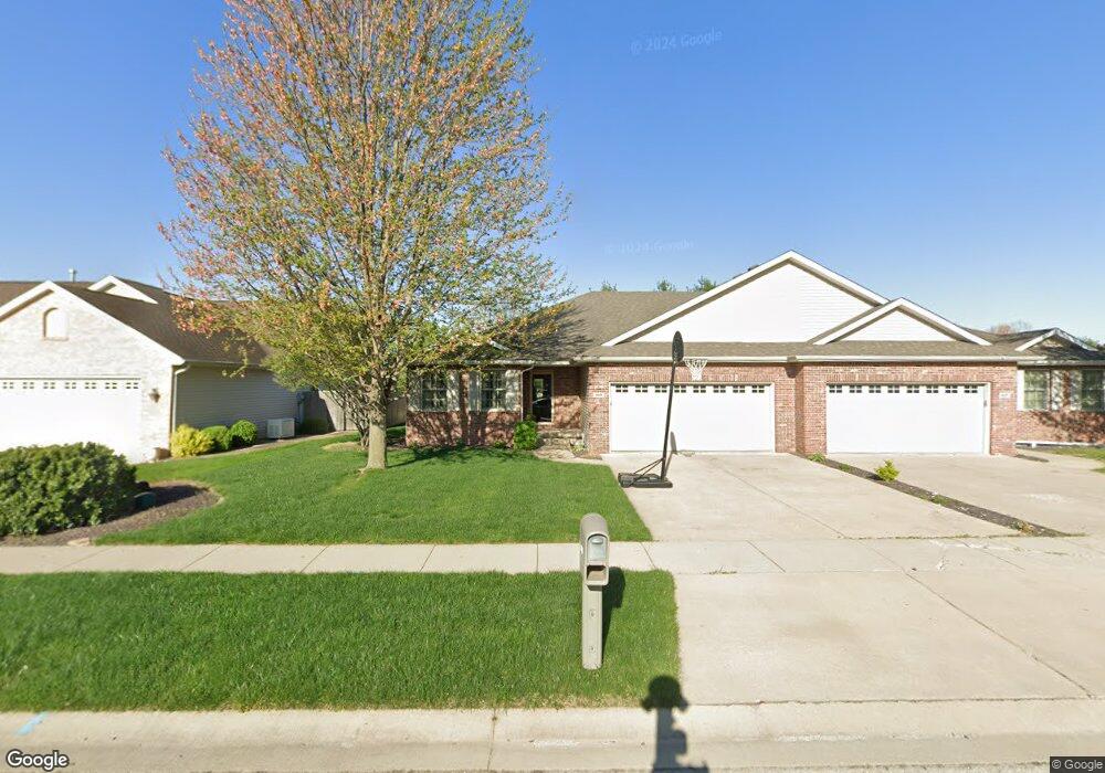
609 Heathrow Ln Rochester, IL 62563
Estimated Value: $281,000 - $288,000
--
Bed
--
Bath
--
Sq Ft
6,534
Sq Ft Lot
About This Home
This home is located at 609 Heathrow Ln, Rochester, IL 62563 and is currently estimated at $285,826. 609 Heathrow Ln is a home located in Sangamon County with nearby schools including Rochester Elementary Ec-1 School, Rochester Elementary School, and Rochester Intermediate School.
Ownership History
Date
Name
Owned For
Owner Type
Purchase Details
Closed on
Jun 14, 2022
Sold by
Barbara Wagoner 2003 Revocable Trust
Bought by
Friedrich Astor R and Friedrich Ana Christina
Current Estimated Value
Home Financials for this Owner
Home Financials are based on the most recent Mortgage that was taken out on this home.
Original Mortgage
$216,000
Outstanding Balance
$180,459
Interest Rate
4.4%
Mortgage Type
New Conventional
Estimated Equity
$105,367
Purchase Details
Closed on
Jan 12, 2010
Purchase Details
Closed on
Oct 30, 2007
Purchase Details
Closed on
Oct 1, 2007
Create a Home Valuation Report for This Property
The Home Valuation Report is an in-depth analysis detailing your home's value as well as a comparison with similar homes in the area
Home Values in the Area
Average Home Value in this Area
Purchase History
| Date | Buyer | Sale Price | Title Company |
|---|---|---|---|
| Friedrich Astor R | $240,000 | Barber Segatto Hoffee Wilke & | |
| -- | -- | -- | |
| -- | -- | -- | |
| -- | -- | -- |
Source: Public Records
Mortgage History
| Date | Status | Borrower | Loan Amount |
|---|---|---|---|
| Open | Friedrich Astor R | $216,000 |
Source: Public Records
Tax History Compared to Growth
Tax History
| Year | Tax Paid | Tax Assessment Tax Assessment Total Assessment is a certain percentage of the fair market value that is determined by local assessors to be the total taxable value of land and additions on the property. | Land | Improvement |
|---|---|---|---|---|
| 2024 | $5,809 | $87,991 | $8,422 | $79,569 |
| 2023 | $5,027 | $74,590 | $9,743 | $64,847 |
| 2022 | $5,004 | $70,627 | $9,225 | $61,402 |
| 2021 | $5,071 | $67,807 | $8,857 | $58,950 |
| 2020 | $4,980 | $66,936 | $8,743 | $58,193 |
| 2019 | $4,889 | $67,374 | $8,800 | $58,574 |
| 2018 | $4,850 | $66,294 | $8,659 | $57,635 |
| 2017 | $4,777 | $65,592 | $8,567 | $57,025 |
| 2016 | $4,635 | $63,448 | $8,287 | $55,161 |
| 2015 | $4,614 | $62,876 | $8,212 | $54,664 |
| 2014 | $4,583 | $62,414 | $8,152 | $54,262 |
| 2013 | $4,517 | $61,699 | $8,059 | $53,640 |
Source: Public Records
Map
Nearby Homes
- 27 Mishawaka Dr Unit 1
- 5 Swannanoa Unit 1
- 112 Deer Creek Rd Unit 1
- 46 Woodland Trail
- 1204 W Main St
- 3440 Woodhaven Dr Unit 1
- 3491 Woodhaven Dr
- 217 E Main St Unit 1
- 3810 Bristlecone Dr Unit 2
- 427 Spring Ridge
- 525 E Mill St Unit 1
- 3149 Beaver Creek Ln
- 329-331 Harbor Point Place
- 312 Harbor Point Place
- 314 Harbor Point Place
- 3504 Hoylake Dr
- 3120 Red Bud Ln
- 66 White Birch Rd
- 4315 Sage Rd
- 25 Cottage Grove Ln Unit 1
- 611 Heathrow Ln
- 613 Heathrow Ln
- 608 Heathrow Ln
- 615 Heathrow Ln
- 612 Heathrow Ln
- 614 Heathrow Ln
- 606 Heathrow Ln
- 617 Heathrow Ln
- 604 Heathrow Ln
- 616 Heathrow Ln
- 701 Heathrow Ln
- 1102 Milldale Dr
- 618 Heathrow Ln
- 1106 Milldale Dr
- 600 Heathrow Ln
- 703 Heathrow Ln
- 700 Heathrow Ln
- 1110 Milldale Dr
- 702 Heathrow Ln