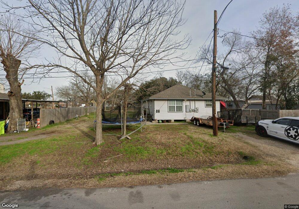
609 Mulcahy St Rosenberg, TX 77471
Estimated Value: $258,000 - $286,973
2
Beds
2
Baths
1,950
Sq Ft
$139/Sq Ft
Est. Value
About This Home
This home is located at 609 Mulcahy St, Rosenberg, TX 77471 and is currently estimated at $271,743, approximately $139 per square foot. 609 Mulcahy St is a home located in Fort Bend County with nearby schools including Travis Elementary School, Henry Wertheimer Middle School, and Briscoe Junior High School.
Ownership History
Date
Name
Owned For
Owner Type
Purchase Details
Closed on
Jan 14, 2012
Sold by
Hollas Investment Group Llc
Bought by
Martinez Osbaldo
Current Estimated Value
Purchase Details
Closed on
Feb 26, 2002
Sold by
Hearne Hattie
Bought by
Hollas Investment Group Llc
Purchase Details
Closed on
Apr 4, 1996
Sold by
Spinks David and Spinks Anne
Bought by
Alvarado Armando and Turrubiates Anita
Create a Home Valuation Report for This Property
The Home Valuation Report is an in-depth analysis detailing your home's value as well as a comparison with similar homes in the area
Home Values in the Area
Average Home Value in this Area
Purchase History
| Date | Buyer | Sale Price | Title Company |
|---|---|---|---|
| Martinez Osbaldo | $2,167 | None Available | |
| Martinez Osbaldo | $2,167 | None Available | |
| Hollas Investment Group Llc | -- | Startex Title | |
| Hollas Investment Group Llc | -- | Startex Title Company | |
| Alvarado Armando | -- | -- |
Source: Public Records
Tax History Compared to Growth
Tax History
| Year | Tax Paid | Tax Assessment Tax Assessment Total Assessment is a certain percentage of the fair market value that is determined by local assessors to be the total taxable value of land and additions on the property. | Land | Improvement |
|---|---|---|---|---|
| 2025 | $5,214 | $292,628 | $52,650 | $239,978 |
| 2024 | $5,214 | $276,030 | $52,650 | $223,380 |
| 2023 | $5,178 | $268,238 | $37,853 | $230,385 |
| 2022 | $5,423 | $264,780 | $37,850 | $226,930 |
| 2021 | $785 | $37,850 | $37,850 | $0 |
| 2020 | $803 | $37,850 | $37,850 | $0 |
| 2019 | $618 | $27,040 | $27,040 | $0 |
| 2018 | $341 | $14,680 | $14,680 | $0 |
| 2017 | $343 | $14,680 | $14,680 | $0 |
| 2016 | $343 | $14,680 | $14,680 | $0 |
| 2015 | $344 | $14,680 | $14,680 | $0 |
| 2014 | $349 | $14,680 | $14,680 | $0 |
Source: Public Records
Map
Nearby Homes
- 1605 Walnut Ave
- 1210 Avenue E
- 428 West St
- 735 Willow St
- 503 Willow St
- 2519 Good Morrow Dr
- 5534 Handlewood Ln
- 2606 Good Morrow Dr
- 2630 Wastelbread Ln
- 2619 Wastelbread Ln
- 2515 Good Morrow Dr
- 2618 Wastelbread Ln
- 2610 Good Morrow Dr
- 1314 Avenue G
- 413 2nd St
- 401 2nd St
- 915 Avenue E
- 1220 Mulcahy St
- 614 Mulcahy St
- 420 4th St
- 601 Mulcahy St
- 1503 Walnut Ave
- 1503 Walnut Ave
- 608 Carlisle St
- 600 Carlisle St
- 1503 Avenue E
- 1505 Avenue E
- 614 Carlisle St
- 618 Mulcahy St
- 1415 Avenue E
- 520 Mulcahy St
- 1603 Walnut Ave Unit 2
- 611 Carlisle St
- 611 Brazos St
- 605 Carlisle St
- 1604 Avenue E
- 518 Mulcahy St
- 1401 Walnut Ave
- 527 Brazos St
- 1601 Avenue E