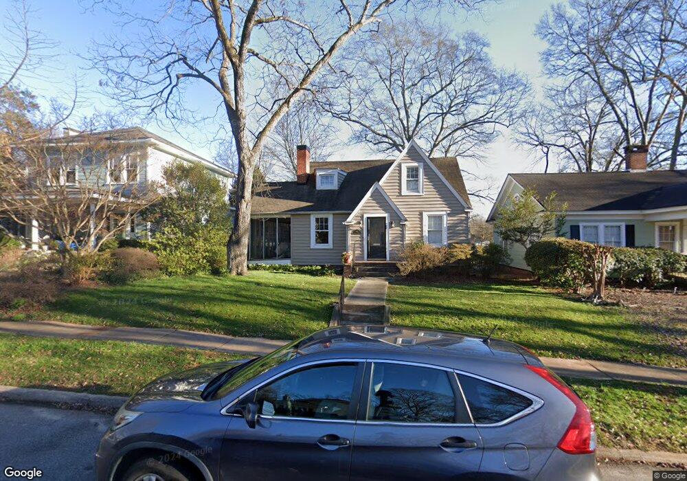
609 Poplar St Spartanburg, SC 29302
Converse Heights NeighborhoodEstimated Value: $345,121 - $427,000
5
Beds
2
Baths
1,800
Sq Ft
$214/Sq Ft
Est. Value
About This Home
This home is located at 609 Poplar St, Spartanburg, SC 29302 and is currently estimated at $386,030, approximately $214 per square foot. 609 Poplar St is a home located in Spartanburg County with nearby schools including Spartanburg High School, Spartanburg Preparatory School, and St. Paul The Apostle Catholic School.
Ownership History
Date
Name
Owned For
Owner Type
Purchase Details
Closed on
Jul 31, 2024
Sold by
Thies Frank R
Bought by
Frank R Thies Iii Revocable Truct R and Frank Thies
Current Estimated Value
Purchase Details
Closed on
Oct 13, 2005
Sold by
Turner M Noel
Bought by
Thies Frank R
Home Financials for this Owner
Home Financials are based on the most recent Mortgage that was taken out on this home.
Original Mortgage
$148,000
Interest Rate
5.71%
Mortgage Type
New Conventional
Purchase Details
Closed on
Aug 24, 2000
Sold by
Vaughn Julia F and Flowers Julia Leigh
Bought by
Turner M Noel
Create a Home Valuation Report for This Property
The Home Valuation Report is an in-depth analysis detailing your home's value as well as a comparison with similar homes in the area
Home Values in the Area
Average Home Value in this Area
Purchase History
| Date | Buyer | Sale Price | Title Company |
|---|---|---|---|
| Frank R Thies Iii Revocable Truct R | -- | None Listed On Document | |
| Thies Frank R | $185,000 | -- | |
| Turner M Noel | $140,000 | -- |
Source: Public Records
Mortgage History
| Date | Status | Borrower | Loan Amount |
|---|---|---|---|
| Previous Owner | Thies Frank R | $148,000 |
Source: Public Records
Tax History Compared to Growth
Tax History
| Year | Tax Paid | Tax Assessment Tax Assessment Total Assessment is a certain percentage of the fair market value that is determined by local assessors to be the total taxable value of land and additions on the property. | Land | Improvement |
|---|---|---|---|---|
| 2025 | $2,478 | $8,411 | $2,047 | $6,364 |
| 2024 | $2,478 | $8,411 | $2,047 | $6,364 |
| 2023 | $2,478 | $8,411 | $2,047 | $6,364 |
| 2022 | $2,111 | $7,314 | $2,212 | $5,102 |
| 2021 | $2,111 | $7,314 | $2,212 | $5,102 |
| 2020 | $2,089 | $7,314 | $2,212 | $5,102 |
| 2019 | $2,089 | $7,314 | $2,212 | $5,102 |
| 2018 | $2,089 | $7,314 | $2,212 | $5,102 |
| 2017 | $1,863 | $6,360 | $1,936 | $4,424 |
| 2016 | $1,863 | $6,360 | $1,936 | $4,424 |
| 2015 | $1,786 | $6,360 | $1,936 | $4,424 |
| 2014 | $1,781 | $6,360 | $1,936 | $4,424 |
Source: Public Records
Map
Nearby Homes
- 649 Poplar St
- 343 Mills Ave
- 618 Palmetto St
- 533 Otis Blvd
- 705 Otis Blvd
- 559 Glendalyn Ave
- 437 Saint Andrews St
- 24 Woodburn Rd
- 169 Mills Ave
- 224 Halifax Ct
- 126 Hannon Ct
- 526 Gadsden Ct
- 371 Saint Andrews St
- 120 Connecticut Ave
- 367 Winsmith Ave
- 571 E Main St
- 356 Saint Andrews St
- 121 Coleman Hill Dr
- 771 Maple St
- 353 Saint Andrews St