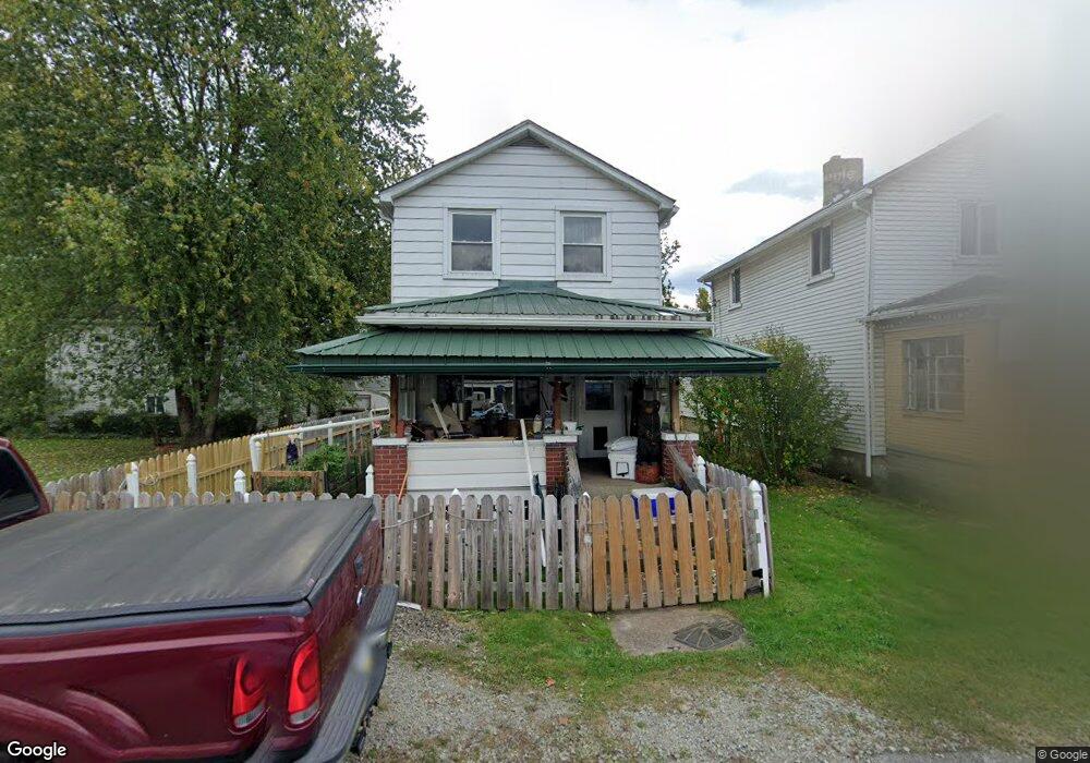
609 Railroad St East Vandergrift, PA 15629
Estimated Value: $73,000 - $100,000
--
Bed
--
Bath
1,120
Sq Ft
$74/Sq Ft
Est. Value
About This Home
This home is located at 609 Railroad St, East Vandergrift, PA 15629 and is currently estimated at $82,451, approximately $73 per square foot. 609 Railroad St is a home with nearby schools including Kiski Area High School and Orchard Hills Christian Academy.
Ownership History
Date
Name
Owned For
Owner Type
Purchase Details
Closed on
Sep 22, 2009
Sold by
Ahlquist Sandra K
Bought by
Lascek Christopher A
Current Estimated Value
Home Financials for this Owner
Home Financials are based on the most recent Mortgage that was taken out on this home.
Original Mortgage
$15,298
Outstanding Balance
$10,066
Interest Rate
5.31%
Mortgage Type
Purchase Money Mortgage
Estimated Equity
$72,385
Create a Home Valuation Report for This Property
The Home Valuation Report is an in-depth analysis detailing your home's value as well as a comparison with similar homes in the area
Home Values in the Area
Average Home Value in this Area
Purchase History
| Date | Buyer | Sale Price | Title Company |
|---|---|---|---|
| Lascek Christopher A | $17,000 | None Available |
Source: Public Records
Mortgage History
| Date | Status | Borrower | Loan Amount |
|---|---|---|---|
| Open | Lascek Christopher A | $15,298 |
Source: Public Records
Tax History Compared to Growth
Tax History
| Year | Tax Paid | Tax Assessment Tax Assessment Total Assessment is a certain percentage of the fair market value that is determined by local assessors to be the total taxable value of land and additions on the property. | Land | Improvement |
|---|---|---|---|---|
| 2025 | $684 | $4,300 | $500 | $3,800 |
| 2024 | $651 | $4,300 | $500 | $3,800 |
| 2023 | $589 | $4,300 | $500 | $3,800 |
| 2022 | $568 | $4,300 | $500 | $3,800 |
| 2021 | $568 | $4,300 | $500 | $3,800 |
| 2020 | $567 | $4,300 | $500 | $3,800 |
| 2019 | $564 | $4,300 | $500 | $3,800 |
| 2018 | $556 | $4,300 | $500 | $3,800 |
| 2017 | $543 | $4,300 | $500 | $3,800 |
| 2016 | $535 | $4,300 | $500 | $3,800 |
| 2015 | $535 | $4,300 | $500 | $3,800 |
| 2014 | $532 | $4,300 | $500 | $3,800 |
Source: Public Records
Map
Nearby Homes
- 608 Kennedy Ave
- 716 Kennedy Ave
- 419 Vandergrift Ln
- 325 -1/2 Quay St
- 404 1/2 Franklin Ave
- 2106 River Rd
- 1206 Wysocki Ave
- 219 Quay St
- 800 Wallace St
- 314 Linden St
- 316 1/2 Emerson St
- 154 Jefferson Ave Unit 6
- 1805 Moore Ave
- 315 Spruce St
- 311 Elm St
- 314 Lowell St Unit 1/2
- 323 Sycamore St
- 314 1/2 Lowell St
- 311 Lowell St
- 404 N 10th St
- 609 Kennedy Ave
- 611 Kennedy Ave
- 613 Railroad St
- 615 Kennedy Ave
- 613 S Elm St
- 619 Kennedy Ave
- 610 Kennedy Ave
- 612 Kennedy Ave
- 613 Kennedy Ave
- 602 Kennedy Ave
- 606 Kennedy Ave
- 600 Kennedy Ave
- 512 Elm St
- 510 Elm St
- 604 Kennedy Ave
- 701 Elm St
- 516 Kennedy Ave
- 514 Kennedy Ave
- 700 Kennedy Ave
- 614 Mckinley Ave